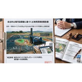
Designated Investigation Agency | Early Soil Investigation to Prevent the Negative Legacy of the Chemical Substance Handling Sector
Early soil investigation to inventory the legacy risks of the chemical substance handling department and prevent future negative legacies, in order to avoid the collapse of land sales and M&A.
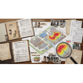
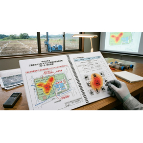
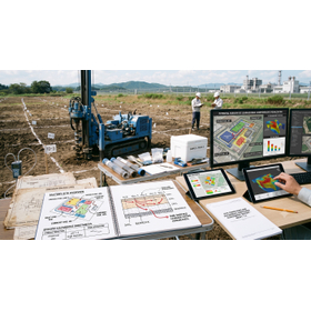
This document is a specialized book aimed at developers and corporate executives preparing for factory sales, M&A, or organizational restructuring. It summarizes the usefulness of early soil investigations to uncover environmental liabilities hidden in the chemical substance handling sector and to prevent future negative legacies. The underground infiltration of specific hazardous substances and the invisible leakage of chemicals from aging equipment can become fatal "hidden defects" in land transactions, leading to contract cancellations and massive damage compensation disputes. This book explains, at a practical level, the method of legacy risk inventory that thoroughly examines past operational histories and the approach to early soil condition surveys to prevent delays during reconstruction. By establishing reliable evidence through the neutral and rigorous designated investigation agency, Geotech, it presents a process that fosters buyer confidence and leads to a smooth sales agreement led by the seller. It covers the latest investigation technologies that provide a seamless response from sampling to official analysis, proving the safety of the ground without halting operations. This book achieves a balance between maximizing real estate value and managing legal risks.
- Company:ジオテック
- Price:100,000 yen-500,000 yen