
List of Investigation, testing and inspection products
- classification:Investigation, testing and inspection
766~810 item / All 5979 items


Natural wood endless tape with a thickness of 0.9 to 3 mm. It contributes to improved yield and productivity as a substitute for solid wood for the edges of furniture and fixtures.


- others


By simply increasing the formwork, we can achieve a variety of variations. Formwork costs are reduced, and productivity is improved! We respond to various site needs with multifunctionality.
- Gutters and U-shaped gutters

Building a three-dimensional future! Essential technologies for improving efficiency at construction sites.
- Surveying
We provide high-quality measurement services to objectively evaluate the airtightness and thermal insulation performance of buildings!
- Structural Survey


Conducting slope and water level observations with one hole reduces drilling costs. Long-term observations are expected to improve quality.
- Geological Survey
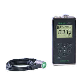

Thickness gauge for measuring cast iron and cast aluminum, achieving accurate thickness measurement through dedicated design.
- Non-destructive testing
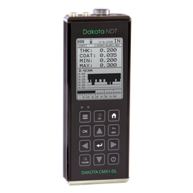
Simultaneously measure the film thickness and the thickness of the base material, completely renewing the hardware to significantly improve measurement accuracy and range.
- Non-destructive testing
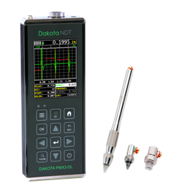
A flagship model equipped with all functions, the best ultrasonic thickness gauge that is highly accurate and powerful.
- Non-destructive testing
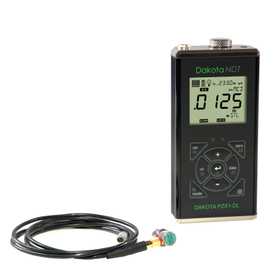
Next-generation precision ultrasonic thickness gauge achieves stable measurements at 0.001mm increments.
- Non-destructive testing
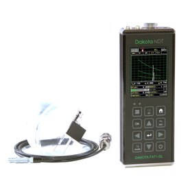
An ultrasonic flaw detector that condenses cutting-edge technology into a body weighing only 400g, with thickness gauge software also included as standard.
- Non-destructive testing
- Other measuring instruments
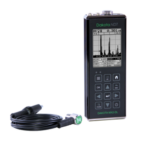
All-round model equipped with A scope and independent 2 gates, usable for various purposes.
- Non-destructive testing
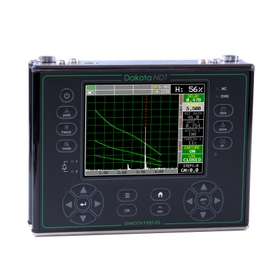
High-performance ultrasonic flaw detector with excellent versatility, equipped with a Blanview LCD display that offers outstanding visibility even in sunlight.
- Non-destructive testing
- Other measuring instruments
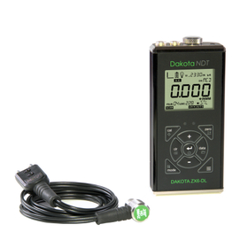
High-grade model of the ZX series with excellent basic performance and a variety of features.
- Non-destructive testing
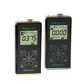
A mid-range thickness gauge equipped with a variety of functions that supports all measurement objects with a 5-level sensitivity adjustment feature.
- Non-destructive testing
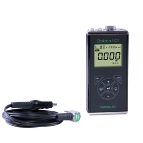
An ultrasonic thickness gauge that changes the concept of entry-level models, achieving overwhelming high precision and measurement range.
- Non-destructive testing
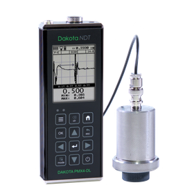
The most powerful ultrasonic thickness gauge in Dakota. Capable of measuring the thickness of GFRP, CFRP, rubber, high-density polyethylene, and cast metals.
- Non-destructive testing
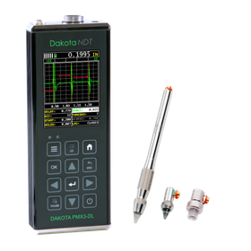
Flagship model for thin material and precision inspection, ultra-high precision ultrasonic thickness gauge.
- Non-destructive testing
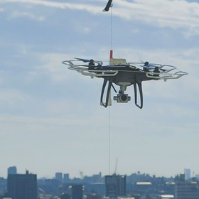

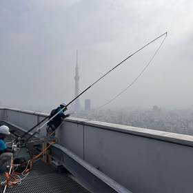
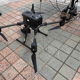
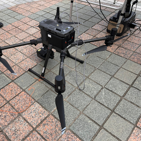
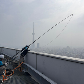
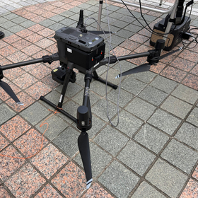
Safe exterior inspections of hotels realized with drones and lines.
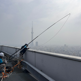
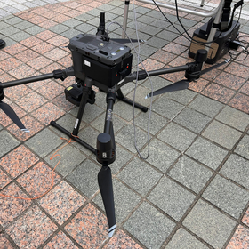
- Structural Survey
![[For Schools] Exterior Wall Inspect...](https://image.www.ipros.com/public/product/image/2050981/IPROS14216626491799214029.jpg?w=280&h=280)
Early detection of building deterioration to reduce repair costs and energy loss!
- Non-destructive testing
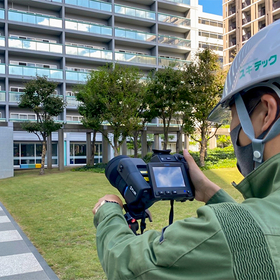
Early detection of water leakage risks! Protecting the asset value of buildings.
- Non-destructive testing
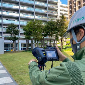
We protect the asset value of the building and optimize repair costs.
- Non-destructive testing
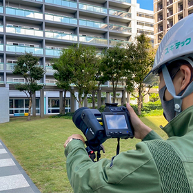
Protecting the asset value of buildings with low-cost and efficient exterior wall deterioration diagnosis.
- Non-destructive testing
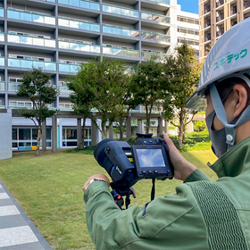
We will ensure the safety of the building and reduce maintenance costs.
- Non-destructive testing
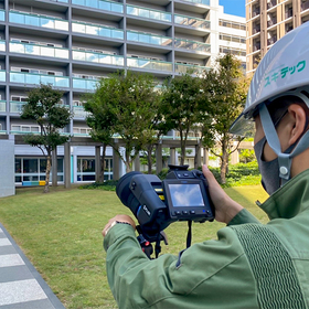
Rationalization of maintenance management for concrete structures, and cost reduction and efficiency improvement in the maintenance and preservation of structures!
- Non-destructive testing
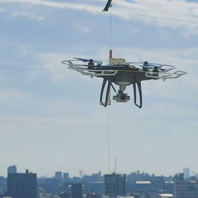
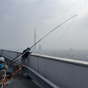
Maximizing property value with a new standard for safe drone operations.
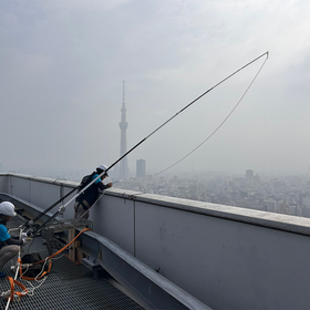
- Structural Survey
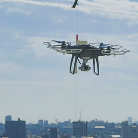
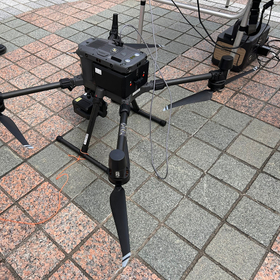
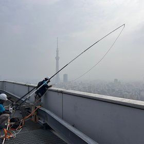
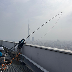
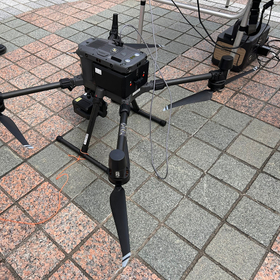
Achieving safe building inspections through the fusion of drones and lines.
- Structural Survey
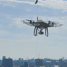
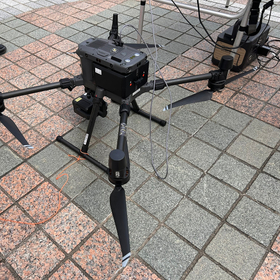
Improving the safety of infrastructure inspections through the fusion of drones and lines.
- Structural Survey
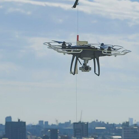
Ensuring safety and efficiency in the inspection of commercial facilities using drones and lines.
- Structural Survey
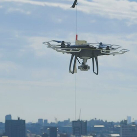
Streamlining safety management of public facilities with drones.
- Structural Survey

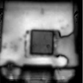

Ultrasonic microscope observation of transistors! It is possible to check the delamination conditions at various locations even at the same focus.
- Analysis and prediction system
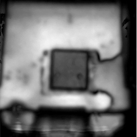
Ultrasonic microscope observation of semiconductor packages
We will introduce the ultrasonic microscopy observation of semiconductor packages that we conduct. Due to storage conditions and mounting conditions, delamination may occur between the metal parts (die pad) and the package resin in semiconductor packages. Delamination inside the package is a defect that significantly affects product quality, but it cannot be detected from the appearance. By using ultrasonic microscopy, we can clearly capture the internal structure of the package and contribute to reliability evaluation.
![[Analysis Case Study] Observation o...](https://image.www.ipros.com/public/product/image/367300/IPROS11362276584300065098.png?w=280&h=280)
If it is something that ultrasound can penetrate, you can check internal information that cannot be confirmed from the appearance!
- Analysis and prediction system
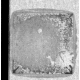
Observation of adhesive conditions through a metal plate using an ultrasonic microscope.
Here is an example of observing the adhesive condition through a metal plate using an ultrasonic microscope. An ultrasonic microscope can confirm internal information that cannot be seen from the outside, as long as the ultrasonic waves can pass through. We observed the condition of the adhesive remaining on the metal plate from the metal side in a sample where the chip came off after reliability testing. Please refer to the PDF document for details and results of the observation.
![[Report] Forecast of Solar Power In...](https://image.www.ipros.com/public/product/image/5cf/2000997196/IPROS78576330056455199906.jpeg?w=280&h=280)

Forecasting the amount of solar power installation in Japan over the next 10 years from two scenarios: "current growth case" and "acceleration case."
- Solar power generation
- Power and Energy Equipment
- Analysis and prediction system

The think tank and consulting company for solar power generation, Resource Comprehensive System, is recruiting personnel.
Resource Comprehensive System Co., Ltd. (Headquarters: Chuo-ku, Tokyo; CEO: Osamu Ichiki), which conducts consulting services related to solar power generation and its associated businesses, is now recruiting new personnel to meet customer needs arising from the expansion of solar power installation and the increasing demand for storage batteries and new fields. Positions available: 1. Researcher 2. General Affairs Staff Location: Headquarters in Chuo-ku, Tokyo, with a combination of remote work For details and application methods, please check our "Recruitment Information Page" (https://www.rts-pv.com/recruit/) Contact: Resource Comprehensive System Co., Ltd. Email: info@rts-pv.com


You can leave everything from the asbestos survey to the report entirely to CIC!
- Structural Survey
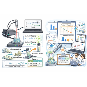
The heterogeneity of the sample governs the model design.
- Other analytical equipment
- Analysis and prediction system

We are currently publishing useful information related to weather, supervised by a meteorologist from Sysmet Co., Ltd., that is helpful for business and daily life.
- Weather Survey
![[ZEROSAI Introduction Interview] Ta...](https://image.www.ipros.com/public/product/image/5ce/2001506016/IPROS11885189802536679812.png?w=280&h=280)
The collaboration between ZEROSAI and LINE WORKS has significantly increased the number of users, making the utilization of weather information a standard practice.
- Weather Survey
- Groupware

[Weather Helpful Information] What to do after a disaster occurs!? Are you familiar with the timeline (disaster prevention action plan)?
Thank you for always watching. In recent years, abnormal weather has been increasing, and disasters caused by heavy rain and typhoons are unavoidable. However, anticipating "how to act" and "what measures to take" in advance greatly influences whether damage can be minimized. This time, we will introduce a "Timeline (Disaster Prevention Action Plan)" that anticipates and plans "how to act" and "what measures to take" in chronological order, as well as an automatic notification service that links business chat with weather forecasts from Sysmet. Table of Contents 1. What is a "Timeline (Disaster Prevention Action Plan)"? 2. Image of the "Timeline (Disaster Prevention Action Plan)" 3. Let's automatically notify weather information through business chat *For more details, please visit our website or feel free to contact us.
![[Free Gift] Useful Product Informat...](https://image.www.ipros.com/public/product/image/e33/2001167954/IPROS32209534549523832735.jpeg?w=280&h=280)
We have compiled useful information from past issues of "Compass PLUS" into an easy-to-read guidebook.
- Harbor Construction
- Coastal construction
- Weather Survey


Achieve optimization of the development process and improvement of analysis accuracy using big data (time series, images)!
- Other Smart Grid
- Analysis and prediction system
- Big Data
![[ZEROSAI Implementation Case] ○○ Fi...](https://image.www.ipros.com/public/product/image/78e/2001514985/IPROS7176189440239303065.jpg?w=280&h=280)
Visualizing coastal gusts: Constantly illuminated three-color indicator lights for quick assessment of work feasibility.
- Anemometer
- Weather Survey
- Coastal construction

[ZEROSAI Implementation Case] Regional Development Bureau National Route No. 〇 Road Improvement Project
We will introduce examples of the implementation of the Natural Disaster Prevention System ZEROSAI (Registration Number QS-150021-VE) in civil engineering and construction work in the construction industry. It can be utilized not only for safety measures but also for creative ideas and technical proposals. [Before Implementation] Due to the proximity of the sea and the lack of obstructions, there were many sudden gusts of wind, making it difficult to determine whether it was safe to continue work. <Issues> - Checking weather apps for work decisions took time, and there was a time lag in informing the entire site. - Delays in deciding to halt work due to strong winds led to cases where work continued while risks were present. We introduced our Natural Disaster Prevention System ZEROSAI along with the optional three-color signal light. For more details, please visit our website or download the PDF.

Centralized management of weather forecast information for the site and upstream rivers in the cloud, with automatic notifications via electronic bulletin boards and business chat during emergencies.
- River construction
- Weather Survey
![[ZEROSAI Implementation Case] Const...](https://image.www.ipros.com/public/product/image/3af/2000403652/IPROS65829576759966670008.jpeg?w=280&h=280)
Visualization of strong winds in construction work!
- Weather Survey
- Crane and others
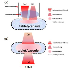
Latest information: Connection to existing Raman spectrometers is possible. Analysis and evaluation of tablets and capsule formulations have become easier.
- others
- Analysis and prediction system
- Measurement and analysis equipment leasing and rental