
List of Surveying related services and equipment products
- classification:Surveying related services and equipment
1~45 item / All 592 items


Natural wood endless tape with a thickness of 0.9 to 3 mm. It contributes to improved yield and productivity as a substitute for solid wood for the edges of furniture and fixtures.


- others


By simply increasing the formwork, we can achieve a variety of variations. Formwork costs are reduced, and productivity is improved! We respond to various site needs with multifunctionality.
- Gutters and U-shaped gutters


Are you considering introducing advanced surveying equipment such as laser scanners, GNSS, and sonar using subsidies? Yokohama Instruments will support you!
- Development permit application

No calibration needed! GNSS antenna with tilt correction function up to 30 degrees.
- Surveying Office

Remote Measurement System: Towards solving the issues of technical inheritance, labor reduction, and efficiency at the site!
- Development permit application
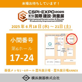
We will exhibit at the 8th Construction and Surveying Productivity Improvement Exhibition (CSPI-EXPO 2026)!
We have decided to exhibit at the 8th Construction and Surveying Productivity Improvement Expo (CSPI-EXPO 2026). We will provide demonstrations of remote surveying using GNSS and electronic leveling instruments, as well as consulting on the introduction of equipment utilizing subsidies! Please feel free to stop by our booth. 【Exhibition Details】 Introduction of the new service "Survey NAVI Series" Completely solving the challenges faced by companies in "measurement, subsidies, remote work, and human resources." Venue: Makuhari Messe Halls 1-6, Outdoor Exhibition Area, Outdoor Exhibition Area ANNEX Dates: June 17 (Wed), 18 (Thu), 19 (Fri), and 20 (Sat), 2026, from 10:00 to 17:00 [Only on the final day, June 20, until 16:00] Booth Location: Exhibition Hall 6, 11-45
![[End] Utilizing Subsidies Free WEB ...](https://image.www.ipros.com/public/product/image/9d4/2000634830/IPROS70105318700977760668.jpeg?w=280&h=280)
You can purchase measuring equipment at 1/2 to 1/3 of the price! For businesses considering introducing cutting-edge measuring equipment using subsidies.
- others
- Surveying Consulting

Check point cloud data obtained from a laser scanner in VR. We also propose technology to remotely operate an automatic tracking total station.


- Development permit application
We will exhibit at the 8th Construction and Surveying Productivity Improvement Exhibition (CSPI-EXPO 2026)!
We have decided to exhibit at the 8th Construction and Surveying Productivity Improvement Expo (CSPI-EXPO 2026). We will provide demonstrations of remote surveying using GNSS and electronic leveling instruments, as well as consulting on the introduction of equipment utilizing subsidies! Please feel free to stop by our booth. 【Exhibition Details】 Introduction of the new service "Survey NAVI Series" Completely solving the challenges faced by companies in "measurement, subsidies, remote work, and human resources." Venue: Makuhari Messe Halls 1-6, Outdoor Exhibition Area, Outdoor Exhibition Area ANNEX Dates: June 17 (Wed), 18 (Thu), 19 (Fri), and 20 (Sat), 2026, from 10:00 to 17:00 [Only on the final day, June 20, until 16:00] Booth Location: Exhibition Hall 6, 11-45

You can check point cloud data obtained from a laser scanner in VR, and even perform simple measurements!
- Development permit application

About the start of the new year’s work.
We would like to inform you about the start of business for the new year. Happy New Year! We are pleased to hear that everyone has welcomed the new spring in good health. Thank you for your generous support over the past year. We look forward to your continued patronage this year as well. We wish you all good health and prosperity. Now, we would like to inform you about the start of business for the new year. The start of business for the new year will be as follows: - First business day of the new year: January 5th, 9:00 AM We appreciate your continued support this year as well.

"Photogrammetry function" and "equipped with a laser rangefinder" expand the scope of one-man surveying!
- Surveying Office

If you want to introduce measuring equipment but are concerned about the price... This is a must-see! We will introduce methods and examples for introducing measuring equipment using subsidies.
- Development permit application

【Maximum Grant Amount 100 Million Yen!】Information on Grants for the Construction Industry "2nd Emergency Support Program for Capital Investment"
A public call for grants aimed at small and medium-sized enterprises with business locations in Tokyo has begun. This grant is intended to subsidize part of the expenses for introducing machinery and equipment necessary for improving productivity and strengthening competitiveness in response to the "2024 Problem." <Eligible Expenses> Expenses for the introduction of machinery, equipment, and software to address the labor shortages caused by the upper limit regulations on overtime work, known as the "2024 Problem." <Grant Rate and Limit> - Grant Rate: Up to 4/5 - Grant Limit: 100 million yen (Minimum grant amount: 1 million yen) <How to Apply for the Grant> Application Reservation Period: From 9:00 AM on October 23, 2024 (Wednesday) to 5:00 PM on November 6, 2024 (Wednesday) Application Acceptance: From 9:00 AM on November 1, 2024 (Friday) to 5:00 PM on November 15, 2024 (Friday) *Applications will be accepted through the electronic system "J-Grant" provided by the national government (Digital Agency). We will provide thorough support from preparation before application, equipment introduction, to confirmation of grant payment. *For more details, please refer to the catalog or PDF materials, or feel free to contact us.

Let's utilize subsidies for the introduction of surveying equipment and surveying CAD! We provide support for equipment proposals and introductions, preparation before application, procedures after ap...


- Development permit application

[Breaking News] The application support for the 11th Business Restructuring Subsidy has started!
The 11th round of the Business Restructuring Subsidy, for which our company provides application support, has started accepting applications from August 8. What is the Business Restructuring Subsidy? It is a subsidy that supports small and medium-sized enterprises that are undertaking bold business restructuring to adapt to the changes in the economic society of the post-COVID era and to strengthen their resilience against crises such as infectious diseases. Requirements (vary by application category) Common requirements for all categories below: 1. Obtain confirmation of the business plan from a certified management innovation support organization. → The business operator must create a business plan in accordance with the business restructuring guidelines and obtain confirmation from a certified support organization or financial institution recognized by the government. 2. Improve added value. Achieve an average annual increase of 3% or more in added value over 3 to 5 years after the completion of the subsidized project, or achieve an average annual increase of 3% or more in added value per employee. <Subsidy Amount> (varies by application category) Subsidy amount: 1 million yen to 100 million yen; subsidy rate: 1/2, 2/3, or 3/4. *The upper limit of the subsidy amount varies depending on the number of employees. Our application support is now open! An upfront fee and success fee will be incurred. *Please apply early as there is a limit on the number of applications. *For more detailed information, please contact us.

Introducing the achievements of introducing laser scanners utilizing manufacturing subsidies and business restructuring subsidies.


- Development permit application
About the start of the new year’s work.
We would like to inform you about the start of business for the new year. Happy New Year! We are pleased to hear that everyone has welcomed the new spring in good health. Thank you for your generous support over the past year. We look forward to your continued patronage this year as well. We wish you all good health and prosperity. Now, we would like to inform you about the start of business for the new year. The start of business for the new year will be as follows: - First business day of the new year: January 5th, 9:00 AM We appreciate your continued support this year as well.
![[End] "Utilization of Scanners/Poin...](https://image.www.ipros.com/public/product/image/299/2000684011/IPROS35417378866815657788.jpeg?w=280&h=280)
[Event] WEB Seminar "Utilization of Laser Scanners/Point Cloud Data and Introduction of Available Subsidies"
- others
- Surveying Consulting

Special introduction of surveying equipment compatible with land, air, and sea. We are currently offering some of the data obtained with the surveying equipment as materials!


- Development permit application
About the start of the new year’s work.
We would like to inform you about the start of business for the new year. Happy New Year! We are pleased to hear that everyone has welcomed the new spring in good health. Thank you for your generous support over the past year. We look forward to your continued patronage this year as well. We wish you all good health and prosperity. Now, we would like to inform you about the start of business for the new year. The start of business for the new year will be as follows: - First business day of the new year: January 5th, 9:00 AM We appreciate your continued support this year as well.

Comprehensive support for the introduction of laser scanners utilizing manufacturing subsidies and business restructuring subsidies! Free case study collection available!


- Development permit application
About the start of the new year’s work.
We would like to inform you about the start of business for the new year. Happy New Year! We are pleased to hear that everyone has welcomed the new spring in good health. Thank you for your generous support over the past year. We look forward to your continued patronage this year as well. We wish you all good health and prosperity. Now, we would like to inform you about the start of business for the new year. The start of business for the new year will be as follows: - First business day of the new year: January 5th, 9:00 AM We appreciate your continued support this year as well.

We propose advanced technology that allows remote operation while staying in the office by utilizing an automatic tracking total station!
- Development permit application
About the start of the new year’s work.
We would like to inform you about the start of business for the new year. Happy New Year! We are pleased to hear that everyone has welcomed the new spring in good health. Thank you for your generous support over the past year. We look forward to your continued patronage this year as well. We wish you all good health and prosperity. Now, we would like to inform you about the start of business for the new year. The start of business for the new year will be as follows: - First business day of the new year: January 5th, 9:00 AM We appreciate your continued support this year as well.

A mobile measurement system equipped with the Z+F IMAGER5016 in a "backpack"!
- Surveying Office
![[Subsidy Application Support] Labor...](https://image.www.ipros.com/public/product/image/c2e/2001515681/IPROS5151476676259281798.jpg?w=280&h=280)
The subsidy application for measuring equipment has an acceptance rate of over 90%! We have supported more than 100 companies!
- Surveying Office
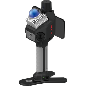
A handheld LiDAR scanner equipped with GNSS receivers and SLAM technology, capable of acquiring high-precision point cloud data both indoors and outdoors.
- Surveying Office
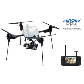

Supports dual-frequency GNSS and PPK positioning. A domestically produced photogrammetry drone that combines long-range communication and convenience.
- photograph


Waterproof load cell. It is a super compact load cell. It can be used underwater. It has an IP67 rating. It is a load cell manufactured by FUTEK.
- Surveying Office
![[Case Studies Available!] Introduct...](https://image.www.ipros.com/public/product/image/8ff/2000823908/IPROS69423412573441044880.jpeg?w=280&h=280)

We have expertise that supports everything from measurement, data processing, to data utilization methods in a seamless manner!

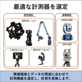


- Surveying Consulting


A professional group utilizing various drones! Leave inspections and aerial photography to us.
- photograph
- Surveying
- Structural Survey


Industrial medium-sized underwater drone equipped with a 10,000lm high-brightness LED light!
- Audio and video equipment
- media

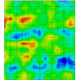
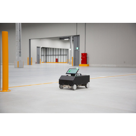
Measure floor accuracy and visualize unevenness and height differences that affect AGV operation. This floor survey is useful for pre-introduction assessments and correction planning. Nationwide suppo...
- Surveying Office
- Automated guided vehicles (AGV, RGV)
- Automated warehouse (AS, RS)
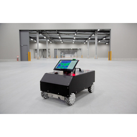
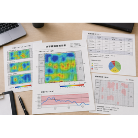
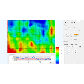
Measure the floor level in 0.1mm increments and visualize it with an unevenness heat map and cross-sectional graph! We also provide corrective proposals before AGV implementation and warehouse renovat...
- Surveying Office
- Other analytical equipment
- Surveying
Measure the floor level in 0.1mm increments and quickly create heat maps. You can easily grasp the unevenness in warehouses and factories. This can be utilized for renovation planning.
- Automated guided vehicles (AGV, RGV)
- Automated warehouse (AS, RS)
- Surveying Consulting
![[Plant and Equipment] Avoiding Inte...](https://image.www.ipros.com/public/product/image/2114348/IPROS896440735043422750.png?w=280&h=280)

Ensure accurate current conditions in design. Completely avoid interference on the PC, eliminating rework and re-measurement on site to zero!
- Drawing, tracing, CAD
- Surveying Consulting
- Architectural design office
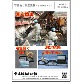

Measurement completed in about 20 minutes! Lightweight and cable-free design allows for on-site measurement of pipe bends, easily transportable by one person. Ideal for measuring small diameter pipes ...
- Surveying Consulting
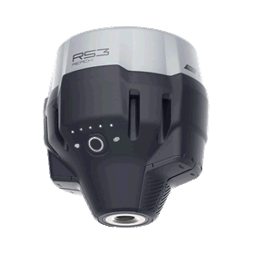

A versatile GNSS antenna that can be used in various situations, equipped with an internal IMU sensor for tilt observation, and supports RTK, static, PPK, and more.
- Surveying Office
- Surveying
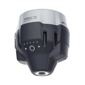
The EMLID Reach RS3 has been registered as a Class 1 GNSS antenna by the Geospatial Information Authority of Japan.
Our GNSS surveying antenna "EMLID Reach RS3," which we handle, has been officially registered as Class 1 GNSS after passing the certification of the Geospatial Information Authority of Japan. Registration date: March 27, 2026 Registration number: No. 259 As a result, the Reach RS3 has become a reliable device that can be confidently used in surveying sites where accuracy and reliability are required, such as public surveying and municipal-related work. Please consider the Reach RS3. For product catalogs and detailed information, please feel free to contact us below.
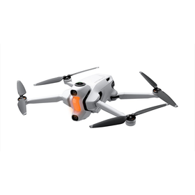
Finally on sale! Drone equipped with a 360-degree camera.
- Surveying
- Surveying Consulting
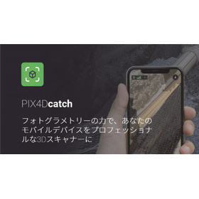
Combine photogrammetry and smartphone LiDAR to turn your smartphone into a professional-grade surveying instrument.
- Surveying
- Surveying Office
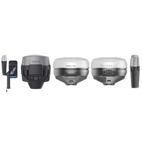
Reach RX2, RS4, RS4 PRO now available! EMLID GNSS antenna comparison event.
EMLID has added three new models, RX2, RS4, and RS4 Pro, to its GNSS antenna lineup starting in April. Therefore, we will hold a comparison experience event where you can compare the existing products RX and RS3 with the new models! This is a rare opportunity to compare all five models together!

Disseminating know-how and technical information on the commercialization of electronic paper, LCD, and LED.
- media
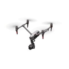
The drone solutions of "DJI," the world's leading drone manufacturer.
- photograph
- Surveying
- Surveying Consulting

We will exhibit at the 8th International Construction and Surveying Expo, CSPI-EXPO 2026, held in June.
This is an exhibition where you can find numerous solutions to challenges in the construction industry, as well as the latest technologies and products on display. We will showcase products that our company confidently recommends, so please make sure to stop by when you visit. We will also hold the event on Saturday again this year. 【Exhibition Information】 - CSPI-EXPO 2026 8th International Construction and Surveying Exhibition - Venue: Makuhari Messe, Booth Number: 28-19 (Exhibition Hall 8) - Dates: June 17 (Wednesday) to June 20 (Saturday), 2026 - Hours: 10:00 AM to 5:00 PM (until 4:00 PM on the final day)
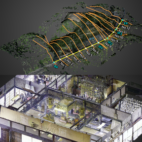

Invisible places and unreachable heights. Fully digitized with drones and ground lasers!
- Surveying Consulting

Providing high-end performance at less than half the cost! Drone LiDAR with a relative accuracy of 5mm and a measurement accuracy of 2-5cm, suitable for public surveying.
- Surveying
- Surveying Office
- Surveying Consulting
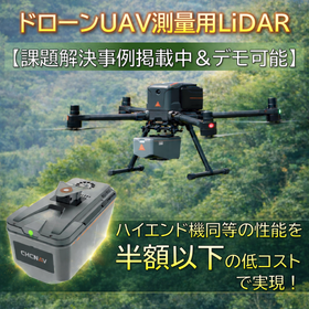
Drone UAV Surveying LiDAR [Case studies available & demonstrations possible]
Do you have any of the following challenges in public surveying? - Wanting to introduce high-precision laser surveying, but costs are a barrier... - Struggling to obtain surface data in forested areas... - Unable to output numerical data for accuracy management tables... The solution to these challenges is the latest drone surveying LiDAR from CHCNAV, the 'Alpha Air 9 (AA9)'! In Japan, it is exclusively available for purchase through our company, SkyLink Japan. This product offered by SkyLink Japan features a compact and lightweight body weighing only 1.45 kg, achieving long-range scanning performance of up to 700 meters and high-speed measurement of 600,000 points per second. It provides "public surveying level" accuracy comparable to high-end models at an overwhelming introduction cost. *If requested, we can arrange a demonstration flight. Please feel free to consult with us. *The catalog PDF includes case studies for solving challenges, archived webinars, and materials detailing pricing and introduction costs.
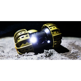

A lunar rover that combines ultra-compact, ultra-lightweight, high strength, and reliable mobility!
- others
- photograph
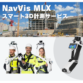

Even in narrow spaces and high places, high-precision 3D acquisition with a lightweight handheld device! 3D measurement is possible in high locations and in narrow areas such as complex machinery room...
- Surveying Consulting
- Other measuring instruments
- Surveying

Eliminate discrepancies between the drawings and the site, and advance the decision-making for layout changes.
- Other interior and exterior systems and units
- Other analytical equipment
- Surveying Consulting
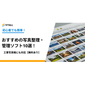

Supports construction photo albums with 'free options'! We will also introduce common challenges and examples of failures in organizing construction photos.
- Construction and process management software
- photograph
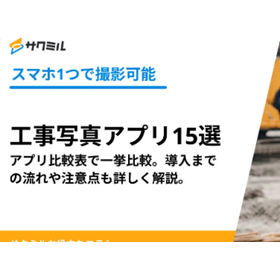
A comprehensive comparison of apps! Detailed explanation of the process and points to note until implementation.
- Construction and process management software
- photograph
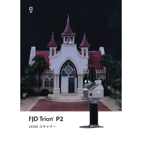

Further evolution towards high precision and miniaturization!
- Surveying Office
- Civil Engineering Company
- Consulting companies
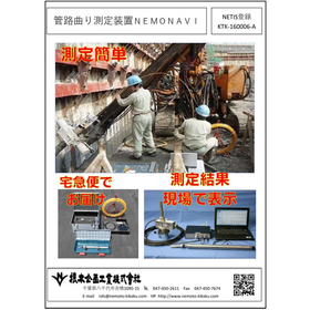
It allows for accurate and easy measurement of the curvature of boreholes for anchor construction, ground improvement work, and investigation of buried pipes (water, communication, electricity, gas, e...
- Surveying Consulting

Measurements in the horizontal and vertical directions, as well as diagonal directions, are also supported. The measuring equipment is delivered directly to the site by courier. Dispatch of measuremen...
- Surveying Consulting


By taking aerial photos and videos every day, it is possible to thoroughly grasp the progress of the construction work!
- Other civil engineering services
- photograph