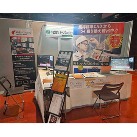
A CAD specifically for civil engineering, born from the voices of the field.
"J-CIVIL" is an add-on (plugin) software for the civil engineering industry that can be integrated with the DWG-compatible CAD software "ARES." It offers functionalities and usability similar to those of globally standard CAD software while being available at a price comparable to general-purpose CAD, thus alleviating the high costs that have been a barrier to adoption. While there are diverse needs in civil engineering sites, it aims to position itself as the standard CAD for civil engineering by focusing on the core, frequently used features to eliminate over-specification.
Inquire About This Product
basic information
<Function Introduction> 〇 Overlaying 2D and 3D Data You can overlay satellite images and map data from the Geospatial Information Authority of Japan onto floor plans. By adding "satellite images" and "3D models" to drawings that were previously composed only of "shapes and text," the understanding of the site is greatly enhanced, allowing meetings and discussions to proceed smoothly based on a common understanding. 〇 Plotting Function for Placing Survey Data on Drawings This function allows you to place markers at specific locations using coordinate data obtained from surveys. It enables accurate representation of coordinates measured on-site in the drawings, making it easier to visually understand the spatial relationships of reference points in conjunction with the background satellite images. 〇 Coordinate Registration Function to Support Site Positioning This function allows for the immediate recording of coordinates on the drawings. The obtained coordinates can be exchanged in SIMA file format, facilitating the use of equipment for site positioning.
Price information
■Add On Plan (J-CIVIL standalone) 1-year license: 55,000 yen 3-year license: 110,000 yen ■Trinity Plan (ARES Commander and J-CIVIL set) 1-year license: 127,600 yen 3-year license: 228,800 yen ■Trinity Plan + UNDET (ARES Commander, J-CIVIL, and point cloud plugin set) 1-year license: 279,600 yen 3-year license: 644,800 yen A one-time purchase plan is also available. *Prices include tax.
Delivery Time
P3
Applications/Examples of results
For more details, please refer to the materials or feel free to contact us.
Detailed information
-

This is a linear feature added in version 1.2. It supports the IP method and the element method, and allows for SIMA input and output.
-

Most functions can be operated with buttons! We have reflected the feedback from our existing customers who requested "terms that are easy to understand at a glance," and we have focused on screen design and expressions that are easy for beginners to understand.
catalog(1)
Download All CatalogsNews about this product(5)
Company information
Kinos Logic is a system development company that has been active in Nagoya since its establishment in 1993, focusing on the development of surveying CAD systems. We have developed our own surveying CAD systems and continued to grow, utilizing the technology, experience, and know-how we have cultivated over the years to develop high-quality and user-friendly systems that our customers will appreciate. The construction and civil engineering industry is currently undergoing a significant transformation, with advancements in efficiency and the introduction of new technologies. We aim to provide innovative solutions that meet the needs of the industry through the enhancement of existing products and the development of new ones.


![[Case Study] Heat Transfer and Thermal Stress Analysis - Casting Cooling Simulation](https://image.www.ipros.com/public/product/image/796/221079029/IPROS_12823254587895474000.jpg?w=280&h=280)


