1~11 item / All 11 items
Displayed results
Filter by category

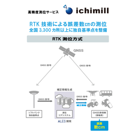
高精度測位サービス「ichimill(イチミル)」
全国3,300以上の独自基準点と衛星(GNSS)信号で高精度・リアルタイムに位置測位。2,000社以上のお客さまにご活用いただいています。