
Improving the efficiency of demolition work using drones.
Data digitization of work processes enables efficient operations! Improved safety and cost reduction.
Demolition work largely relies on the experience and eyes of operators and supervisors, but by introducing 3D data into drone aerial photography, work planning, and management, it becomes possible to carry out efficient operations while ensuring the safety of workers. It allows for clear calculations of the structure of the target building, the scope of demolition, and the amount of waste generated. Additionally, signals and monitoring that were previously conducted from high places can now be done from a distance, significantly improving safety. Furthermore, drones can also be utilized for urgent investigations related to demolition and removal in the event of a disaster. 【Features】 ■ Improved work efficiency ■ Enhanced safety ■ Cost reduction ■ Accurate estimates ■ Visualization of plans *For more details, please refer to the PDF materials or feel free to contact us.
- Company:征和建設 本社
- Price:Other
![[Recommended Drone Measurement!] High-Precision 3D UAV 'Winser'](https://image.www.ipros.com/public/product/image/d5a/2000342404/IPROS161092115312677775.PNG?w=280&h=280)


![[Drone] New AeroBot PPK (AS-MC03-PPKHL)](https://image.www.ipros.com/public/product/image/c29/2001099510/IPROS04147789082142540405.png?w=280&h=280)


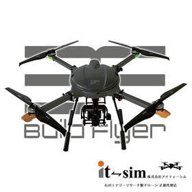


![Hose Connection [Agriflyer by Ishikawa Energy Research]](https://image.www.ipros.com/public/product/image/e7d/2000918265/IPROS89759832429516209303.png?w=280&h=280)
![[Splash Drone 4] 3-axis gimbal 4K camera kit and others](https://image.www.ipros.com/public/product/image/772/2000935051/IPROS69941397155585755281.jpeg?w=280&h=280)


![[Production Achievements] Large Drone](https://image.www.ipros.com/public/product/image/ec0/2000654265/IPROS70858486781098674993.png?w=280&h=280)

![[AEROBO Solution Implementation Case] Takenaka Corporation](https://image.www.ipros.com/public/product/image/af8/2000402230/IPROS8284925792696959032.jpg?w=280&h=280)
![[AEROBO Introduction Case] Haseko Anesis Co., Ltd.](https://image.www.ipros.com/public/product/image/40a/2000405080/IPROS15916790621751272570.jpg?w=280&h=280)

