
List of Other measuring instruments products
- classification:Other measuring instruments
676~720 item / All 9592 items


Numerous delivery achievements nationwide! Offered at prices made possible by in-house production.


- Sports related facilities


From maintaining aesthetics during new installations to renewing existing ones. Enhancing spaces with a luxurious texture and supporting the increase of property value through magnet installations.


- Elevator
- Interior wall decoration
- Fabric wallpaper
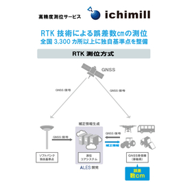

Supports agricultural autonomous driving with positioning accuracy of a few centimeters.
- Other measuring instruments
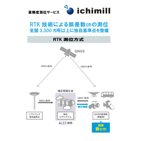
RTK technology achieves an accuracy of a few centimeters. Supports heavy machinery guidance at over 3,300 reference points nationwide.
- Other measuring instruments
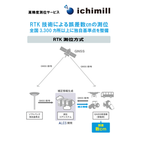
Achieving positioning with an error of a few centimeters. Improving the accuracy of terrain mapping.
- Other measuring instruments
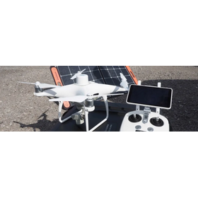
High-precision RTK-GNSS available for a monthly fee of several thousand yen: 'ichimill' thoroughly tested by Kōbe Seiko for drone surveying and point cloud measurement.
This article was published in Construction IT World on March 18, 2022. SoftBank offers a high-precision positioning service called "ichimill," which provides "correction information" used in "RTK-GNSS" capable of high-precision surveying. Despite its accuracy of just a few centimeters, the usage fee is surprisingly low at several thousand yen per month. A technical sales representative from Kobe Seiko, a surveying equipment sales company based in Kobe, Hyogo Prefecture, thoroughly tested the capabilities of ichimill using point cloud measurements with drones and 3D laser scanners.
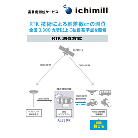
To improve the accuracy of logging plans. Achieving positioning with an error of a few centimeters.
- Other measuring instruments
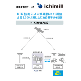
Positioning with an error of a few centimeters in drone aerial photography. Over 3,300 unique reference points nationwide.
- Other measuring instruments
High-precision RTK-GNSS available for a monthly fee of several thousand yen: 'ichimill' thoroughly tested by Kōbe Seiko for drone surveying and point cloud measurement.
This article was published in Construction IT World on March 18, 2022. SoftBank offers a high-precision positioning service called "ichimill," which provides "correction information" used in "RTK-GNSS" capable of high-precision surveying. Despite its accuracy of just a few centimeters, the usage fee is surprisingly low at several thousand yen per month. A technical sales representative from Kobe Seiko, a surveying equipment sales company based in Kobe, Hyogo Prefecture, thoroughly tested the capabilities of ichimill using point cloud measurements with drones and 3D laser scanners.

Aiming for on-site completion of drone surveying operations! The ICT Promotion Group has chosen the option "Kumiki."
- Other measuring instruments
- Other Software
- Surveying
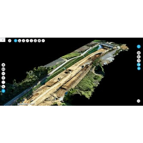
Introducing a case where work style was improved with a reduction of over 90% in working hours!
- Other measuring instruments
- Other Software
- Surveying
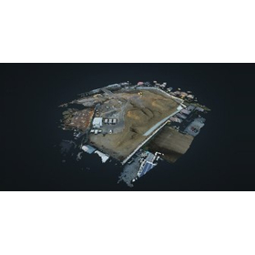
Improving work styles with a reduction of over 90% in working hours! Introducing the case study of Kumiki.
- Other measuring instruments
- Other Software
- Surveying
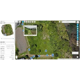
Installing and inspecting solar panels safely, accurately, and quickly! Utilizing drone surveying in approximately 4,000 field operations.
- Other measuring instruments
- Other Software
- Surveying
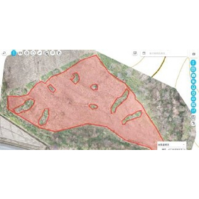
The area measurement that used to take 3 hours per hectare has been shortened to just 30 minutes!
- Other measuring instruments
- Other Software
- Surveying
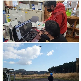
Utilized in afforestation inspections! Introducing a case that reduced surveying and inspection man-hours by 70%.
- Other measuring instruments
- Other Software
- Surveying
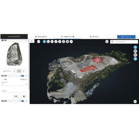
Significantly reduced the labor hours for inventory stocktaking management from 48 hours to just 6 hours!
- Other measuring instruments
- Other Software
- Surveying
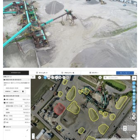
We will introduce a case where the labor required for inventory stocktaking management was significantly reduced from 48 hours to just 6 hours!
- Other measuring instruments
- Other Software
- Surveying
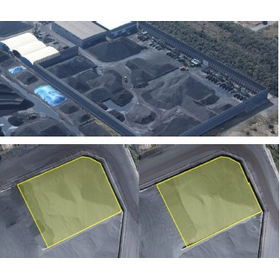
Smart yard management realized before measurement variability becomes a risk!
- Other measuring instruments
- Other Software
- Surveying
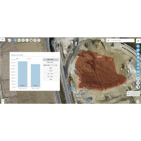
Streamlining the overall understanding of accumulated waste and leftover soil! Reducing work hours by 60%.
- Other measuring instruments
- Other Software
- Surveying
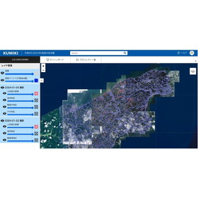
We will introduce examples of analyzing areas affected by landslides and publicly releasing them nationwide for free!
- Other measuring instruments
- Other Software
- Surveying
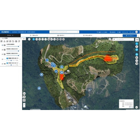
Utilized for investigating disaster areas on forest roads, key to sharing damage status and rapid disaster recovery!
- Other measuring instruments
- Other Software
- Surveying


Visualize indoor carbon dioxide levels at one-second intervals! A CO2 sensor that clearly indicates when to ventilate.
- Other measuring instruments


Strong on-site performance, dustproof and waterproof capabilities, and robustness! Significantly reduces preparation, measurement, and cleanup tasks.
- Measurement and Inspection
- Other measuring instruments

With this one device, you can carry out network installation work! Simply connect the cables and press the TEST button for easy operation.
- Other measuring instruments

Correcting measurement errors of the torque meter! Safely evaluating power conditioners with high voltage.
- Other measuring instruments

Improve work efficiency with a lead that has a switch! An insulation resistance tester that allows for smooth start and stop operations.
- Measurement and Inspection
- Other measuring instruments


A pressure-type seal strength testing machine widely used in the pharmaceutical, cosmetics, and food industries. It is a device for testing the seal strength of pouch and tube products.
- Other measuring instruments
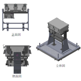

A fully automated testing and management solution for communication quality evaluation and monitoring in D2C satellite communication!
- Other measuring instruments


[New Release] Small, lightweight, and easy to measure! A magnetic field measuring device that responds to the voices from the field. Just press the hold button to save measurement data!
- Other measuring instruments
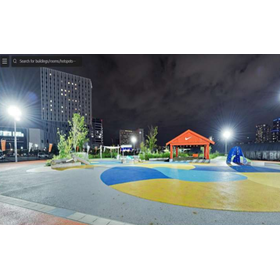
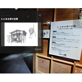
Faithfully reproducing real space with 16K panoramic photos. Smooth sharing with lightweight data. Supporting free secondary use and operation through the transfer of rights to the shooting data.
- Other measuring instruments

Announcement of the 4DKanKan Online Briefing on Starting Field DX with This Year's Budget
We would like to invite you to the online product presentation of "4DKanKan," a tool that promotes 3D digitalization and DX of sites and facilities. With a 3D digital twin camera that can simultaneously capture ultra-high-definition 16K panoramic photos and 1cm mesh point cloud data, you can advance the digitalization of your site without any specialized knowledge. 【Free】4DKanKan Online Product Presentation Presentation Content: 1. What is 4DKanKan? 2. Introduction of features using captured data 3. Introduction of optional services (hardware and software) 4. Use cases 5. Pricing and implementation methods 6. Q&A Do you have any of these concerns? - The burden of travel for site inspections is high - It is difficult to share the situation with just photos - You are interested in utilizing point clouds and 3D data but do not know how to implement them "4DKanKan" is here to solve these issues. It is being utilized to improve efficiency across a wide range of industries, including construction management, surveying, manufacturing, infrastructure, and events. Small starts are also possible through rentals, proof-of-concept experiments, and photography contracts. If you are considering DX initiatives for the next fiscal year, please join us.
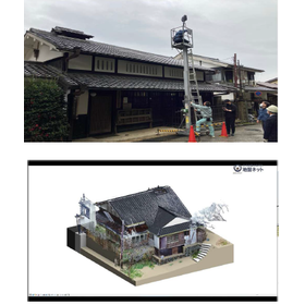
Efficient restoration and preservation of historical buildings without existing blueprints! Easy inter-departmental sharing with lightweight point cloud data.
- Other measuring instruments
Announcement of the 4DKanKan Online Briefing on Starting Field DX with This Year's Budget
We would like to invite you to the online product presentation of "4DKanKan," a tool that promotes 3D digitalization and DX of sites and facilities. With a 3D digital twin camera that can simultaneously capture ultra-high-definition 16K panoramic photos and 1cm mesh point cloud data, you can advance the digitalization of your site without any specialized knowledge. 【Free】4DKanKan Online Product Presentation Presentation Content: 1. What is 4DKanKan? 2. Introduction of features using captured data 3. Introduction of optional services (hardware and software) 4. Use cases 5. Pricing and implementation methods 6. Q&A Do you have any of these concerns? - The burden of travel for site inspections is high - It is difficult to share the situation with just photos - You are interested in utilizing point clouds and 3D data but do not know how to implement them "4DKanKan" is here to solve these issues. It is being utilized to improve efficiency across a wide range of industries, including construction management, surveying, manufacturing, infrastructure, and events. Small starts are also possible through rentals, proof-of-concept experiments, and photography contracts. If you are considering DX initiatives for the next fiscal year, please join us.
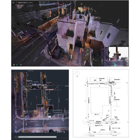
Achieving two-person system field measurements with just one person! Contributing to the reduction of manpower in surveying operations without the need for operational skills.
- Other measuring instruments
Announcement of the 4DKanKan Online Briefing on Starting Field DX with This Year's Budget
We would like to invite you to the online product presentation of "4DKanKan," a tool that promotes 3D digitalization and DX of sites and facilities. With a 3D digital twin camera that can simultaneously capture ultra-high-definition 16K panoramic photos and 1cm mesh point cloud data, you can advance the digitalization of your site without any specialized knowledge. 【Free】4DKanKan Online Product Presentation Presentation Content: 1. What is 4DKanKan? 2. Introduction of features using captured data 3. Introduction of optional services (hardware and software) 4. Use cases 5. Pricing and implementation methods 6. Q&A Do you have any of these concerns? - The burden of travel for site inspections is high - It is difficult to share the situation with just photos - You are interested in utilizing point clouds and 3D data but do not know how to implement them "4DKanKan" is here to solve these issues. It is being utilized to improve efficiency across a wide range of industries, including construction management, surveying, manufacturing, infrastructure, and events. Small starts are also possible through rentals, proof-of-concept experiments, and photography contracts. If you are considering DX initiatives for the next fiscal year, please join us.
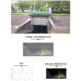
Records clearly even in dark places with 16K high resolution! Reduces re-investigation and rework, and streamlines repair considerations.
- Other measuring instruments
Announcement of the 4DKanKan Online Briefing on Starting Field DX with This Year's Budget
We would like to invite you to the online product presentation of "4DKanKan," a tool that promotes 3D digitalization and DX of sites and facilities. With a 3D digital twin camera that can simultaneously capture ultra-high-definition 16K panoramic photos and 1cm mesh point cloud data, you can advance the digitalization of your site without any specialized knowledge. 【Free】4DKanKan Online Product Presentation Presentation Content: 1. What is 4DKanKan? 2. Introduction of features using captured data 3. Introduction of optional services (hardware and software) 4. Use cases 5. Pricing and implementation methods 6. Q&A Do you have any of these concerns? - The burden of travel for site inspections is high - It is difficult to share the situation with just photos - You are interested in utilizing point clouds and 3D data but do not know how to implement them "4DKanKan" is here to solve these issues. It is being utilized to improve efficiency across a wide range of industries, including construction management, surveying, manufacturing, infrastructure, and events. Small starts are also possible through rentals, proof-of-concept experiments, and photography contracts. If you are considering DX initiatives for the next fiscal year, please join us.
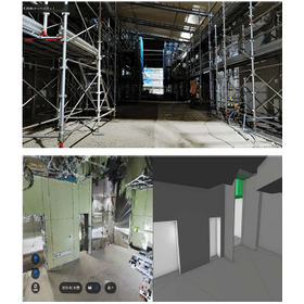
Record the completed state in 16K×3D! Enable remote consideration for future renovations.
- Other measuring instruments
Announcement of the 4DKanKan Online Briefing on Starting Field DX with This Year's Budget
We would like to invite you to the online product presentation of "4DKanKan," a tool that promotes 3D digitalization and DX of sites and facilities. With a 3D digital twin camera that can simultaneously capture ultra-high-definition 16K panoramic photos and 1cm mesh point cloud data, you can advance the digitalization of your site without any specialized knowledge. 【Free】4DKanKan Online Product Presentation Presentation Content: 1. What is 4DKanKan? 2. Introduction of features using captured data 3. Introduction of optional services (hardware and software) 4. Use cases 5. Pricing and implementation methods 6. Q&A Do you have any of these concerns? - The burden of travel for site inspections is high - It is difficult to share the situation with just photos - You are interested in utilizing point clouds and 3D data but do not know how to implement them "4DKanKan" is here to solve these issues. It is being utilized to improve efficiency across a wide range of industries, including construction management, surveying, manufacturing, infrastructure, and events. Small starts are also possible through rentals, proof-of-concept experiments, and photography contracts. If you are considering DX initiatives for the next fiscal year, please join us.
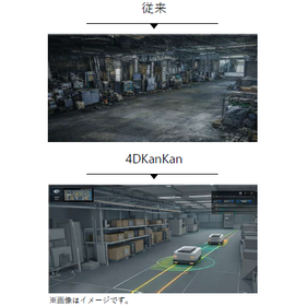
Build a 3D point cloud field that faithfully reproduces the real world! Improve the accuracy of robot route verification.
- Other measuring instruments
Announcement of the 4DKanKan Online Briefing on Starting Field DX with This Year's Budget
We would like to invite you to the online product presentation of "4DKanKan," a tool that promotes 3D digitalization and DX of sites and facilities. With a 3D digital twin camera that can simultaneously capture ultra-high-definition 16K panoramic photos and 1cm mesh point cloud data, you can advance the digitalization of your site without any specialized knowledge. 【Free】4DKanKan Online Product Presentation Presentation Content: 1. What is 4DKanKan? 2. Introduction of features using captured data 3. Introduction of optional services (hardware and software) 4. Use cases 5. Pricing and implementation methods 6. Q&A Do you have any of these concerns? - The burden of travel for site inspections is high - It is difficult to share the situation with just photos - You are interested in utilizing point clouds and 3D data but do not know how to implement them "4DKanKan" is here to solve these issues. It is being utilized to improve efficiency across a wide range of industries, including construction management, surveying, manufacturing, infrastructure, and events. Small starts are also possible through rentals, proof-of-concept experiments, and photography contracts. If you are considering DX initiatives for the next fiscal year, please join us.
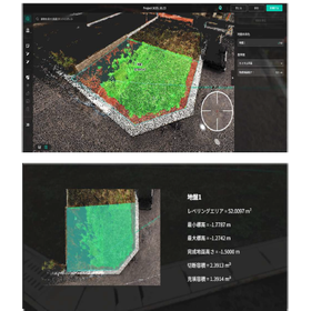
Suppressing soil volume discrepancies with point cloud data! Reducing shooting time to half compared to total station.
- Other measuring instruments
Announcement of the 4DKanKan Online Briefing on Starting Field DX with This Year's Budget
We would like to invite you to the online product presentation of "4DKanKan," a tool that promotes 3D digitalization and DX of sites and facilities. With a 3D digital twin camera that can simultaneously capture ultra-high-definition 16K panoramic photos and 1cm mesh point cloud data, you can advance the digitalization of your site without any specialized knowledge. 【Free】4DKanKan Online Product Presentation Presentation Content: 1. What is 4DKanKan? 2. Introduction of features using captured data 3. Introduction of optional services (hardware and software) 4. Use cases 5. Pricing and implementation methods 6. Q&A Do you have any of these concerns? - The burden of travel for site inspections is high - It is difficult to share the situation with just photos - You are interested in utilizing point clouds and 3D data but do not know how to implement them "4DKanKan" is here to solve these issues. It is being utilized to improve efficiency across a wide range of industries, including construction management, surveying, manufacturing, infrastructure, and events. Small starts are also possible through rentals, proof-of-concept experiments, and photography contracts. If you are considering DX initiatives for the next fiscal year, please join us.
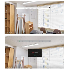
Improve effectiveness with training utilizing shooting data! Achieve online training based on real-world scenarios.
- Other measuring instruments
Announcement of the 4DKanKan Online Briefing on Starting Field DX with This Year's Budget
We would like to invite you to the online product presentation of "4DKanKan," a tool that promotes 3D digitalization and DX of sites and facilities. With a 3D digital twin camera that can simultaneously capture ultra-high-definition 16K panoramic photos and 1cm mesh point cloud data, you can advance the digitalization of your site without any specialized knowledge. 【Free】4DKanKan Online Product Presentation Presentation Content: 1. What is 4DKanKan? 2. Introduction of features using captured data 3. Introduction of optional services (hardware and software) 4. Use cases 5. Pricing and implementation methods 6. Q&A Do you have any of these concerns? - The burden of travel for site inspections is high - It is difficult to share the situation with just photos - You are interested in utilizing point clouds and 3D data but do not know how to implement them "4DKanKan" is here to solve these issues. It is being utilized to improve efficiency across a wide range of industries, including construction management, surveying, manufacturing, infrastructure, and events. Small starts are also possible through rentals, proof-of-concept experiments, and photography contracts. If you are considering DX initiatives for the next fiscal year, please join us.
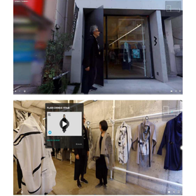
Share the atmosphere and world view of the store online! Accessible at any time, contributing to increased recognition.
- Other measuring instruments
Announcement of the 4DKanKan Online Briefing on Starting Field DX with This Year's Budget
We would like to invite you to the online product presentation of "4DKanKan," a tool that promotes 3D digitalization and DX of sites and facilities. With a 3D digital twin camera that can simultaneously capture ultra-high-definition 16K panoramic photos and 1cm mesh point cloud data, you can advance the digitalization of your site without any specialized knowledge. 【Free】4DKanKan Online Product Presentation Presentation Content: 1. What is 4DKanKan? 2. Introduction of features using captured data 3. Introduction of optional services (hardware and software) 4. Use cases 5. Pricing and implementation methods 6. Q&A Do you have any of these concerns? - The burden of travel for site inspections is high - It is difficult to share the situation with just photos - You are interested in utilizing point clouds and 3D data but do not know how to implement them "4DKanKan" is here to solve these issues. It is being utilized to improve efficiency across a wide range of industries, including construction management, surveying, manufacturing, infrastructure, and events. Small starts are also possible through rentals, proof-of-concept experiments, and photography contracts. If you are considering DX initiatives for the next fiscal year, please join us.
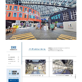
Attract customers who couldn't attend the exhibition! Achieve a digital archive of the produced materials.
- Other measuring instruments
Announcement of the 4DKanKan Online Briefing on Starting Field DX with This Year's Budget
We would like to invite you to the online product presentation of "4DKanKan," a tool that promotes 3D digitalization and DX of sites and facilities. With a 3D digital twin camera that can simultaneously capture ultra-high-definition 16K panoramic photos and 1cm mesh point cloud data, you can advance the digitalization of your site without any specialized knowledge. 【Free】4DKanKan Online Product Presentation Presentation Content: 1. What is 4DKanKan? 2. Introduction of features using captured data 3. Introduction of optional services (hardware and software) 4. Use cases 5. Pricing and implementation methods 6. Q&A Do you have any of these concerns? - The burden of travel for site inspections is high - It is difficult to share the situation with just photos - You are interested in utilizing point clouds and 3D data but do not know how to implement them "4DKanKan" is here to solve these issues. It is being utilized to improve efficiency across a wide range of industries, including construction management, surveying, manufacturing, infrastructure, and events. Small starts are also possible through rentals, proof-of-concept experiments, and photography contracts. If you are considering DX initiatives for the next fiscal year, please join us.
Publish shooting data on the web and social media! Enable participation from both domestic and international sources to accelerate event attraction.
- Other measuring instruments
Announcement of the 4DKanKan Online Briefing on Starting Field DX with This Year's Budget
We would like to invite you to the online product presentation of "4DKanKan," a tool that promotes 3D digitalization and DX of sites and facilities. With a 3D digital twin camera that can simultaneously capture ultra-high-definition 16K panoramic photos and 1cm mesh point cloud data, you can advance the digitalization of your site without any specialized knowledge. 【Free】4DKanKan Online Product Presentation Presentation Content: 1. What is 4DKanKan? 2. Introduction of features using captured data 3. Introduction of optional services (hardware and software) 4. Use cases 5. Pricing and implementation methods 6. Q&A Do you have any of these concerns? - The burden of travel for site inspections is high - It is difficult to share the situation with just photos - You are interested in utilizing point clouds and 3D data but do not know how to implement them "4DKanKan" is here to solve these issues. It is being utilized to improve efficiency across a wide range of industries, including construction management, surveying, manufacturing, infrastructure, and events. Small starts are also possible through rentals, proof-of-concept experiments, and photography contracts. If you are considering DX initiatives for the next fiscal year, please join us.
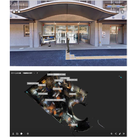
Centralized management of equipment information in 3D space! A ledger that anyone can use, accommodating staff changes.
- Other measuring instruments
Announcement of the 4DKanKan Online Briefing on Starting Field DX with This Year's Budget
We would like to invite you to the online product presentation of "4DKanKan," a tool that promotes 3D digitalization and DX of sites and facilities. With a 3D digital twin camera that can simultaneously capture ultra-high-definition 16K panoramic photos and 1cm mesh point cloud data, you can advance the digitalization of your site without any specialized knowledge. 【Free】4DKanKan Online Product Presentation Presentation Content: 1. What is 4DKanKan? 2. Introduction of features using captured data 3. Introduction of optional services (hardware and software) 4. Use cases 5. Pricing and implementation methods 6. Q&A Do you have any of these concerns? - The burden of travel for site inspections is high - It is difficult to share the situation with just photos - You are interested in utilizing point clouds and 3D data but do not know how to implement them "4DKanKan" is here to solve these issues. It is being utilized to improve efficiency across a wide range of industries, including construction management, surveying, manufacturing, infrastructure, and events. Small starts are also possible through rentals, proof-of-concept experiments, and photography contracts. If you are considering DX initiatives for the next fiscal year, please join us.
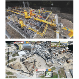
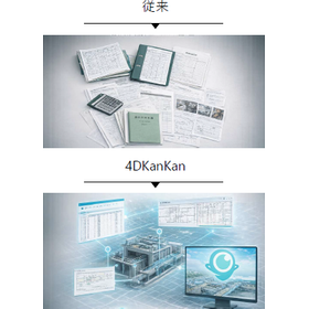
Streamline design review through visual inspection and manual work! The offline version also meets security requirements.
- Other measuring instruments
Announcement of the 4DKanKan Online Briefing on Starting Field DX with This Year's Budget
We would like to invite you to the online product presentation of "4DKanKan," a tool that promotes 3D digitalization and DX of sites and facilities. With a 3D digital twin camera that can simultaneously capture ultra-high-definition 16K panoramic photos and 1cm mesh point cloud data, you can advance the digitalization of your site without any specialized knowledge. 【Free】4DKanKan Online Product Presentation Presentation Content: 1. What is 4DKanKan? 2. Introduction of features using captured data 3. Introduction of optional services (hardware and software) 4. Use cases 5. Pricing and implementation methods 6. Q&A Do you have any of these concerns? - The burden of travel for site inspections is high - It is difficult to share the situation with just photos - You are interested in utilizing point clouds and 3D data but do not know how to implement them "4DKanKan" is here to solve these issues. It is being utilized to improve efficiency across a wide range of industries, including construction management, surveying, manufacturing, infrastructure, and events. Small starts are also possible through rentals, proof-of-concept experiments, and photography contracts. If you are considering DX initiatives for the next fiscal year, please join us.
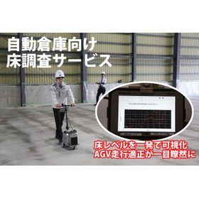

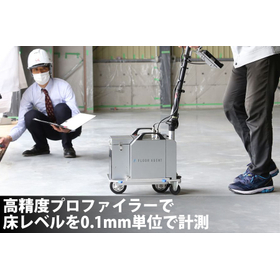
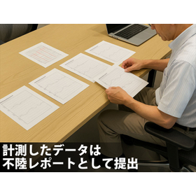
Proposal for a floor survey service that quantifies floor accuracy before the introduction of AGVs and AMRs, visualizes unevenness and defects, and leads to optimal renovation decisions.
- Surveying
- Other measuring instruments


You can easily implement cloud-based solutions for sensors and measuring instruments from other companies, such as flow meters, enabling remote monitoring and email alert functions during anomalies!
- Other measuring instruments

Approximately 1 year of operation on battery, remote monitoring via cloud, email alerts during anomalies, measurement resolution is 0.001°.


- Other measuring instruments

Cloud-based data from flow meters and other devices to streamline leak monitoring!
- Other measuring instruments

Remote monitoring of water levels in rice paddies and fields! Optimizing water management.
- Other measuring instruments

You can easily implement cloud-based remote monitoring and email notifications for various sensors and measuring instruments from different manufacturers, such as flow meters!
- Other measuring instruments

Cloudify measuring instruments such as flow meters to streamline progress management!
- Other measuring instruments