
List of Surveying products
- classification:Surveying
181~225 item / All 1014 items


Segmented construction is possible! A new type of modular bridge that allows for rapid and easy installation.

- Foundation construction


Please leave the investigation of high places or coastal cliffs, as well as the investigation of disaster sites such as rockfalls, to us!
- photograph
- Surveying


A surveying-specific model equipped with Yellow Scan's LiDAR on a domestically produced and secure PF2-AE.
- Surveying


Classroom learning is available online on demand, so you can take it anytime!
- photograph
- Surveying
- others


For one-man surveying! Surveying is possible with intuitive operation through the integration of real and virtual.
- Surveying


A good "partner" in the environment, public health, and national land conservation maintained by the national and local governments!
- Surveying
- Confirmation application procedures
- Other civil engineering services


Utilizing drones for faster response! They also play a vital role during disasters.
- Surveying


[News 2023/3/3] A construction DX case study using the MR software TS+ for Microsoft's HoloLens 2.

- Surveying
- Architectural Design Software
- VR/AR

【News 2023/2/16】Mitsubishi Electric Engineering has developed a rebar inspection device that reduces inspection time by approximately 60%. High-precision inspections are achieved using AI technology.

- Steel bar construction
- Surveying
- Other Software

[News] The ideal receiver for surveying and displacement measurement: "Trimble R750"
- Surveying


We will introduce a case where the introduction has led to a reduction in work hours and smoother workflow!
- Measurement and Inspection
- Surveying
- Surveying Consulting


It is also possible to measure from a distance! Easy measurement even in dark places.
- Surveying

Measure within a limited time! You can investigate in detail on the data.
- Surveying

Accurately measure the angle of the ceiling and create a blueprint to restore it!
- Surveying

Having data on fields, irrigation channels, and farm roads makes it easier to improve agricultural land!
- Surveying

Non-contact measurement! No risk of damage, capable of creating 3D blueprints.
- Surveying

It is possible to work safely even in harsh environments where heat sources are generated!
- Surveying


Fully automatic without using high-pressure gas! By using water pressure, it has become lighter and easier to handle.
- Other measuring instruments
- Surveying


"Not welding" metal crack repair! We repair cracks without applying any heat. Since no heat is applied, there is no thermal distortion at all.
- Surveying

"Non-welding" metal crack repair! The cracks are repaired without applying any heat. Since no heat is applied, there is no thermal distortion at all.
- Surveying

"Non-welding" metal crack repair! We repair cracks without applying any heat. Since no heat is applied, there is no thermal distortion at all.
- Surveying


A glossary of terms useful for utilizing drones, from experienced professional pilots to beginners.
- Surveying

"Non-welding" metal crack repair! Cracks are repaired without applying any heat. Since no heat is applied, there is no thermal distortion at all.
- Surveying

"Not welding" metal crack repair! We repair cracks without applying any heat. Since no heat is applied, there is no thermal distortion at all.
- Surveying

"Not welding" metal crack repair! We repair cracks without applying any heat. Since no heat is applied, there is no thermal distortion at all.
- Surveying

Introducing penetration testing equipment for preliminary ground surveys and understanding the structure of river embankments!
- Surveying
- Surveying Consulting
- Geological Survey
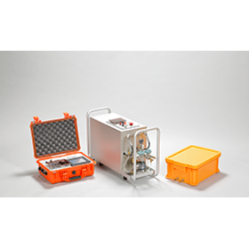
Control, automatic pressurization device, probe, composed of water tank! Stable pressurization up to 20MPa is possible.
- Other measuring instruments
- Surveying

The volume change of the standpipe and the probe is the same due to the reciprocating pump method! Achieving high-precision measurement.
- Other measuring instruments
- Surveying


It is noted for being safer and quicker to photograph wind turbines than rope work.
- Surveying

Pilots are deployed across the country! We can respond to any site instantly.
- Surveying


A portable, intuitively operable, high-speed 3D laser scanner equipped with a spherical camera, designed with high productivity in mind.
- Surveying


A compact, lightweight domestic remote ID weighing 12g, free to install!
- Surveying


The man-hours for data acquisition have been significantly reduced! Tasks such as working at heights are no longer necessary, improving safety on site.
- Surveying


High-precision scanning of small parts with the highest accuracy in the series.
- Surveying


A unique green laser scanner system that can be used in both terrestrial and shallow water environments.
- Surveying


Construction surveys for roads, rivers, and fields! Contributing to societal development with reliable surveying and design technology.
- Surveying Office
- Surveying
- Surveying Consulting

We are introducing the "Surveying Museum," established by President Toshiyuki Kiyono using his personal funds!
- Surveying

President Toshiyuki Kiyono introduces his time as a new employee in the surveying equipment industry!
- Surveying

We are introducing a column about the establishment of Asahikawa System Service Co., Ltd.!
- Surveying


Acquire 3D data of a wide area of the surface in a short time. Suitable for shortening construction periods and reducing manpower!
- Surveying

PENTAX's surveying equipment manufacturer has launched measurement and point cloud data processing services, obtaining realistic 3D color point clouds using high-density 3D measuring instruments.
Dear Valued Customers, We are pleased to hear of your continued prosperity. Thank you very much for your exceptional support of Pentax surveying equipment. TI Asahi Corporation has commenced measurement operations using UAV and laser surveying systems, as well as ground-based 3D laser scanners, starting from September 2024. Prices vary depending on the scale and duration of the measurement location. Please feel free to contact us for inquiries.

Acquire 3D data of a wide area of the surface in a short time, suitable for shortening construction periods and reducing labor!
- Surveying


The unique explanatory materials for the free app "PIX4Dcatch," developed by Pix4D, have been significantly renewed and are now available for free!
- Surveying


Now is the time! Would you like to save the 3D measurement data of important buildings?
- Surveying