LogisticaTRUCK-2 Distance Calculation Version 19 2026 Edition
LogisticaTRUCK-2 Distance Calculation Ver19 PA Edition National Digital Road Map 2026 Edition

LogisticaTRUCK-2 Distance Calculation Ver19 PA Edition Final Highly Anticipated New Feature: Shortest Route!
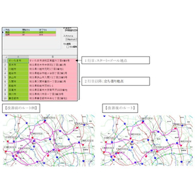
The "Shortest Route" feature allows for the quick creation and design of routes for milk runs and joint distribution. If you already have routes for the shortest route, milk runs, or joint distribution, you may experience improvements by using them. The Ver19 PA version allows for distance calculations without pay-per-use charges based on the number of calculations, just like before, with a one-time purchase. Additionally, there are no restrictions on the number of stops or usage for the "Shortest Route."
Inquire About This Product
basic information
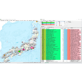
(1) Spread Distance Specify the "starting address column, ending address column, and loading weight column" in the Excel/CSV file, and calculate distance fares for large datasets in bulk. You can also create a fare table based on the calculated distances for different loading capacities (tons). (2) Shortest Route Calculate the shortest route based on the addresses of the start and goal locations, as well as the stopover points. There is no limit on the number of stopover points. (3) Start-End Via Point Distance Specify the start point, end point, and via points using municipality names, postal codes, or JIS municipality codes, and perform distance calculations or route displays. (4) Bulk Distance from Start Point Create a distance table (kilometer table) from a base location to all municipalities nationwide (between government offices). (5) CSV Distance Calculate distances from an unlimited number of data points using a CSV file in a two-row format for departure and arrival points. (6) Spread Distribution Classify and display input values on a map based on an address list in an Excel/CSV file, such as shipping destinations and company bases. This can be utilized for optimizing logistics hubs. (7) Base-Customer Matrix Create a matrix of distances and travel times between multiple company bases and customers.
Price information
\176,000
Price range
P3
Delivery Time
P3
Applications/Examples of results
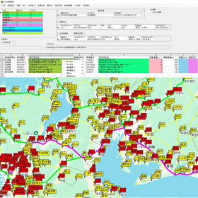
(1) Latest National Digital Road Map The Sumitomo Electric System Solutions digital road map PowerAtlas is compatible with the 2026 edition of the national road map for clients. It includes expressways and toll roads up to September 13, 2026. (2) Route Search Conditions The distance between the departure point and the destination is the total distance of narrow streets near the departure and destination points and the main roads with a width of 5.5m or more between the departure and destination points. The route search conditions prioritize time and distance, exploring routes with more or fewer travel times and distances between main roads. (3) Plotting Road Maps from Address Search Data It includes address data up to April 1, 2026, covering national city, ward, town, and village information, as well as location data for block numbers and addresses. The address data is plotted at the exact location on the road map. (4) Freight Tariff It includes general cargo truck transportation business consolidated and charter freight rates from Showa 55 to Reiwa 6, as well as international large marine container transportation rates. (5) Freight Calculation You can specify a discount or surcharge percentage to one decimal place, and round up or down to the nearest 1, 10, 100, or 500 yen.
Company information

Our company is engaged in the development and sales of software packages and consulting services. We handle distance and freight cost calculation software (standalone) as well as the Logistica cloud sales kilometer distance Web API service. Please feel free to contact us if you have any inquiries.