Essential for ground investigation companies with GeoCarte III! Achieve significant improvements in speed, accuracy, and work efficiency.
This system is designed for ground investigation companies that possess Geo-Card III. By integrating with the report creation support system, it can reduce work time by up to 94 minutes. When data is collected on-site, it automatically allows for the confirmation of rounded data to 25 cm. Users can visually check self-sinking layers and rotating layers on a graph, enabling them to make decisions about additional investigations on the spot. Furthermore, by registering the photo capture frames as a master list, it prevents forgetting to take on-site photos. Since inputs such as checklists and water levels can be entered directly from the app and reflected on the server, there is no need for transcription work after returning to the office or for paper input, significantly improving operational efficiency. 【Features】 ■ Reduces work time by up to 94 minutes through integration with the report creation support system ■ Enables quick decision-making for additional investigations through on-site graph checks, eliminating the need for rework ■ Prevents forgetting to take on-site photos with the master registration feature ■ Eliminates the need for transcription after returning to the office through direct input and reflection from the app *For more details, please download the PDF or feel free to contact us.

Inquire About This Product
basic information
【Specifications and Pricing】 ■ Mobile App: 9,000 yen/month (GeoWeb System mobile app usage fee) ■ Server App: 10,000 yen/month (GeoWeb System server app usage fee) ■ GeoWeb Porter: 8,000 yen/month (GeoWeb System Porter usage fee) ■ Server Basic Fee: 9,800 yen/per case (Electronic certification basic fee) ■ Electronic Certification Fee (Standard): 1,000 yen/per case ■ Electronic Certification Fee (Premium): 19,800 yen/month * All displayed prices are excluding tax. GeoChart III integration features are also available. * For more details, please download the PDF or feel free to contact us.
Price range
Delivery Time
Applications/Examples of results
【Uses and Examples of Achievements】 ■ Transfer of site photos and survey data in ground investigations ■ Input of check sheets, soil quality, water level information, etc., on-site ■ Quick decision-making for additional surveys through visual graph confirmation ■ Realization of direct commuting for site personnel ■ Reduction of work after returning to the office ■ Achievement of increasing the number of ground investigations from 2 to 3 *For more details, please download the PDF or feel free to contact us.
catalog(1)
Download All Catalogs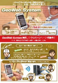
Company information
Our company was established with a strong desire to improve the harsh working conditions of ground surveyors, enhance the reliability of ground survey data, and allow people to build homes with peace of mind. Since our founding in 2008, we have been committed to preventing fraud in the residential ground industry, starting with the GeoWeb System. This system, which suppresses and prevents tampering through automation of work and visualization of data, not only improves the workflow on-site but also contributes to the efficiency of office tasks, achieving an enhancement in the quality of ground surveys and the restoration of trust. Furthermore, by alleviating the workload, it also contributes to increasing the retention rate of ground surveyors.

![[Case Study] Streamlining Cleaning Operations Reporting](https://image.www.ipros.com/public/product/image/de5/2000818377/IPROS80572366485830354610.jpeg?w=280&h=280)