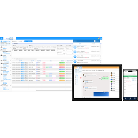
Streamline survey and inspection tasks smartly! Put maps, survey forms, voice recorders, and materials all on a tablet for smooth on-site work!
This is a tool for on-site work, information gathering, and research tasks. Why not improve efficiency through digitization from the field? ◆ It can accommodate various business and personnel needs, so the software won't go to waste! ◆ The more you use it, the lower the cost per case becomes. ◆ With reduced baggage, work becomes smoother! Plus, easy operation enhances efficiency! ◆ Button customization is completely flexible to match the business or investigator's needs. <Maps/Drawings> Download geographic maps only for the investigation area, enabling free and offline fieldwork. It also supports the import of CAD data, image files, and PDF files! <Survey Items> Survey items can be freely set by the user. It accommodates various input methods such as multiple choice, multiple selection, dropdown selection, and numeric input. <Menu> Customizing the number, type, button names, and colors of menu buttons is easy. You can differentiate usage based on the level of business or personnel. <Field Survey> Inputting survey results is completed with a tap on the screen! Using the built-in camera of the tablet reduces baggage as well. You can use not only the built-in GPS but also external GPS devices.
Inquire About This Product
basic information
As a tool for information gathering and survey work on-site, we have developed "Shukkanto Ver.2" based on actual customer feedback. It is a highly versatile field survey system that can accommodate various tasks. ◆ It meets the needs of various tasks and personnel, ensuring that the software is not wasted! ◆ The more it is used, the lower the cost per case becomes. ◆ With reduced baggage, work becomes smoother! Additionally, easy operation leads to increased efficiency! ◆ Buttons can be freely customized to match the tasks and surveyors. <Maps/Drawings> Download geographical maps only for the survey area, enabling free and offline field work. It also supports the import of CAD data, image files, and PDF files! <Survey Items> Survey items can be freely set by the user. It accommodates various input methods such as multiple choice, multiple selection, dropdown selection, and numeric input. <Menu> It can be easily customized, allowing for differentiation based on the level of tasks and personnel! <Field Survey> Inputting survey results is completed with a tap on the screen! Using the built-in camera of the tablet reduces baggage. You can use not only the built-in GPS but also external GPS devices.
Price information
There is an application of site license.
Price range
P3
Delivery Time
P2
※For online authentication licenses, same-day service is also possible. Please contact us.
Applications/Examples of results
Currently, various grants and subsidies are being provided by public authorities for operations that include on-site surveys. At Mapcon, we have developed "Shutsukancho Ver.2" as a highly versatile on-site survey system that can accommodate all types of operations, based on feedback from companies conducting on-site survey work. <Usage Examples> Lighting pole surveys, land classification surveys Vacant house condition surveys, inspections of dangerous block walls, Outdoor advertising surveys, river and waterway surveys, road facility inspection surveys, etc.
catalog(1)
Download All CatalogsCompany information
Our company is a developer of Geographic Information Systems (GIS). To create a full-fledged geographic information system, it is necessary to have software development capabilities, expertise in maps, and the ability to create map data. Mapcon not only develops commercial application software and PC-MAPPING but also specializes in the development of custom systems. We support all aspects of geographic information systems, from planning and design to hardware configuration, to ensure that operational aspects are also covered. Additionally, we have a data creation department that produces large-scale business data, such as national road data, and map data designed to suit user applications. Recently, there have been scenarios where GIS can be utilized for functions such as UAV flight path design and management and utilization of 3D point cloud data. We are updating our features to accommodate new methods of data acquisition and new data formats.


