Quickly acquire point cloud data that meets the required accuracy using suitable equipment according to the situation!
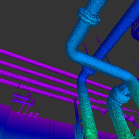
Our company offers surveying services using a "3D laser scanner" that can acquire 3D data of terrain and structures without contact. "3D laser scanner surveying" differs from traditional point-based surveying by rapidly and accurately capturing millions of point data per second, allowing for surface measurements of the target object. Additionally, the measurement data can be utilized as foundational data for various purposes, such as creating plans and cross-sectional diagrams, 3D modeling, and providing materials for the consideration of new construction, renovations, and maintenance of various facilities. 【Advantages】 ■ High safety ■ Visually easy to understand *For more details, please contact us.
Inquire About This Product
basic information
【Equipment Owned】 ■Stationary ・Leica RTC360 ・Leica P50 ・Leica P40 ■Mobile ・PX-80 ・STENCIL2 *For more details, please contact us.
Price range
Delivery Time
Applications/Examples of results
For more details, please contact us.
catalog(3)
Download All CatalogsCompany information
Our company is engaged in four main businesses: infrastructure maintenance, disaster prevention and mitigation, special vehicle operations, and civil engineering design. We conduct detailed data acquisition (three-dimensional measurement) to extend the lifespan of social infrastructure built during the period of high economic growth. We will further support the consideration of social infrastructure development, enhance the safety and quality of maintenance work, and contribute to improving operational efficiency.


![You can see under the concrete! [Information on Concrete Buried Object Investigation]](https://image.www.ipros.com/public/product/image/f8c/2000553813/IPROS67773938085651783902.jpeg?w=280&h=280)


![Cadmium concentration in rice - Simple measurement kit [for sale]](https://image.www.ipros.com/public/product/image/42a/2001516322/IPROS157372938992547760.png?w=280&h=280)