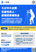
【Maximum Grant Amount 100 Million Yen!】Information on Grants for the Construction Industry "2nd Emergency Support Program for Capital Investment"
A public call for grants aimed at small and medium-sized enterprises with business locations in Tokyo has begun. This grant is intended to subsidize part of the expenses for introducing machinery and equipment necessary for improving productivity and strengthening competitiveness in response to the "2024 Problem."
<Eligible Expenses>
Expenses for the introduction of machinery, equipment, and software to address the labor shortages caused by the upper limit regulations on overtime work, known as the "2024 Problem."
<Grant Rate and Limit>
- Grant Rate: Up to 4/5
- Grant Limit: 100 million yen (Minimum grant amount: 1 million yen)
<How to Apply for the Grant>
Application Reservation Period: From 9:00 AM on October 23, 2024 (Wednesday) to 5:00 PM on November 6, 2024 (Wednesday)
Application Acceptance: From 9:00 AM on November 1, 2024 (Friday) to 5:00 PM on November 15, 2024 (Friday)
*Applications will be accepted through the electronic system "J-Grant" provided by the national government (Digital Agency).
We will provide thorough support from preparation before application, equipment introduction, to confirmation of grant payment.
*For more details, please refer to the catalog or PDF materials, or feel free to contact us.

Inquiry about this news
Contact Us Online
Related Documents
Related product


Related catalog(22)

![[Attention Kanagawa Prefecture Businesses!] Subsidy for the Promotion of Productivity Improvement for Small and Medium Enterprises in Fiscal Year 2024](https://image.www.ipros.com/public/catalog/image/01/3b5/750199/IPROS62197564750867279215.jpeg?w=120&h=170)


![[Subsidy-eligible product] PENTAX Z+F IMAGER5016 Laser Scanner](https://image.www.ipros.com/public/catalog/image/01/2e7/606864/IPROS52783956900246676094.jpeg?w=120&h=170)
![[Subsidy-eligible product] 'Leica RTC360' 3D reality capture solution](https://image.www.ipros.com/public/catalog/image/01/48f/507038/IPROS62747457392826736115.jpeg?w=120&h=170)
![[Subsidy-eligible products] 3D and 2D laser scanners 'PENTAX S Series'](https://image.www.ipros.com/public/catalog/image/01/ac3/446243/IPROS19093341542938425025.jpeg?w=120&h=170)
![[Subsidy-eligible product] Laser scanner 'Leica ScanStation P50'](https://image.www.ipros.com/public/catalog/image/01/cae/426979/IPROS27342789044026833293.jpeg?w=120&h=170)

![UAV Laser Surveying System UL-1 [Discontinued]](https://image.www.ipros.com/public/catalog/image/01/a34/507039/IPROS31283546511752388759.jpeg?w=120&h=170)
![[Subsidy-eligible product] NORBIT-WINGHEAD Ultra High-Resolution Narrow Multi-Beam Sonar](https://image.www.ipros.com/public/catalog/image/01/ca9/615899/IPROS58552909415493052088.jpeg?w=120&h=170)

![[Subsidy-eligible product] GNSS survey instrument 'Leica GS18I'](https://image.www.ipros.com/public/catalog/image/01/1be/549987/IPROS27679954776591843026.jpeg?w=120&h=170)

![[Eligible for IT Introduction Subsidy!] Large-scale Point Cloud Editing Tool 'Wing Earth' Materials](https://image.www.ipros.com/public/catalog/image/01/80a/515324/IPROS44919236532072656878.jpeg?w=120&h=170)


Distributors


