iPROS Urban Planning
  • Search for products by classification category

    • Building Materials
      Building Materials
      36676items
    • Facilities
      Facilities
      57727items
    • Lighting and Interior
      Lighting and Interior
      17586items
    • Common materials
      Common materials
      37231items
    • Civil Engineering Materials
      Civil Engineering Materials
      10203items
    • Construction, work and methods
      Construction, work and methods
      29182items
    • Surveys, Measurements, and Services
      Surveys, Measurements, and Services
      29725items
    • IT/Software
      IT/Software
      33553items
    • others
      others
      89297items
    • Store and facility supplies
      Store and facility supplies
      4599items
    • Office and commercial supplies
      Office and commercial supplies
      11728items
    • Hospital and welfare facility supplies
      Hospital and welfare facility supplies
      1057items
    • Logistics Equipment
      Logistics Equipment
      7333items
    • Energy and Resources
      Energy and Resources
      11968items
  • Search for companies by industry

    • Information and Communications
      7295
    • others
      7210
    • Building materials, supplies and fixtures manufacturers
      6631
    • Service Industry
      4754
    • Trading company/Wholesale
      3072
    • Other construction industries
      2445
    • Electrical equipment construction business
      719
    • Construction Consultant
      607
    • Interior Design
      519
    • General contractors and subcontractors
      490
    • Facility Design Office
      489
    • Architectural design office
      363
    • retail
      362
    • Housing manufacturers and construction companies
      349
    • Warehousing and transport related industries
      329
    • Building Management
      292
    • Electricity, Gas and Water Industry
      285
    • Interior construction business
      278
    • Medical and Welfare
      275
    • Educational and Research Institutions
      253
    • Renovation and home construction industry
      222
    • Water supply and drainage construction business
      205
    • Transportation
      174
    • Real Estate Developers
      165
    • Fisheries, Agriculture and Forestry
      132
    • Structural Design Office
      65
    • Finance, securities and insurance
      41
    • Restaurants and accommodations
      32
    • self-employed
      31
    • Mining
      26
    • Public interest/special/independent administrative agency
      20
    • Police, Fire Department, Self-Defense Forces
      17
    • Property Owner
      9
    • Store and building owners
      9
    • Government
      9
    • Individual
      9
  • Special Features
  • Ranking

    • Overall Products Ranking
    • Overall Company Ranking
Search for Products
  • Search for products by classification category

  • Building Materials
  • Facilities
  • Lighting and Interior
  • Common materials
  • Civil Engineering Materials
  • Construction, work and methods
  • Surveys, Measurements, and Services
  • IT/Software
  • others
  • Store and facility supplies
  • Office and commercial supplies
  • Hospital and welfare facility supplies
  • Logistics Equipment
  • Energy and Resources
Search for Companies
  • Search for companies by industry

  • Information and Communications
  • others
  • Building materials, supplies and fixtures manufacturers
  • Service Industry
  • Trading company/Wholesale
  • Other construction industries
  • Electrical equipment construction business
  • Construction Consultant
  • Interior Design
  • General contractors and subcontractors
  • Facility Design Office
  • Architectural design office
  • retail
  • Housing manufacturers and construction companies
  • Warehousing and transport related industries
  • Building Management
  • Electricity, Gas and Water Industry
  • Interior construction business
  • Medical and Welfare
  • Educational and Research Institutions
  • Renovation and home construction industry
  • Water supply and drainage construction business
  • Transportation
  • Real Estate Developers
  • Fisheries, Agriculture and Forestry
  • Structural Design Office
  • Finance, securities and insurance
  • Restaurants and accommodations
  • self-employed
  • Mining
  • Public interest/special/independent administrative agency
  • Police, Fire Department, Self-Defense Forces
  • Property Owner
  • Store and building owners
  • Government
  • Individual
Special Features
Ranking
  • Overall Products Ranking
  • Overall Company Ranking
  • privacy policy
  • terms of service
  • About Us
  • Careers
  • Advertising
  1. Home
  2. General contractors and subcontractors
  3. 大浦工測 [東京本社・横浜支店・九州支店・関西支店・仙台営業所・ベトナム国ホーチミン事務所]
  4. Product/Service List
General contractors and subcontractors
  • Added to bookmarks

    Bookmarks list

    Bookmark has been removed

    Bookmarks list

    You can't add any more bookmarks

    By registering as a member, you can increase the number of bookmarks you can save and organize them with labels.

    Free membership registration

大浦工測 [東京本社・横浜支店・九州支店・関西支店・仙台営業所・ベトナム国ホーチミン事務所]

EstablishmentMay 13, 1969
capital2000Ten thousand
number of employees330
addressTokyo/Kita-ku/2-25-1 Ukima, Oura Kousoku Building
phone03-5916-4901
  • Special site
  • Official site
last updated:Feb 03, 2026
大浦工測logo
  • Contact this company

    Contact Us Online
  • Before making an inquiry

    Download PDF
  • Company information
  • Products/Services(41)
  • catalog(44)
  • news(5)

大浦工測 List of Products and Services

  • category

1~11 item / All 11 items

Displayed results

Filter by category

General measurement General measurement
CAD CAD
3D laser scanner measurement 3D laser scanner measurement
3D photogrammetry 3D photogrammetry
Survey for Development Permit and Excavation Application Survey for Development Permit and Excavation Application
Site supervisor dispatch  
Supervisory assistance tasks, photography, miscellaneous ink output Site supervisor dispatch Supervisory assistance tasks, photography, miscellaneous ink output
Final disposal site measurement Final disposal site measurement
3D

3D photogrammetry

Since the launch of our 3D photogrammetry service, we have conducted numerous measurements through photo analysis. In the construction industry, measurements at the "design and construction accuracy level" have been renewed, and there are also examples of creating CG. Due to the high precision of recent digital cameras, it is a simpler task compared to 3D laser scanners, yet it achieves equal or greater accuracy in close-range measurements. Additionally, by combining it with TS (Total Station/optical surveying equipment), its applications have expanded to measuring complex and large areas in fields such as plants.

CAD data conversion for structures and plant equipment! 3D measurement and inspection services.

Accurately capture any complex shape! 3D scanning of piping and equipment in factories and plants!

Our "3D Measurement and Surveying Service" utilizes state-of-the-art 3D laser scanners and 3D photogrammetry systems to convert spatial information of piping and equipment in plants and factories into CAD data. This significantly reduces costs and labor for plant expansions and modification designs. We can provide detailed and accurate data even for areas that cannot be captured through manual measurements! We guarantee quality, as well as the provision of data in a short period and at low cost. 【Ideal for the following situations】 ■ The drawings do not match the current piping. There are no existing drawings. ■ We received 3D data from the design but want to compare it with the actual situation. ■ We have partial 3D data but want to investigate interference with the surroundings. ■ We want to measure the current piping but have no time or it is too costly. ■ The measurement results are not accurate or satisfactory. ■ The measurement location is dangerous (e.g., high places, restricted areas). *For more details, please refer to the catalog. Feel free to contact us with any inquiries.

Added to bookmarks

Bookmarks list

Bookmark has been removed

Bookmarks list

You can't add any more bookmarks

By registering as a member, you can increase the number of bookmarks you can save and organize them with labels.

Free membership registration

Obtain 3D data in a short time while walking: '3D Laser Measurement Service'

Acquire extensive 3D data in a short time while walking! For data creation related to plant and factory maintenance, renovation design, urban planning, and infrastructure maintenance!

Our company offers a "3D measurement service" using a wearable device that can acquire 3D point cloud data while walking. The device is equipped with two LiDARs, enabling high-precision measurements. By utilizing SLAM technology, we can provide high-quality spatial information. It can easily avoid obstacles, allowing for efficient measurement of large facilities and spaces. 【Features】 ■ Capable of measuring an area of 10,000 to 20,000 m² per day ■ Obtains seamless data for elevation differences such as stairs and slopes, both indoors and outdoors ■ Captures 360° panoramic images and point cloud data from LiDAR using four cameras ■ By combining with surveying, it is possible to construct data based on global geodetic systems or arbitrary coordinate systems We have a proven track record in various scenarios, such as understanding layouts inside and outside factories (measuring 3,000 m² in one hour) and surveying for urban planning (measuring 15,000 m² in four hours). *You can view the catalog and case studies from the "PDF Download."

Added to bookmarks

Bookmarks list

Bookmark has been removed

Bookmarks list

You can't add any more bookmarks

By registering as a member, you can increase the number of bookmarks you can save and organize them with labels.

Free membership registration

Non-contact, high-speed, high-precision [3D measurement and inspection services]

For preliminary surveys of renovation work! Accurately grasp the shape of structures and equipment with a 3D laser scanner.

The "3D Measurement and Inspection Service" uses a 3D laser scanner to measure and visualize the shapes of existing structures and piping systems on a PC. This service significantly reduces costs and man-hours for plant expansions and renovation designs. Since measurements can be taken without contact from a distance, it alleviates work in high or hazardous areas, thereby improving safety. It is also effective for preliminary surveys of renovation and renewal work, as well as for measuring the volume of stockyards. 【Features】 ■ Supports complex shapes ■ Acquires 50,000 coordinate points per second with the laser scanner ■ Measures a full 360° around and 300° vertically with an error of just a few millimeters in about 3 minutes ■ Allows immediate drafting with CAD data conversion ■ Over 50 years of experience as a surveying specialist company *For more details, please download the catalog or contact us.

Added to bookmarks

Bookmarks list

Bookmark has been removed

Bookmarks list

You can't add any more bookmarks

By registering as a member, you can increase the number of bookmarks you can save and organize them with labels.

Free membership registration

Achieving a precision of 0.030 mm! 【Handheld Scanner Measurement Service】

Achieving a precision of 0.030 mm, a micron-level handheld 3D scanning measurement service! Ideal for measuring machined parts and prototypes!

The handheld scanning measurement contract service provides micron-level 3D measurement, drafting, and dimensional inspection, with 3D data delivered in a report. It is suitable for measuring machined parts, prototypes, worn parts, comparison verification with CAD, reverse engineering, and more. 【Features】 ■ Accuracy: Up to 0.030 mm ■ Focal distance from the object: 300 mm ■ Recommended part size range: 0.1 to 4 m ■ Output formats: STL, OBJ, IGES, STEP, etc. 【Examples of Use】 Measurement of machined parts, prototypes, worn parts, comparison verification with CAD, reverse engineering, etc. *For details, please request materials or view the PDF data from the download.

Added to bookmarks

Bookmarks list

Bookmark has been removed

Bookmarks list

You can't add any more bookmarks

By registering as a member, you can increase the number of bookmarks you can save and organize them with labels.

Free membership registration

Aerial Photography × OURA [Drone Photogrammetry Measurement Service]

Drone photogrammetry using surveying techniques and 3D measurement technology developed over many years.

Oura Kousoku utilizes its long-developed surveying technology and 3D measurement technology to conduct drone photogrammetry. In terrain surveying, we create surveying data such as point clouds, meshes, volume calculations, longitudinal and cross-sectional diagrams, contour lines, and orthophotos from photos taken by drones. Additionally, for photo and video shooting, we also capture images in places inaccessible to people or at high altitudes, as well as fixed-point photography. 【Service Contents】 ■ Terrain Surveying ■ Photo and Video Shooting *For more details, please refer to the PDF document or feel free to contact us.

Added to bookmarks

Bookmarks list

Bookmark has been removed

Bookmarks list

You can't add any more bookmarks

By registering as a member, you can increase the number of bookmarks you can save and organize them with labels.

Free membership registration

[Non-contact, high-speed, high-precision] 3D measurement and measurement services *Exhibition information available

For preliminary surveys of renovation work! Accurately grasp the shapes of structures and equipment with a 3D laser scanner.

The "3D Measurement and Surveying Service" uses a 3D laser scanner to measure and visualize the shapes of existing structures and piping systems on a PC. This service significantly reduces costs and man-hours for plant expansions and renovation designs. Since measurements can be taken without contact from a distance, it alleviates work in high or hazardous areas, thereby improving safety. It is also effective for preliminary surveys of renovation and renewal work, as well as for measuring the volume of stockyards. 【Features】 ■ Supports complex shapes ■ Acquires 50,000 coordinate points per second with the laser scanner ■ Measures a full 360° around and 300° vertically with an error of just a few millimeters in about 3 minutes ■ CAD data can be created immediately for drafting ■ Over 45 years of experience as a surveying specialist company *For more details, please download the PDF or contact us.

Added to bookmarks

Bookmarks list

Bookmark has been removed

Bookmarks list

You can't add any more bookmarks

By registering as a member, you can increase the number of bookmarks you can save and organize them with labels.

Free membership registration

Non-contact, high-speed, high-precision! 【3D measurement and inspection services】

For preliminary surveys of renovation work! Accurately grasp the shapes of structures and equipment with a 3D laser scanner.

The "3D Measurement and Surveying Service" utilizes a 3D laser scanner to measure and visualize the shapes of existing structures and piping systems on a PC. This service significantly reduces costs and man-hours for plant expansions and renovation designs. Since measurements can be taken without physical contact from a distance, it alleviates work in high or hazardous areas, enhancing safety. It is also effective for preliminary surveys of renovation and renewal projects, as well as volume measurements of stockyards. 【Features】 ■ Capable of handling complex shapes ■ Acquires over 1 million coordinate points per second with the laser scanner ■ Measures a full 360° around and 300° vertically with an error of just a few millimeters in about 3 minutes ■ CAD data can be generated for immediate drafting ■ Over 50 years of experience as a surveying specialist company *For more details, please download the PDF or contact us.

Added to bookmarks

Bookmarks list

Bookmark has been removed

Bookmarks list

You can't add any more bookmarks

By registering as a member, you can increase the number of bookmarks you can save and organize them with labels.

Free membership registration

Presenting case studies that solve problems with 3D laser scanners!

For preliminary surveys of renovation work! Accurately digitize the current state with a 3D laser scanner. Use surveying technology to match reality with digital data.

The "3D Measurement and Surveying Service" uses a 3D laser scanner to measure and create point cloud data of the shape layout of structures and piping facilities in plant facilities, converting them into digital drawings. By utilizing this service, you can significantly reduce the costs and man-hours associated with plant expansions and modification designs. Additionally, since measurements can be taken without contact, it alleviates work in high or dangerous areas, improving safety. It is also effective for preliminary surveys for maintenance and renovation work, daily maintenance management, and inventory quantity management. 【Features】 ■ Supports everything from simple to complex shapes ■ Instantly captures over 1 million coordinate points per second ■ Full dome color measurement in all directions in a short time ■ One-stop processing from measurement to data conversion ■ Various 3D models, BIM, 2D drawings, isometric drawings, shape analysis, and more ■ Over 50 years of experience as a surveying specialist company *For more details, please download the PDF or contact us.

Added to bookmarks

Bookmarks list

Bookmark has been removed

Bookmarks list

You can't add any more bookmarks

By registering as a member, you can increase the number of bookmarks you can save and organize them with labels.

Free membership registration

From Aerial Photographs to 3D Data! [Introduction to Drone Surveying]

Drone surveying converts aerial photographs into 3D data! It is particularly useful for larger areas.

Conventional topographic surveys have required a vast amount of time and cost. Drone surveying is particularly useful for larger areas as it converts aerial photographs into 3D data. By incorporating survey control points (reference points) into the photographs, it is possible to set the scale and convert the data to match the coordinate system of construction drawings. We also offer aerial video shooting, which is not typically visible. Our company has manufacturer-certified dedicated staff who handle everything from "flight planning" to "shooting flights" and "editing results" in a consistent manner. 【Flow from Aerial Photography to Analysis】 ■ Pre-planning ■ Flight plan creation ■ Installation of control points ■ Drone flight shooting ■ Photo synthesis ■ Analysis work *For more details, please refer to the PDF document or feel free to contact us.

Added to bookmarks

Bookmarks list

Bookmark has been removed

Bookmarks list

You can't add any more bookmarks

By registering as a member, you can increase the number of bookmarks you can save and organize them with labels.

Free membership registration

Walk the future of the city with 'NavVis VLX' for innovative urban development!

Obtain 3D point cloud data that can be used for urban planning and current situation assessment while walking with the "NavVis VLX"!

By simply walking, you can collect high-precision 3D data over a wide area in a short time, enabling efficient urban design. The 'NavVis VLX' captures complex urban structures in detail and acquires data approximately five times faster compared to the ground-based laser scanners we handle. 【Features】 ■ Rapid situation assessment: Records vast terrains and complex structures in three dimensions just by walking. ■ Efficient consensus building: Promotes visual communication with clients and residents using clear 3D data. ■ Flexible surveying: Capable of data acquisition in difficult locations such as sidewalks and under bridges where vehicles cannot pass. 【Expansion of Data Utilization】 The acquired data can be directly used for building digital twins of cities and creating 3D urban models. This enables more specific and practical urban design, such as plans for eliminating utility poles and landscape simulations.

Added to bookmarks

Bookmarks list

Bookmark has been removed

Bookmarks list

You can't add any more bookmarks

By registering as a member, you can increase the number of bookmarks you can save and organize them with labels.

Free membership registration

Introduction of new product: Plant design support software and services.

Providing software development and services that can be utilized in practice through collaboration with the design department!

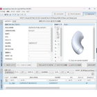
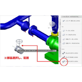
Our company develops and sells add-on software for plant design support based on AutoCAD Plant 3D and AutoCAD/BricsCAD, creates piping component catalogs, and provides training. We offer a wide range of services, including add-on software specialized in 3D piping support called "ASTO," and add-on software focused on 2D piping design called "AUSE," as well as the creation of piping component catalogs and practical training and implementation support for AutoCAD Plant 3D. 【Product and Service List】 ■ASTO: AutoCAD Plant 3D Add-on Software - Equipped with features for placing piping support models, automatic output to 2D production drawings, and automatic aggregation functions. ■AUSE: AutoCAD/BricsCAD Add-on Software - Provides three tools: water treatment piping diagram tool, isometric database tool, and P&ID tool. ■Piping Component Catalog Creation - Supports the creation of a large number of components such as pipes, fittings, and instruments. ■AutoCAD Plant 3D Training - Participant satisfaction rate of 98% based on surveys, with 400 companies and 2,500 individuals trained over 10 years. *For more details, please download the PDF or feel free to contact us.

Added to bookmarks

Bookmarks list

Bookmark has been removed

Bookmarks list

You can't add any more bookmarks

By registering as a member, you can increase the number of bookmarks you can save and organize them with labels.

Free membership registration
Prev 1 Next
  • 目的・課題から技術・サービスを探せるメディカルケア専門サイト
    • Contact this company

      Contact Us Online
    • Before making an inquiry

      Download PDF

    Products

    • Search for Products

    Company

    • Search for Companies

    Special Features

    • Special Features

    Ranking

    • Overall Products Ranking
    • Overall Company Ranking

    support

    • site map
    IPROS
    • privacy policy Regarding external transmission of information
    • terms of service
    • About Us
    • Careers
    • Advertising
    IPROS Services
    • >IPROS GMS | Search site for the manufacturing industry
    • >IPROS | Search site for the B2B industry
    COPYRIGHT © 2001-2026 IPROS CORPORATION ALL RIGHTS RESERVED.
    Please note that the English text on this page is automatically translated and may contain inaccuracies.