4DKanKanMeta
A next-generation 4D platform that allows you to easily create 3D virtual spaces and freely customize experience design.
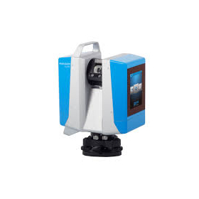
4DKanKan Meta is a platform based on the concept of "3D virtual space × time = 4D experience," allowing anyone to easily create virtual spaces using a camera, app, and cloud. The ultra-high-precision scanning of 905nm LiDAR can collect a modeling range of up to 70m with a single point scan, generating high-resolution point cloud data with 16K HD images widely used in construction, government, healthcare, education, museums, and the BIM industry. With the SLAM function, 3D space design and creation can be done using only the captured materials, eliminating the need for large-scale equipment. The camera itself has been made lightweight at 2.9kg, making it easy to carry while still enabling high-quality shooting, thus expanding its applications across various uses.
- Company:ジオサイン
- Price:Other
![[Example] Kato Group Co., Ltd. S-3180V Color Point Cloud Video](https://image.www.ipros.com/public/product/image/bfe/2000681169/IPROS35204242396801312932.png?w=280&h=280)


![Leica RTC360 3D [Rental] [Sale]](https://image.www.ipros.com/public/product/image/109/2000586745/IPROS16356456011224363220.png?w=280&h=280)