
Introduction to surveying services using 3D laser scanners.
Obtain 3D data of surfaces! It is possible to create various results from a large amount of data.
At Data Giken Co., Ltd., we offer surveying services using 3D laser scanners to significantly improve the efficiency of surveying. All acquired data is in three-dimensional format, allowing for surveying without entering hazardous areas. Even in challenging surveying sites, we can project lasers from a distance, enabling safe and swift operations. 【Benefits of Using the Scanner】 ■ Operation feels the same as TS work ■ Data acquisition can be completed in a short time ■ On-site shape confirmation can be done simultaneously with observations *For more details, please download the PDF or feel free to contact us.
- Company:データ技研 本社
- Price:Other
![Utilization of 3D Laser Scanners for the Plant Industry [*Case Study Material Provided*]](https://image.www.ipros.com/public/product/image/b86/2000405276/IPROS1295072321827316650.jpg?w=280&h=280)

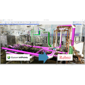
![[Reference Case] 3D Measurement Work for New Piping Design](https://image.www.ipros.com/public/product/image/56b/2001181647/IPROS64160757444625566968.jpeg?w=280&h=280)
![[Reference Example] Simulation of Safety Fence Installation](https://image.www.ipros.com/public/product/image/00a/2001181665/IPROS10811820190111298084.jpeg?w=280&h=280)


![[Case Study] 3D Laser Scanning of Cultural Heritage Measurement at Fukuoka Castle Ruins](https://image.www.ipros.com/public/product/image/100/2000500875/IPROS33229906276700393808.jpeg?w=280&h=280)


![[Example] Kato Group Co., Ltd. S-3180V Color Point Cloud Video](https://image.www.ipros.com/public/product/image/bfe/2000681169/IPROS35204242396801312932.png?w=280&h=280)

