Drone Product List and Ranking from 88 Manufacturers, Suppliers and Companies | IPROS

Last Updated: Aggregation Period:Jul 22, 2026~Aug 18, 2026
This ranking is based on the number of page views on our site.

Drone Manufacturer, Suppliers and Company Rankings

Last Updated: Aggregation Period:Jul 22, 2026~Aug 18, 2026
This ranking is based on the number of page views on our site.

  1. ドローン・フロンティア Tokyo//Service Industry
  2. AdAir LLC Head Quater Kyoto//others
  3. 未来工業 Gifu//Building materials, supplies and fixtures manufacturers
  4. 4 富士テクニカルリサーチ Kanagawa//others
  5. 5 MAKUW Osaka//Fisheries, Agriculture and Forestry

Drone Product ranking

Last Updated: Aggregation Period:Jul 22, 2026~Aug 18, 2026
This ranking is based on the number of page views on our site.

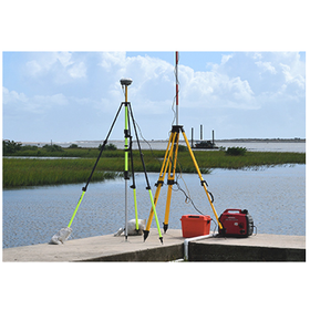
  1. [Drone Inspection Case] Investigating the scope of inspection for Article 12 / Area approximately 700 square meters ドローン・フロンティア
  2. PVK Design Box [Rainproof type convenient for outdoor use] 未来工業
  3. Clarifying misconceptions about parachutes: Part 2 - Opening speed and minimum opening altitude (distance) AdAir LLC Head Quater
  4. 4 Drone Frontier's 'Infrared Survey/Building Inspection Case Studies Vol. 1' ドローン・フロンティア
  5. 5 Introduction to 3D Measurement Solutions 富士テクニカルリサーチ

Drone Product List

91~120 item / All 143 items

Displayed results

Drone building and roof inspection

It is possible to inspect a wide area in a short time. We quickly inspect the condition of roofs using drones at a low cost.

Our company uses drones to quickly inspect the condition of roofs. Roofs are exposed to harsh environments such as UV rays and rain throughout the year, making them prone to aging. When a roof deteriorates, it can negatively affect the ceiling and walls. By using drones, we can inspect large areas in a short amount of time, making it possible to conduct inspections of large factory sites at a low cost. 【Benefits of Using Drones】 ■ Inspect large areas in a short time. ■ Conduct inspections of large factory sites at a low cost. ■ Safe inspections of hazardous areas with strong odors can be done from the air. ■ You can check the condition of roofs and buildings through video, ensuring peace of mind and safety. *For more details, please download the catalog or feel free to contact us.

  • Roof and gutter construction
  • Drone

Added to bookmarks

Bookmarks list

Bookmark has been removed

Bookmarks list

You can't add any more bookmarks

By registering as a member, you can increase the number of bookmarks you can save and organize them with labels.

Free membership registration

Must-see for those who want to move hundreds of kilograms in Okayama: Heavy goods transportation.

Leave the transportation, relocation, and removal of precision machinery and heavy objects to us!

Nakaun Co., Ltd. specializes in the transportation of heavy goods. We handle a variety of equipment, from kitchen appliances and medical devices to printing machines and production lines, with full responsibility for our work. Even if you think that loading and unloading may be difficult, please feel free to consult with us. 【Features】 ■ Loading and unloading: Using crane trucks and specialized equipment ■ Installation: Marking, leveling, anchoring, etc. ■ Relocation: From single items to entire sets, on-site relocation without transportation is also possible ■ Removal: Loading, replacement, disposal item collection, and handling of procedural documents, etc. *For more details, please refer to the PDF materials or feel free to contact us.

  • Construction machinery leasing and rental
  • Equipment leasing and rental
  • Other construction services
  • Drone

Added to bookmarks

Bookmarks list

Bookmark has been removed

Bookmarks list

You can't add any more bookmarks

By registering as a member, you can increase the number of bookmarks you can save and organize them with labels.

Free membership registration

Introduction to the Utilization of 3D Data

Quickly create a 3D model of the site! Suitable for point cloud measurement in i-Construction!

We propose the introduction of UAVs (drones) and laser scanners suitable for point cloud measurement in i-Construction. By introducing drones and laser scanners, it is possible to streamline the process from surveying to inspection using consistent 3D data. Additionally, the created 3D data can be utilized for understanding the current situation, detailed design, and even for post-construction inspections. 【Procedure】 ■1. Initial Survey ■2. Design and Construction Planning ■3. Construction ■4. Inspection *For more details, please download the PDF or feel free to contact us.

  • Surveying Consulting
  • Other construction services
  • Drone

Added to bookmarks

Bookmarks list

Bookmark has been removed

Bookmarks list

You can't add any more bookmarks

By registering as a member, you can increase the number of bookmarks you can save and organize them with labels.

Free membership registration

[Case Study] Drone Photography at Kyoto University Campus

Using drones and action cameras to capture the vast campus!

From Kyoto University, we received a request to produce drone footage as English-language content for international students. In the production of the video, we researched overseas drone footage and creatively approached filming and editing. In addition to using drones, we also utilized action cameras to capture aerial footage and shots from a human perspective, experimenting with various angles to achieve dynamic visuals. 【Project Overview】 ■ Client: Kyoto University ■ Project: Drone filming of Kyoto University campus ■ Date: December 2021 ■ Client's Feedback: - The drone filming and editing effectively conveyed the campus's vastness and greenery, which could not be expressed through still images. - This contributed to enhancing the university's image, receiving high praise from both within and outside the university. *For more details, please refer to the PDF document or feel free to contact us.

Added to bookmarks

Bookmarks list

Bookmark has been removed

Bookmarks list

You can't add any more bookmarks

By registering as a member, you can increase the number of bookmarks you can save and organize them with labels.

Free membership registration

Introduction to the "Drone Aerial 3D Terrain Survey" Service

Terrain surveying boasts several times the work efficiency and high quality compared to conventional measurement techniques!

Our company conducts the creation of high-quality, low-file-size 3D models and 2D floor plans and cross-sections, modeled using advanced analysis of drone aerial photography and 3D tracing technology. We handle everything from work planning to the delivery of final products. Please feel free to consult with us. 【Features】 ■ Several times the work efficiency compared to conventional surveying techniques ■ Wide range of utilization of results ■ High quality *For more details, please download the PDF or feel free to contact us.

  • Surveying Consulting
  • Surveying
  • photograph
  • Drone

Added to bookmarks

Bookmarks list

Bookmark has been removed

Bookmarks list

You can't add any more bookmarks

By registering as a member, you can increase the number of bookmarks you can save and organize them with labels.

Free membership registration

Planning and design services for civil engineering and architectural structures.

For planning and design of civil engineering and architectural structures, please leave it to us.

Our company provides services from basic planning to detailed design of civil engineering and architectural structures. We offer a wide range of services, including bridge planning and location selection, underground structure design, civil facility design, and architectural drawing creation, all delivered with high technical expertise and prompt response. 【Business Overview】 ■ Bridge Planning Design ■ Erection Planning Design ■ Steel Superstructure Design ■ Steel Structure Design ■ Bridge Substructure Design, etc. *For more details, please download the PDF or contact us.

  • Architectural design office
  • Structural Design Office
  • Civil Engineering Design Office
  • Drone

Added to bookmarks

Bookmarks list

Bookmark has been removed

Bookmarks list

You can't add any more bookmarks

By registering as a member, you can increase the number of bookmarks you can save and organize them with labels.

Free membership registration

Drone guidance system

Effective even in non-GPS environments! A series of systems for communication and control!

The drone guidance system is a series of systems that enable communication and control between drones and surveying instruments through software developed by our company. A reflective prism (corner cube) that reflects laser light is attached to the drone (multicopter), and it is tracked by an automatic tracking total station for surveying. Additionally, by using minor modifications to existing drones and widely available surveying instruments, this system allows for automation and labor-saving at a low cost without significant investment. 【Features】 ■ No need for operator expertise! ■ Demonstrates power in infrastructure inspections! ■ Streamlines surveying (construction surveying)! ■ Defines strict flight ranges, and ensures safe flight at ultra-low altitudes! etc. *For more details, please download the PDF or feel free to contact us.

  • Surveying Office
  • Surveying
  • Drone

Added to bookmarks

Bookmarks list

Bookmark has been removed

Bookmarks list

You can't add any more bookmarks

By registering as a member, you can increase the number of bookmarks you can save and organize them with labels.

Free membership registration

Drone "PHANTOM 4 PRO"

Longer flight times, smarter!

The "PHANTOM 4 PRO" is a lightweight drone equipped with a 1-inch 20-megapixel CMOS sensor Exmor R camera. By adopting a titanium alloy and magnesium alloy structure, the agility of the aircraft has been enhanced, and it has been made lighter. Additionally, it is capable of detecting obstacles in five directions and avoiding obstacles in four directions. 【Features】 ■ Camera equipped with a 1-inch, 20-megapixel sensor ■ Capable of shooting 4K/60fps video and 14fps burst shots ■ Five-direction obstacle detection ■ Transmitter with dedicated display ■ Lightweight design *For more details, please download the PDF or feel free to contact us.

  • Other measuring instruments
  • Other analytical equipment
  • Drone

Added to bookmarks

Bookmarks list

Bookmark has been removed

Bookmarks list

You can't add any more bookmarks

By registering as a member, you can increase the number of bookmarks you can save and organize them with labels.

Free membership registration

A must-see! [Drone Work Examples] Bridge Inspection

Bridge inspection using drones! An example of work where we proposed repainting to prevent corrosion.

We would like to introduce the bridge inspection conducted by our company on a steel bridge completed in November 1965. Due to the inspection being limited to just one day, we were unable to capture images to check for small cracks; however, no noticeable cracks, such as those in the main girders, were found during this inspection. As a result of the inspection, no significant damage to the steel was observed, and if maintenance is to be continued, we recommend repainting to prevent corrosion. By utilizing drones for the inspection, we can eliminate the need for scaffolding setup, allowing for a quick assessment of the bridge's current condition, including any damaged areas. Please feel free to contact us if you require our services. *For more details, please refer to the PDF document or feel free to reach out to us.

  • Other measuring instruments
  • Other services and technologies
  • Drone

Added to bookmarks

Bookmarks list

Bookmark has been removed

Bookmarks list

You can't add any more bookmarks

By registering as a member, you can increase the number of bookmarks you can save and organize them with labels.

Free membership registration

Construction, surveying equipment-related, business space solutions business

Providing solutions for the realization of DX in the construction industry! Total support for contractors who want to introduce and utilize ICT construction.

We would like to introduce our "Construction, Surveying Equipment Related, and Business Space Solution Business." Our team, primarily composed of civil engineers from construction consulting and contracting backgrounds, provides a wide range of services to promote construction DX, from pilot training at drone schools to surveying, BIM/CIM, and i-Construction projects. We offer total support from recommending suitable drone equipment to delivering BIM/CIM models. 【Services】 ■ Sales and rental of various manufacturers' surveying equipment ■ Software sales ■ Drone sales ■ Machine guidance and compaction management system sales ■ Remote management system sales and rental *For more details, please download the PDF or feel free to contact us.

  • Surveying
  • Drone

Added to bookmarks

Bookmarks list

Bookmark has been removed

Bookmarks list

You can't add any more bookmarks

By registering as a member, you can increase the number of bookmarks you can save and organize them with labels.

Free membership registration

Aeroji Lab Inc. Company Profile

Leave drone manufacturing and sales, aerial photography, video production, and joint development to us.

Aeroji Lab Co., Ltd. is a company with a relatively short history, but it is firmly supported by the technical expertise, development capabilities, and operational skills that have been steadily built up since the era of radio-controlled helicopters. We design and develop everything from software to hardware for what we want and what we want to use, and our in-house staff continuously improves our products by providing feedback from the know-how gained in the actual field. As a result, we have developed the flexibility and proposal capabilities to meet various customer needs, and we continue to grow into a company that can confidently provide drone solutions. 【Business Activities】 ■ Development, design, manufacturing, and sales of UAVs (unmanned aerial vehicles) ■ Aerial photography and various video production *For more details, please refer to the PDF materials or feel free to contact us.

Added to bookmarks

Bookmarks list

Bookmark has been removed

Bookmarks list

You can't add any more bookmarks

By registering as a member, you can increase the number of bookmarks you can save and organize them with labels.

Free membership registration

Fixed-point camera analysis outsourcing service

We propose suitable pricing plans based on the number of photos taken! The analysis of shooting data is conducted using an AI image analysis system.

Sky Seeker Co., Ltd.'s fixed-point camera analysis outsourcing service significantly reduces the operational resources of municipal staff. We use an AI image analysis system for analyzing shooting data. You can leave everything from the installation of fixed-point cameras, species identification, data sorting, to report creation to us. 【Features】 ■ Capable of identifying three species ■ Our staff will install fixed-point cameras at your specified locations ■ Use AI to identify the species of wildlife captured in the shooting data ■ Sort the data by species identified in the analysis and deliver it to you ■ Create reports summarizing species, numbers, and occurrence dates statistically *For more details, please refer to the PDF materials or feel free to contact us.

  • Pest and insect control products
  • Security cameras and surveillance systems
  • Drone

Added to bookmarks

Bookmarks list

Bookmark has been removed

Bookmarks list

You can't add any more bookmarks

By registering as a member, you can increase the number of bookmarks you can save and organize them with labels.

Free membership registration

Drone "Hikisuke MG"

An agricultural pesticide spraying drone that can cover 1 hectare in 10 minutes!

The "Hizuke MG" is an agricultural pesticide spraying drone that allows even beginners to easily perform spraying tasks. Equipped with DJI's waterproof, dustproof, and high cooling performance brushless motors and ESCs, it can operate continuously for long periods even in harsh summer conditions. Additionally, it features a sturdy carbon frame designed to withstand the rigors of the field, ensuring it won't break from minor impacts. 【Features】 ■ Foldable compact design ■ Nozzle designed to prevent droplet fall ■ Highly durable and robust frame ■ Brushless motor ■ Quick-release exhaust valve *For more details, please download the PDF or feel free to contact us.

  • others
  • Drone

Added to bookmarks

Bookmarks list

Bookmark has been removed

Bookmarks list

You can't add any more bookmarks

By registering as a member, you can increase the number of bookmarks you can save and organize them with labels.

Free membership registration

[Case Study] Sorachi Forest Association

The area measurement that used to take 3 hours per hectare has been shortened to just 30 minutes!

We would like to introduce a case where the "Kumiki" system was implemented at the Sorachi Forest Association. Previously, even with GPS surveying equipment on steep slopes, it took about three hours to measure an area of 1 hectare. After the implementation, simply uploading photos to "Kumiki" allows for automatic notifications once the terrain data is completed, enabling simultaneous work on other PC tasks. [Case Overview] ■ Challenge: It took about three hours to measure an area. ■ Effects: - Only a few minutes of automatic drone flight photography on-site. - Ability to perform other PC tasks simultaneously. *For more details, please download the PDF or feel free to contact us.

  • Other measuring instruments
  • Other Software
  • Surveying
  • Drone

Added to bookmarks

Bookmarks list

Bookmark has been removed

Bookmarks list

You can't add any more bookmarks

By registering as a member, you can increase the number of bookmarks you can save and organize them with labels.

Free membership registration

Cardboard manufacturing service

We offer a variety of parts that meet your needs!

Our cardboard division designs and manufactures packaging for export products, various cardboard accessories, and environmentally friendly packaging. To enhance product content display, illustrations, and product images, we are equipped with a flexo 2C printing machine that can handle small lots and various sizes. We provide not only cardboard for safely transporting products but also contribute to the image enhancement of outer boxes. 【Features】 ■ Responsive to diverse needs from small lots to mass production ■ Flexible slitting for small lots and various sizes using our original developed slitter ■ A computer-controlled cardboard die-cutting machine that meets the complex product needs, diverse lot requirements, and short delivery times *For more details, please download the PDF or feel free to contact us.

  • Packaging materials
  • Drone

Added to bookmarks

Bookmarks list

Bookmark has been removed

Bookmarks list

You can't add any more bookmarks

By registering as a member, you can increase the number of bookmarks you can save and organize them with labels.

Free membership registration

[Drone Inspection Case] Falling Exterior Wall Tiles / Prompt Response to Urgent Investigation Request

"Drone Infrared Inspection" Achieving faster, safer, and cost-effective inspections through the investigation of the deterioration of buildings using drones and infrared cameras.

Our company, which conducts building inspections using drones, has many pilots with over 1,000 hours of flight time. During actual operations, those who hold the national qualification of "Unmanned Aircraft Pilot" are involved. Additionally, the staff responsible for infrared image analysis and report creation includes holders of the "Infrared Building Diagnosis Technician" certification, ensuring that not only flight experience but also expertise in the details of the work is present. 【Drone Infrared Survey: Case Introduction】 - Purpose of Survey: Emergency Investigation - Survey Area: Approximately 1,300 square meters - Inspection Method: Drone and Rope Access - On-site Survey Duration: 5 days - Survey Cost: Approximately 900,000 yen *You can view our company's case materials for "Drone Infrared Survey" from the "PDF Download" link below.

  • Structural Survey
  • Drone

Added to bookmarks

Bookmarks list

Bookmark has been removed

Bookmarks list

You can't add any more bookmarks

By registering as a member, you can increase the number of bookmarks you can save and organize them with labels.

Free membership registration

[Drone Inspection Case] Investigation request before building repairs / Investigation for prioritization

"Drone infrared inspection" is a method that enables inspections to be conducted quickly, safely, and at a reduced cost. This is an example of a survey conducted for prioritizing repairs.

Our company, which conducts building inspections using drones, has many pilots with over 1,000 hours of flight time. During actual operations, those who hold the national qualification of "Unmanned Aircraft Pilot" are involved. Additionally, the staff responsible for infrared image analysis and report creation includes holders of the "Infrared Building Diagnosis Technician" certification, ensuring that not only flight experience but also detailed knowledge of the work is provided by skilled individuals. 【Drone Infrared Survey: Case Introduction】 - Purpose of Survey: Pre-repair Inspection - Survey Area: Approximately 3,500 square meters - Inspection Method: Drone - On-site Survey Duration: 2 days - Survey Cost: Approximately 1.4 million yen *You can view our case materials for "Drone Infrared Survey" from the "PDF Download" link below.

  • Structural Survey
  • Drone

Added to bookmarks

Bookmarks list

Bookmark has been removed

Bookmarks list

You can't add any more bookmarks

By registering as a member, you can increase the number of bookmarks you can save and organize them with labels.

Free membership registration

[Drone Inspection Case] Explanation of Article 12 inspection/investigation methods and reports is also conducted.

"Drone Infrared Survey" Conducted upon direct request from the management association. Participated in the board meetings before and after the survey and provided explanations as well.

Our company, which conducts building inspections using drones, has many pilots with over 1,000 hours of flight time. During actual operations, those who hold the national qualification of "Unmanned Aircraft Pilot" are involved in the work. Additionally, the staff responsible for infrared image analysis and report creation includes holders of the "Infrared Building Diagnosis Technician" certification, ensuring that not only flight experience but also detailed knowledge of the tasks is present in the operations. 【Drone Infrared Survey: Case Introduction】 - Purpose of Survey: Article 12 Inspection (Regular Inspection of Specific Buildings) - Survey Area: Approximately 5,000 square meters - Inspection Method: Drone + Rope Access Testing - On-site Survey Duration: 1 day - Survey Cost: Approximately 1.9 million yen *You can view our company's case materials for "Drone Infrared Survey" from the "PDF Download" link below.

  • Structural Survey
  • Drone

Added to bookmarks

Bookmarks list

Bookmark has been removed

Bookmarks list

You can't add any more bookmarks

By registering as a member, you can increase the number of bookmarks you can save and organize them with labels.

Free membership registration

[Drone Inspection Case] Investigating the scope of inspection for Article 12 / Area approximately 700 square meters

"Drone infrared survey" will take 1 day for the on-site investigation. Investigate areas that may pose a risk to residents and passersby.

Our company, which conducts inspections of buildings using drones, has many pilots with over 1,000 hours of flight time. During actual operations, those who hold the national qualification of "Unmanned Aircraft Pilot" are involved. Additionally, the staff responsible for infrared image analysis and report creation includes holders of the "Infrared Building Diagnosis Technician" certification, ensuring that not only flight experience but also detailed knowledge of the work is handled by skilled professionals. 【Drone Infrared Survey: Case Introduction】 - Purpose of Survey: Article 12 Inspection (Regular Inspection of Specific Buildings) - Survey Area: Approximately 700 square meters - Inspection Method: Drone - On-site Survey Duration: 1 day - Survey Cost: Approximately 400,000 yen *You can view our case materials for "Drone Infrared Survey" from the "PDF Download" link below.

  • Structural Survey
  • Drone

Added to bookmarks

Bookmarks list

Bookmark has been removed

Bookmarks list

You can't add any more bookmarks

By registering as a member, you can increase the number of bookmarks you can save and organize them with labels.

Free membership registration

Capable of detecting various drones! R2-Wireless

Iron Dome-class drone detection technology!

R2-Wireless can protect against drone threats with an end-to-end solution powered by its proprietary cutting-edge AI-equipped RF sensing SDR technology. ★Key Feature★ Almost all drones other than DJI can be detected! Including Parrot, Autel, Skydio, SwellPro, Ruko, Hubsan, Yuneec, Futuba, etc. (including remote controls) Other Features - Continuously scans ultra-wideband below 6GHz - Optionally identifies and classifies unidentified objects - High-precision AI-based TDoA method enables wide-area location detection - Identifies threats (drones, remote ID, controllers, etc.) using specialized algorithms and AI - Open API allows integration with third-party systems (e.g., backing for remote ID, etc.)

Added to bookmarks

Bookmarks list

Bookmark has been removed

Bookmarks list

You can't add any more bookmarks

By registering as a member, you can increase the number of bookmarks you can save and organize them with labels.

Free membership registration

Plant Equipment Drone Inspection Service

Leave the internal inspection of plant equipment to us.

In our company, in addition to internal inspections of chimneys, we conduct inspections of large equipment inside plants. By introducing drones, we can ensure safety not only in places where scaffolding is difficult to set up, such as inside boilers and large ducts, or in areas where the ceiling or floor is severely deteriorated and workers cannot enter, but we can also shorten construction periods. We customize the drone's equipment according to the internal environment, allowing inspections in various settings. 【Benefits of Drone Implementation】 ■ Improved safety in inspections ■ Minimal equipment required (reducing labor costs and shortening construction periods) ■ Database creation and AI processing (digital processing and reviewable) *For more details, please download the PDF or feel free to contact us.

  • Surveying
  • Drone

Added to bookmarks

Bookmarks list

Bookmark has been removed

Bookmarks list

You can't add any more bookmarks

By registering as a member, you can increase the number of bookmarks you can save and organize them with labels.

Free membership registration

[Construction Case] Bridge Removal

Amazing technique achieved in one night! Using special construction machinery such as mobile multi-axis dollies and 240t stage jacks.

We would like to introduce a case of "bridge removal" by M. M. Bridge. The highway was closed, and after supporting the bridge with a special trailer equipped with jacking equipment, the bridge was cut. It was then transported to a community ground that served as the work yard and crushed using a concrete crusher. The work involved the use of special construction machinery, including a "mobile multi-axle trailer" developed for transporting super-heavy objects, a "240t stage jack" that excels in horizontal load resistance, and a "large hydraulic crusher" capable of easily crushing large structures. [Overview] ■ The highway was closed, and after supporting the bridge with a special trailer equipped with jacking equipment, the bridge was cut. ■ It was transported to a community ground that served as the work yard and crushed using a concrete crusher. *For more details, please refer to the PDF document or feel free to contact us.

  • Bridge Construction
  • Dismantling and moving
  • Drone

Added to bookmarks

Bookmarks list

Bookmark has been removed

Bookmarks list

You can't add any more bookmarks

By registering as a member, you can increase the number of bookmarks you can save and organize them with labels.

Free membership registration

Drone "Infinite51"

A long-flying drone that does not require battery depletion or battery replacement during flight, making business expansion feasible.

"Infinite51" is a drone that can fly for long periods without the need for spare batteries, and it has a low-cost system. By utilizing the repulsion of magnets to generate power, it significantly extends flight time. The power generation system is simple and less prone to failure. Since there is no need for battery depletion or replacement during flight, business expansion is expected. 【Features】 ■ Generates power using magnetic repulsion ⇒ Significantly extends flight time ■ The power generation system is simple and less prone to failure ■ Development of drones equipped with this function is underway, in addition to existing drones ■ No spare batteries required, and the system is low-cost ■ Since there is no need for battery depletion or replacement during flight, business expansion is anticipated *For more details, please refer to the PDF document or feel free to contact us.

  • others
  • Drone

Added to bookmarks

Bookmarks list

Bookmark has been removed

Bookmarks list

You can't add any more bookmarks

By registering as a member, you can increase the number of bookmarks you can save and organize them with labels.

Free membership registration

Drone "DRS-06"

Flight time is 10 to 15 minutes! The tank capacity is 6 liters, and the spray flow rate is 0.8 liters per minute, with adjustable discharge volume!

We would like to introduce our product, the 'DRS-06'. The flight time is 10 to 15 minutes. The spray width is 3.5 to 4.5 meters, and the spray flow rate is 0.8L/min, with adjustable discharge volume. It comes with two 6S-10,000mAh batteries. Please feel free to contact us if you have any inquiries. 【Specifications (partial)】 ■ Dimensions with arms and propellers extended: 1562×1255×477mm ■ Dimensions with arms folded: 650×612×477mm ■ Arm diameter: 30mm ■ Tank capacity: 6L ■ Number of propellers: 4 *For more details, please refer to the PDF document or feel free to contact us.

  • others
  • Drone

Added to bookmarks

Bookmarks list

Bookmark has been removed

Bookmarks list

You can't add any more bookmarks

By registering as a member, you can increase the number of bookmarks you can save and organize them with labels.

Free membership registration

Drone "DRS-410"

Adjustable discharge volume! Introducing a drone with a flight time of 10 to 15 minutes and a spraying flow rate of 0.8L/min.

We would like to introduce the 'DRS-410' that we handle. When the arms and propellers are extended, the dimensions are 1801×1801×567mm. The flight time is between 10 to 15 minutes, and the spraying flow rate is 0.8L/min. Additionally, the tank capacity is 10L, but if more than 9L of chemicals are loaded, the takeoff weight will exceed 25kg, so it is necessary to include "additional information on aircraft standards compliance" when applying for flight. 【Specifications (partial)】 ■ Dimensions when arms are folded: 701×701×567mm ■ Arm diameter: 40mm ■ Spraying width (m): 4m ■ Number of propellers: 4 ■ Transmitter/Receiver: Skydroid H12 *For more details, please refer to the PDF document or feel free to contact us.

  • others
  • Drone

Added to bookmarks

Bookmarks list

Bookmark has been removed

Bookmarks list

You can't add any more bookmarks

By registering as a member, you can increase the number of bookmarks you can save and organize them with labels.

Free membership registration

Clarifying Misunderstandings About Parachutes Part 1: The Weight of the Parachute

Introducing the total weight, which is always asked when explaining emergency parachutes for drones!

The parachute, which is only an image of fabric and string, seems to carry a misconception stemming from insufficient knowledge that it is "light." People say, "It's heavier than I thought," and "It needs to be lighter to be carried by the drone." So, should we just carry the parachute itself? That would be meaningless. This means that the parachute alone is not useful. It is a tool to control the risk of a crash by correctly understanding and handling the roles and functions of the equipment. *You can view the detailed content of the blog in the PDF document. For more information, please feel free to contact us.*

  • Material handling systems and equipment
  • Drone

Added to bookmarks

Bookmarks list

Bookmark has been removed

Bookmarks list

You can't add any more bookmarks

By registering as a member, you can increase the number of bookmarks you can save and organize them with labels.

Free membership registration

Clarifying misconceptions about parachutes: Part 2 - Opening speed and minimum opening altitude (distance)

Introduction to opening speed and minimum opening altitude (distance) of parachutes!

When explaining parachutes, most people's concerns are, "How fast does it open?" and "What is the required altitude (distance) from the ground?" Since it is something that is useful when falling, there is an expectation or desire for it to open as quickly as possible, even 0.1 seconds faster or 1mm shorter in fall height. However, the top priority for manufacturers is not to shorten the opening time. Rather, they prioritize preventing the intentional delay of opening too early to avoid tearing or structural damage at the seams and surrounding materials, as well as preventing kinks and tangles in the multiple suspensions to ensure a proper opening shape. The opening time of a parachute is proportional to the length from the top (tip) to the connect (connection point). *For more detailed information, please refer to the PDF materials. Feel free to contact us for more details.

  • Material handling systems and equipment
  • Drone

Added to bookmarks

Bookmarks list

Bookmark has been removed

Bookmarks list

You can't add any more bookmarks

By registering as a member, you can increase the number of bookmarks you can save and organize them with labels.

Free membership registration

Emergency Parachute for Drones OWL-VG & Mouse

The emergency parachute for drones is required to deploy forcibly from any attitude in unpredictable situations.

A double parachute system that responds to all aircraft postures assumed during a drone crash. A parachute that launches a small pilot chute with a fast opening speed, which then forcibly extracts and opens a larger main parachute with significant fabric weight. This system employs unique technology that allows for a maximum 40% variation in wing area during deployment, tailored to the weight of the drone or the cargo it carries, as well as wind speed due to weather conditions at the time of use. (Patent pending) Explanation of why specialized knowledge is required for emergency parachutes: https://youtu.be/psWO2FH4gDQ Patent pending technology 2: Variable wing area parachute https://youtu.be/jTjmuvY0o7A?si=KP4vZhp_eiKuaLC5 Misconceptions about the forced opening method seen in the opening process: https://youtu.be/gowHWNC-2Y4

  • container
  • Drone

Added to bookmarks

Bookmarks list

Bookmark has been removed

Bookmarks list

You can't add any more bookmarks

By registering as a member, you can increase the number of bookmarks you can save and organize them with labels.

Free membership registration

Drone Transportation Crisis Management Manual

Drone Transport Crisis Management Explanation

Drone Transport Crisis Management Guidance School: A specialized school for expert knowledge based on the flight know-how of manned flying in sky sports, where absolute safety is the priority. 《stop showing our Manual at Oct 2025》 reason why, anybody missunderstood they can do Dron transport quickly by our Manual, after get it. It's wrong, our manual can teach only few case which is regarding some risk on the way to filght as transport, however there are too many case of some risk, not only show on our manualbook. so, we recomend that's better you will learne flight tecnology by face to face on our traning proglam

  • container
  • Drone

Added to bookmarks

Bookmarks list

Bookmark has been removed

Bookmarks list

You can't add any more bookmarks

By registering as a member, you can increase the number of bookmarks you can save and organize them with labels.

Free membership registration