Ground Investigation | Multifaceted Considerations on the Inclination of Support Layers in Riverfront Condominium Developments
Ground investigation

A multifaceted examination of the slope of the supporting layer of riverside condominiums! Reliable geotechnical precision ground surveys guided by neighboring data and assessments from qualified professionals.
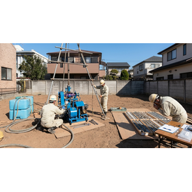
In the new construction project of a condominium located along the river, a thorough examination of the risks in the invisible underground areas, such as the complex alluvial deposits and the steep inclines of supporting layers that have arisen due to changes in the river's course, is strongly required. Relying solely on measurement data from a single location or automated judgment programs for ground evaluation poses the risk of overlooking the unevenness of micro-topography and potential subsidence risks, leaving concerns about future building subsidence and structural damage. Geotech provides a rigorous operational system compliant with the ISO 9001 quality management system and offers multifaceted ground investigations conducted by experienced and qualified staff, including geological survey engineers. In addition to on-site measurement data, we conduct comparative analyses with tens of thousands of neighboring columnar diagrams and surface geological maps stored in our proprietary database "GEODAS," accurately identifying the steep inclines of supporting layers that vary significantly over short distances. With clearly visualized ground assessment reports and a ground warranty system of up to 10 years, we strongly support the trust of our clients and the safe foundation design.
Inquire About This Product
basic information
GeoTech's ground investigation is conducted under a quality management system certified by the international standard ISO 9001 (for the residential land survey department and geological survey department). Thorough pre-start inspections and verifications using a screw point wear checker are carried out based on internal regulations. Qualified geological survey engineers and residential land chief engineers are responsible for the analysis, correlating field measurement values with the internal database GEODAS (which contains over 50,000 ground information records in the metropolitan area). The delivered ground investigation report consists of two volumes with a color cover that separates objective data from multifaceted analyses, and a ground warranty system is applicable for up to 10 years and a maximum of 50 million yen.
Price information
Please contact us.
Delivery Time
※Please contact us.
Applications/Examples of results
It is utilized in new construction projects such as condominiums, large retail stores, and rental apartments planned in river proximity areas and alluvial ground. It is used for evaluating subsidence risk associated with the inclination of underground support layers, ensuring compliance with ground guarantee systems assessed by third-party organizations, and providing scientific-based ground consulting to designers of architecture and structures. Additionally, it is widely used to present objective evidence to clients and prospective condominium buyers, to appeal to asset safety during sales, to mitigate after-guarantee risks for builders regarding post-construction defects and future differential settlement accidents, and to assess the surrounding environment to prevent neighborhood disputes.
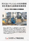
catalog(3)
Download All Catalogs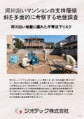

Company information

-