
Ministry of Land, Infrastructure, Transport and Tourism Catalog Listed Technology | Supporting Bridge Scour Inspection with Underwater Drones

Technology for supporting scour inspection of bridges using underwater drones.
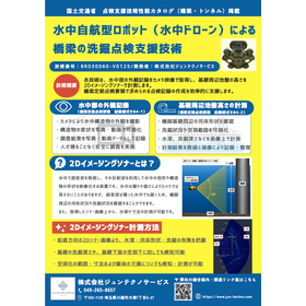
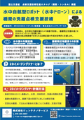
Are you having trouble with "confirming underwater parts" or "understanding scouring conditions" during bridge inspections? This document introduces the bridge scouring inspection support technology using underwater drones, as listed in the Ministry of Land, Infrastructure, Transport and Tourism's inspection support technology performance catalog. In addition to recording the appearance of underwater structures through camera footage, it supports the measurement of riverbed shapes around bridge pier foundations, the presence or absence of scouring, water depth, dimensions, and more using 2D imaging sonar. This allows for safe investigations without the need for divers, leading to organized records through photos, videos, and numerical data.
Inquire About This Product
basic information
▪️Technology Name: Inspection Support Technology for Scour at Bridges Using Autonomous Underwater Robots (Underwater Drones) ▪️Publication Information: Ministry of Land, Infrastructure, Transport and Tourism Inspection Support Technology Performance Catalog (Bridges and Tunnels) ▪️Technology Number: BR030060-V0125 ▪️Main Applications: Recording the appearance of underwater parts of bridges, measuring the height of the ground around the foundation ▪️Technologies Used: Underwater drones, camera footage, 2D imaging sonar ▪️Verification and Recording Content: - Capturing the appearance of underwater structures - Visualizing structural deformations through photos and videos - Confirming the riverbed shape around bridge pier foundations - Visualizing scour conditions and cavity ranges - Measuring water depth, scour depth, etc., on images - Recording and organizing measurement results in numerical and image formats
Price range
Delivery Time
Applications/Examples of results
Bridge inspection, underwater inspection, scour inspection, pier investigation, riverbed shape, 2D imaging sonar, underwater drone, infrastructure inspection, maintenance management, Ministry of Land, Infrastructure, Transport and Tourism inspection support technology performance catalog.
catalog(12)
Download All Catalogs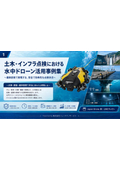



![[Free Download] Guide to Underwater Drone Use Cases and Advanced Inspection Diagnosis Technology](https://image.www.ipros.com/public/catalog/image/01/a2a/632687/IPROS79906525389731107510.jpeg?w=120&h=170)

Company information

At Jun Techno Service, we provide inspection and photography services for aging infrastructure in civil engineering, addressing the global challenges of infrastructure deterioration and workforce shortages that have been overlooked for a long time. In an era where proper maintenance management is deemed crucial, we prioritize human life and promote the IT transformation of infrastructure inspection surveys using underwater autonomous robot cameras (underwater drones) to enable continuous and efficient inspections. We aim to create a long-term safe society in collaboration with the community and everyone involved. ◆ NETIS Registration: Conservation inspection technology for underwater installations using underwater autonomous robot cameras (underwater drones) KTK-210002-A Examples of utilizing underwater autonomous robot cameras (underwater drones): - Bridge pier inspections and regular checks - Maintenance management of dam facilities - Maintenance management of reservoirs - Management of treatment plants and pump stations - Marine research at universities - Investigation of watershed sewer pipelines - Observation of aquaculture growth conditions - Investigation within agricultural drainage channels - Investigation of pipelines in ozone contact tanks at water purification plants


