Batch filtering processing! It is possible to display the Geospatial Information Authority of Japan tiles.
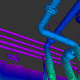
"3D-BASE PRO" is a large point cloud management system with layer and filtering functions. It allows for the creation of triangular meshes and contour lines for each layer, and multiple square meshes can be managed to calculate earthwork volumes through layer comparisons. Additionally, it supports overhangs, filtering overhang data, and generating triangular meshes from slope directions. 【Features】 ■ Management, display, and editing of large point clouds by layer ■ Multiple routes can be created by layer ■ Handling of group layers is possible ■ Addition and editing of shapes using CAD functions ■ Various accuracy management options are available *For more details, please refer to the PDF document or feel free to contact us.

Inquire About This Product
basic information
【Various Functions (Partial)】 ■ Coordinate Import ■ Coordinate Export ■ Triangle Mesh Generation ■ Triangle Polygon ■ Route ■ Drawing ■ CAD ■ Accuracy Management ■ Square Mesh Generation ■ Display Method *For more details, please refer to the PDF materials or feel free to contact us.
Price range
Delivery Time
Applications/Examples of results
For more details, please refer to the PDF document or feel free to contact us.
catalog(1)
Download All Catalogs
Company information

Mirai System Laboratory Co., Ltd. supports design and three-dimensional analysis operations through the development and sales of various analysis software, including three-dimensional analysis and agricultural civil engineering consulting. In Hokkaido, where our headquarters is located, we have a very high market share in drainage-related and agricultural land development systems. Our staff, who possess various qualifications and experiences, provide support for design and measurement operations in the field from multiple perspectives.