iPROS Urban Planning
  • Search for products by classification category

    • Building Materials
      Building Materials
      35541items
    • Facilities
      Facilities
      56657items
    • Lighting and Interior
      Lighting and Interior
      17273items
    • Common materials
      Common materials
      37004items
    • Civil Engineering Materials
      Civil Engineering Materials
      9533items
    • Construction, work and methods
      Construction, work and methods
      27655items
    • Surveys, Measurements, and Services
      Surveys, Measurements, and Services
      30352items
    • IT/Software
      IT/Software
      31783items
    • others
      others
      84503items
    • Store and facility supplies
      Store and facility supplies
      4358items
    • Office and commercial supplies
      Office and commercial supplies
      11462items
    • Hospital and welfare facility supplies
      Hospital and welfare facility supplies
      952items
    • Logistics Equipment
      Logistics Equipment
      7378items
    • Energy and Resources
      Energy and Resources
      11606items
  • Search for companies by industry

    • Information and Communications
      7197
    • others
      6979
    • Building materials, supplies and fixtures manufacturers
      6683
    • Service Industry
      4607
    • Trading company/Wholesale
      2996
    • Other construction industries
      2456
    • Electrical equipment construction business
      642
    • Interior Design
      528
    • Facility Design Office
      492
    • Construction Consultant
      464
    • Architectural design office
      361
    • retail
      345
    • Warehousing and transport related industries
      321
    • Electricity, Gas and Water Industry
      290
    • General contractors and subcontractors
      288
    • Interior construction business
      274
    • Medical and Welfare
      272
    • Educational and Research Institutions
      258
    • Building Management
      253
    • Renovation and home construction industry
      224
    • Water supply and drainage construction business
      204
    • Housing manufacturers and construction companies
      187
    • Transportation
      160
    • Real Estate Developers
      155
    • Fisheries, Agriculture and Forestry
      124
    • Structural Design Office
      66
    • Finance, securities and insurance
      35
    • Restaurants and accommodations
      29
    • self-employed
      29
    • Mining
      26
    • Public interest/special/independent administrative agency
      18
    • Police, Fire Department, Self-Defense Forces
      18
    • Store and building owners
      9
    • Property Owner
      8
    • Government
      8
    • Individual
      8
  • Special Features
  • Ranking

    • Overall Products Ranking
    • Overall Company Ranking
Search for Products
  • Search for products by classification category

  • Building Materials
  • Facilities
  • Lighting and Interior
  • Common materials
  • Civil Engineering Materials
  • Construction, work and methods
  • Surveys, Measurements, and Services
  • IT/Software
  • others
  • Store and facility supplies
  • Office and commercial supplies
  • Hospital and welfare facility supplies
  • Logistics Equipment
  • Energy and Resources
Search for Companies
  • Search for companies by industry

  • Information and Communications
  • others
  • Building materials, supplies and fixtures manufacturers
  • Service Industry
  • Trading company/Wholesale
  • Other construction industries
  • Electrical equipment construction business
  • Interior Design
  • Facility Design Office
  • Construction Consultant
  • Architectural design office
  • retail
  • Warehousing and transport related industries
  • Electricity, Gas and Water Industry
  • General contractors and subcontractors
  • Interior construction business
  • Medical and Welfare
  • Educational and Research Institutions
  • Building Management
  • Renovation and home construction industry
  • Water supply and drainage construction business
  • Housing manufacturers and construction companies
  • Transportation
  • Real Estate Developers
  • Fisheries, Agriculture and Forestry
  • Structural Design Office
  • Finance, securities and insurance
  • Restaurants and accommodations
  • self-employed
  • Mining
  • Public interest/special/independent administrative agency
  • Police, Fire Department, Self-Defense Forces
  • Store and building owners
  • Property Owner
  • Government
  • Individual
Special Features
Ranking
  • Overall Products Ranking
  • Overall Company Ranking
  • privacy policy
  • terms of service
  • About Us
  • Careers
  • Advertising
  1. Home
  2. ProductSearch
  3. IT/Software
  4. CAD
  5. Other CAD
  6. General-purpose GIS PC-MAPPING HT

General-purpose GIS PC-MAPPING HT

  • Added to bookmarks

    Bookmarks list

    Bookmark has been removed

    Bookmarks list

    You can't add any more bookmarks

    By registering as a member, you can increase the number of bookmarks you can save and organize them with labels.

    Free membership registration

last updated:Apr 08, 2022

マプコン
マプコン
  • Official site

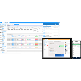
A versatile GIS engine developed by Mapcon. Software equipped with a wealth of features for importing, editing, and spatial analysis of vector data.

GIS manages various information by linking maps and databases. PC-MAPPING is a versatile GIS that not only has basic functions such as importing, editing, and analyzing vector data, but also includes database-related functions and customization features. ◆Structured Data The basic structure is structured data, which allows for a representation that is more aligned with reality. ◆Multiple Vectors in One Layer The data structure allows for different vector elements to coexist within a single layer. ◆Database Mechanism It has its own database mechanism, allowing for a small start without the need for other database engines. ◆In-House Development Since everything is fundamentally developed in-house, it can quickly respond to function additions, bug fixes, and new domestic formats. In addition to its analytical capabilities as a GIS, it also offers rich drawing functions, achieving a CAD-like operational feel.

    Other CADOther Software
256.PNG

General-purpose GIS PC-MAPPING HT

256.PNG
256.PNG
  • Related Link - https://www.mapcom.tokyo/product/ht/

Inquire About This Product

  • Contact Us Online

basic information

PC-MAPPING allows you to use all features without any additional options in principle. Leveraging the strengths of our domestic in-house development, it can handle not only new domestic formats but also 3D data such as three-dimensional point cloud data (LAS, CSV) and CityGML as one type of GIS data. Additionally, it excels in customization, allowing for both simple menu bars created by combining menus and advanced customization where you can write scripts for control through Automation. If needed, please feel free to consult us about creating dedicated menus tailored to your business needs.

Price range

P5

Delivery Time

Please contact us for details

※In the case of online authentication licenses, same-day service is also possible. Please contact us.

Applications/Examples of results

It is widely utilized as a production tool for various tasks related to drawings, as well as a tool for managing and operating data. - Road ledger, property tax, UAV flight course design - Sewage, cultural properties, urban planning, agricultural land ledger, outdoor advertising - Rivers, forests, disaster prevention, park facilities, vacant houses, vacant stores - Point cloud data

News about this product(4)

You can receive tax benefits by purchasing PC-MAPPING HT! [Until the end of March 2023]

  • Product news

As a preferential tax system for software implementation, the "Small and Medium Enterprise Management Enhancement Tax System" has been established. This system allows small and medium-sized enterprises to apply for immediate depreciation or tax credits when they make capital investments to improve their management capabilities. We have also registered our GIS engine "PC-MAPPING HT" as a product eligible for this system. For more details, please refer to the linked page.

Added to bookmarks

Bookmarks list

Bookmark has been removed

Bookmarks list

You can't add any more bookmarks

By registering as a member, you can increase the number of bookmarks you can save and organize them with labels.

Free membership registration

Information about the 3D Point Cloud Data Kit

  • Product news

We will provide rental kits for the following services, which are part of the National Land Geographic Institute's orders for the fiscal year 2022. The provision is scheduled to start on May 10. 【Target Items】 - Three-dimensional point cloud data maintenance work based on R4 aerial laser survey results We will provide a set of tools to efficiently advance almost all processes of the specifications. - Aerial laser survey and three-dimensional point cloud data maintenance We will provide a set of tools to efficiently advance some processes of the work. Please refer to the link for the scope of the kit.

Added to bookmarks

Bookmarks list

Bookmark has been removed

Bookmarks list

You can't add any more bookmarks

By registering as a member, you can increase the number of bookmarks you can save and organize them with labels.

Free membership registration

Integration of flight planning function for drones (UAV) into GIS [Function modification]

  • Product news

**Function Improvement** Recently, drones (UAVs) have gained significant attention not only for their use in photography and civil engineering surveying at construction sites but also for their expected wide-ranging applications in emergency response during disasters and the collection of disaster prevention information. However, it is also true that accidents have increased with their proliferation, and one of the causes is the lack of accuracy in flight planning. In response, our company has developed a function that allows for the design of highly accurate flight plans using geographic information, leveraging the know-how we have cultivated since our establishment in developing geographic information systems. Additionally, we can create flight plans not only for photography but also for laser acquisition. We particularly focus on calculations that take height data into account and offer unique features that are not found elsewhere, such as: - Route design that considers elevation differences to avoid gaps in the photographic results - Flight route design that follows the surface of the terrain, which is a unique flying pattern of drones - Loading and readjusting the planned course, followed by re-output - Route design that avoids specified specific locations - Recalculating laps from the course - Creating waypoints only when there is a specified change in elevation as a battery management measure and more.

Added to bookmarks

Bookmarks list

Bookmark has been removed

Bookmarks list

You can't add any more bookmarks

By registering as a member, you can increase the number of bookmarks you can save and organize them with labels.

Free membership registration

3D urban model (Project PLATEAU) supports import for the 23 wards of Tokyo.

  • Product news

The Ministry of Land, Infrastructure, Transport and Tourism is currently promoting the development of 3D city models in approximately 50 cities nationwide, including the 23 wards of Tokyo, as part of Project PLATEAU, aiming for nationwide dissemination and expanded utilization by the end of fiscal year 2020. The G Spatial Information Center has made the 3D city model of the 23 wards of Tokyo available for free download and unrestricted use, including for commercial purposes. We have added functionality to import the CityGML of the 23 wards of Tokyo into PC-MAPPING, allowing it to be displayed on GIS. It is treated as one of the GIS data sets, enabling overlay with other data and 3D representation. By utilizing the PVP save function (extended version), it can also be distributed as a viewer. For more details, please refer to the link.

Added to bookmarks

Bookmarks list

Bookmark has been removed

Bookmarks list

You can't add any more bookmarks

By registering as a member, you can increase the number of bookmarks you can save and organize them with labels.

Free membership registration

Companynews list (5)

Company information

マプコン

マプコン

others

Added to bookmarks

Bookmarks list

Bookmark has been removed

Bookmarks list

You can't add any more bookmarks

By registering as a member, you can increase the number of bookmarks you can save and organize them with labels.

Free membership registration
  • Official site
Phone number/address

Our company is a developer of Geographic Information Systems (GIS). To create a full-fledged geographic information system, it is necessary to have software development capabilities, expertise in maps, and the ability to create map data. Mapcon not only develops commercial application software and PC-MAPPING but also specializes in the development of custom systems. We support all aspects of geographic information systems, from planning and design to hardware configuration, to ensure that operational aspects are also covered. Additionally, we have a data creation department that produces large-scale business data, such as national road data, and map data designed to suit user applications. Recently, there have been scenarios where GIS can be utilized for functions such as UAV flight path design and management and utilization of 3D point cloud data. We are updating our features to accommodate new methods of data acquisition and new data formats.

Product/Service List (3)

The related categories of Other CAD

  • IT/Software
  • CAD
  • Other CAD
  • software
  • Other Software
          

Inquire About This Product

  • Contact Us Online

Products

  • Search for Products

Company

  • Search for Companies

Special Features

  • Special Features

Ranking

  • Overall Products Ranking
  • Overall Company Ranking

support

  • site map
IPROS
  • privacy policy Regarding external transmission of information
  • terms of service
  • About Us
  • Careers
  • Advertising
COPYRIGHT © 2001-2025 IPROS CORPORATION ALL RIGHTS RESERVED.
Please note that the English text on this page is automatically translated and may contain inaccuracies.