1~13 item / All 13 items
Displayed results

Added to bookmarks
Bookmarks listBookmark has been removed
Bookmarks listYou can't add any more bookmarks
By registering as a member, you can increase the number of bookmarks you can save and organize them with labels.
Free membership registration
Contact this company
Contact Us Online1~13 item / All 13 items
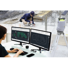
Data flows. Work progresses smoothly. Easily create necessary data from CAD using positioning devices like "Rakuichi." *This is an add-on software for AutoCAD/Revit.* - Easily and automatically extract high-precision coordinate data needed for marking out using surveying equipment from design drawings. - Return measurement result data to CAD/BIM and compare it with design values. - Simply follow the wizard to create a coordinate list.
Added to bookmarks
Bookmarks listBookmark has been removed
Bookmarks listYou can't add any more bookmarks
By registering as a member, you can increase the number of bookmarks you can save and organize them with labels.
Free membership registration
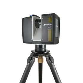
Up to 2 million points per second. Approximately 16 times the scanning speed compared to conventional machines. - High speed, high density, high precision - Maximum scan of 400m - Lightweight body at 4.4kg despite high performance - Selectable measurement styles: Collage Site/Collage Office - Selectable camera sensors - Status confirmation possible with light and sound
Added to bookmarks
Bookmarks listBookmark has been removed
Bookmarks listYou can't add any more bookmarks
By registering as a member, you can increase the number of bookmarks you can save and organize them with labels.
Free membership registration
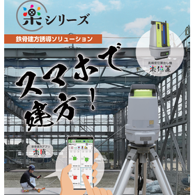
Topcon's steel frame construction guidance solution is a groundbreaking solution that allows anyone to easily perform steel frame construction alignment tasks alone, and it can automatically generate reports. The smartphone app "Rakuza" controls the measuring device "Rakuichi" to measure the verticality of columns.
Added to bookmarks
Bookmarks listBookmark has been removed
Bookmarks listYou can't add any more bookmarks
By registering as a member, you can increase the number of bookmarks you can save and organize them with labels.
Free membership registration
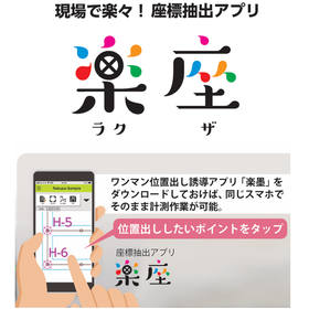
"On-site and design connect easily" Easy three steps with a smartphone! 1. Import drawing data (DXF format) 2. Tap the points you want to position 3. Load the data created in Rakuza into the app "Rakusumi" and start positioning!
Added to bookmarks
Bookmarks listBookmark has been removed
Bookmarks listYou can't add any more bookmarks
By registering as a member, you can increase the number of bookmarks you can save and organize them with labels.
Free membership registration
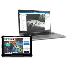
Analyze on-site, share in the cloud! We will propose the optimal 3D workflow for you by combining various solutions. ■ Field software for scanners: Collage Site Supports remote operation and real-time data verification. ■ Cloud-based 3D point cloud analysis software: Collage Web Analyzes scanner data from the cloud. ■ 3D point cloud processing software: Collage Office Generates point clouds and synthesizes data with a single software.
Added to bookmarks
Bookmarks listBookmark has been removed
Bookmarks listYou can't add any more bookmarks
By registering as a member, you can increase the number of bookmarks you can save and organize them with labels.
Free membership registration
All-encompassing from architecture to civil engineering with a variety of features! Achieving intuitive operation and expanded work range! - Equipped with a camera - Non-prism measurement function - Highly visible green laser pointer - Expanded measurement range - Height correction function - Inspection and adjustment function
Added to bookmarks
Bookmarks listBookmark has been removed
Bookmarks listYou can't add any more bookmarks
By registering as a member, you can increase the number of bookmarks you can save and organize them with labels.
Free membership registration
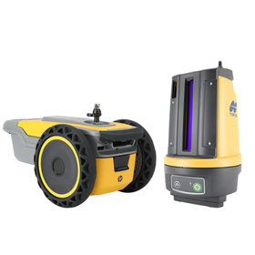
Achieve high-precision marking easily for anyone in collaboration with "Hang Navi"! - High-speed and high-precision marking while moving - AI selects the most efficient route - Reduces work costs and downtime - Increases productivity of marking work by up to 10 times* *This is based on a proprietary survey by HP, analyzing actual usage data from customers who have implemented "HP SitePrint" overseas. The extent of productivity improvement may vary depending on factors such as line density and site size.
Added to bookmarks
Bookmarks listBookmark has been removed
Bookmarks listYou can't add any more bookmarks
By registering as a member, you can increase the number of bookmarks you can save and organize them with labels.
Free membership registration
Safe to use for a whole day! Achieve long hours of continuous work! - Long hours of work are worry-free! Equipped with an external power port - Usage time increased by 120% compared to conventional models! Achieves 6 hours of continuous use - Expanded measurable range! Easily covers steep slopes - Easy installation with automatic leveling - Bright and easy-to-see guide light - Compatible as a sensor for the Pile Navigation ICT construction machinery family (optional) *For more details, please refer to the catalog PDF or feel free to contact us.
Added to bookmarks
Bookmarks listBookmark has been removed
Bookmarks listYou can't add any more bookmarks
By registering as a member, you can increase the number of bookmarks you can save and organize them with labels.
Free membership registration
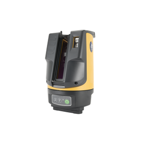
The "Rakuichi" is a one-man surveying device that allows anyone to easily perform layout and foundation checks. It is ideal for promoting work style reforms through digital utilization aimed at improving productivity, known as "Construction DX." The high-precision positioning device "Rakuichi" and the smartphone application "Rakuzumi" for one-man positioning guidance on construction sites create a "one-man positioning system for construction work" that allows anyone to easily perform positioning and inspections alone by directly utilizing 3D design data. 【Features】 ■ Supports various measurements with one device ■ Positioning work using your own smartphone ■ Easy smartphone operation, even for beginners ■ Improved work efficiency with one-person operation (one-man measurement) ■ Set up in your preferred location and start work immediately *For more details, please refer to the catalog PDF or feel free to contact us.
Added to bookmarks
Bookmarks listBookmark has been removed
Bookmarks listYou can't add any more bookmarks
By registering as a member, you can increase the number of bookmarks you can save and organize them with labels.
Free membership registration
By digitizing the layout work with the combination of "Gakuboku" and the stake navigator (LN-100/LN-150), there are many benefits, including not only labor-saving and shortening of construction time but also reduction of construction errors and the ability to keep construction records as digital data. At residential foundation construction sites: ■ Confirmation of boundary points ■ Positioning of ground lines ■ Setting up of guide stakes ■ Layout work At large construction sites: ■ Centering of foundation piles ■ Layout work ■ Confirmation of floor level And more: ■ Installation of escape stakes/layout marks ■ Guidance of excavation position and height ■ Confirmation of alignment
Added to bookmarks
Bookmarks listBookmark has been removed
Bookmarks listYou can't add any more bookmarks
By registering as a member, you can increase the number of bookmarks you can save and organize them with labels.
Free membership registration
● Efficient Point Cloud Workflow - Target scanning is possible even at a distance of 200m. In large-scale sites, the number of target movements is significantly reduced, resulting in a substantial decrease in workload. - It supports 360° prisms, allowing immediate measurement without changing the orientation of the prism when moving the instrument point. This achieves faster measurement times. ● Improvement in Point Cloud Quality - It is robust against low-reflectivity dark road surfaces, ensuring a surface accuracy of 1mm (σ)*. It is compatible with the measurement of pavement construction in i-Construction. * When analyzed with MAGNET Collage. - 3D point cloud data colored using standard images may suffer from blackouts in shaded areas and overexposure in sunlit areas, but using HDR images generates more natural and realistic 3D point cloud data. 【Features】 ■ Equipped with instrument point and rear view method/back intersection method programs ■ Long-distance target scanning compatible with 360° prisms ■ Surface accuracy improved to 1mm (σ) ■ Clear 3D point cloud data generation with HDR imaging ■ Remote control compatible ■ Purely domestic laser scanner capable of rapid support * For more details, please refer to the catalog PDF or feel free to contact us.
Added to bookmarks
Bookmarks listBookmark has been removed
Bookmarks listYou can't add any more bookmarks
By registering as a member, you can increase the number of bookmarks you can save and organize them with labels.
Free membership registration
"Edgewise" is a BIM model creation support software that can automatically extract BIM models from current 3D point clouds. Using automatic extraction and pattern extraction features, it reduces the time required to create BIM models from current 3D point clouds by up to 75%. Furthermore, it supports seamless data integration and works with various BIM software. [Features] ■ Automatic extraction of components such as piping, steel frames, and walls ■ Pattern extraction of structurally similar components ■ Significant reduction in modeling time ■ Easy BIM modeling of structures from 3D point cloud data ■ Data integration with various BIM software, including Autodesk Revit *For more details, please refer to the catalog PDF or feel free to contact us.
Added to bookmarks
Bookmarks listBookmark has been removed
Bookmarks listYou can't add any more bookmarks
By registering as a member, you can increase the number of bookmarks you can save and organize them with labels.
Free membership registration
"Verity" is a quality management software for construction that automatically compares current 3D point clouds with BIM models, enabling visualization of construction accuracy. 【Features】 ■Instantly grasp the construction accuracy on-site ■Improve inspection efficiency for structures and piping ■Reduce risks of budget and schedule changes ■Utilize point clouds obtained non-contact via laser scanners ■Export inspection results to project management tools ■Quality verification remotely via the web ■Autodesk Navisworks add-on software *For more details, please refer to the catalog PDF or feel free to contact us.
Added to bookmarks
Bookmarks listBookmark has been removed
Bookmarks listYou can't add any more bookmarks
By registering as a member, you can increase the number of bookmarks you can save and organize them with labels.
Free membership registration