1~7 item / All 7 items
Displayed results
Filter by category

Added to bookmarks
Bookmarks listBookmark has been removed
Bookmarks listYou can't add any more bookmarks
By registering as a member, you can increase the number of bookmarks you can save and organize them with labels.
Free membership registration
Contact this company
Contact Us Online1~7 item / All 7 items
Filter by category

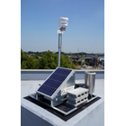
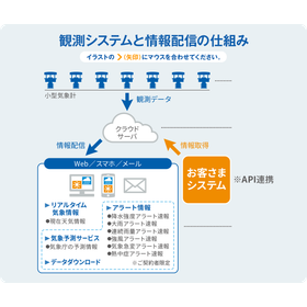
"POTEKA" is a super high-density weather observation and information service that captures signs of weather changes through real-time monitoring. It consists of small weather instruments that can be installed in various locations and a network connecting them. By precisely placing weather instruments in the area you want to monitor, you can obtain accurate weather information at specific points. [Features] - Small weather instruments that can be placed anywhere - Real-time observation based on actual measurements - Provision of accumulated big data *For more details, please refer to the related links or feel free to contact us.
Added to bookmarks
Bookmarks listBookmark has been removed
Bookmarks listYou can't add any more bookmarks
By registering as a member, you can increase the number of bookmarks you can save and organize them with labels.
Free membership registration
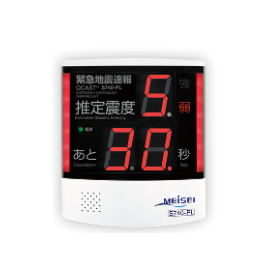
The "QCAST Series" is an earthquake disaster prevention device designed to protect people's lives and livelihoods from the threat of sudden massive earthquakes. It receives information (forecasts and emergency earthquake alerts for advanced users) distributed by broadcasting operators and calculates and displays pinpoint estimated seismic intensity and lead time (the estimated time until the S-wave of the seismic wave arrives) before strong shaking occurs. It can alert people through audio broadcasting (building-wide announcements) and control various devices and equipment (such as elevators) using output connections. 【Features】 ■ Standard equipped with self-calculation and redistribution functions ■ Supports long-period seismic motion classification predictions ■ 24/7, 365 days a year, reliable maintenance service *For more details, please refer to the related links or feel free to contact us.
Added to bookmarks
Bookmarks listBookmark has been removed
Bookmarks listYou can't add any more bookmarks
By registering as a member, you can increase the number of bookmarks you can save and organize them with labels.
Free membership registration
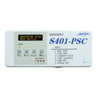
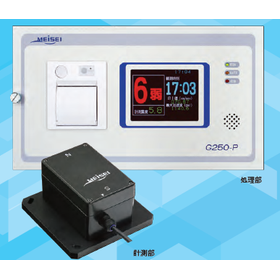
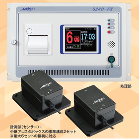
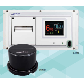
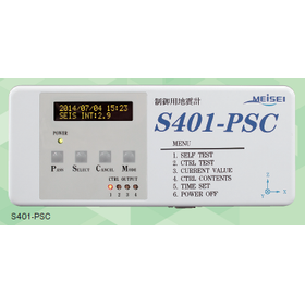
We would like to introduce the Myojo Seismometer series that we handle. The 'S401-PSC' measures the intensity of earthquakes by calculating the PHILVOLCS Earthquake Intensity Scale (PEIS) developed by the Philippine Institute of Volcanology and Seismology (PHIVOLCS) and displays this intensity scale in real-time on the screen. The 'G250 Series' uses servo acceleration sensors and is of the same model certified by the Japan Meteorological Agency. It has been delivered to the Japanese government, public institutions, local governments, and transportation-related facilities, achieving great success. 【Features】 ■ Used by the Japan Meteorological Agency ■ Used by the Philippine Institute of Volcanology and Seismology (PHIVOLCS) ■ Can be safely installed *For more details, please refer to the related links or feel free to contact us.
Added to bookmarks
Bookmarks listBookmark has been removed
Bookmarks listYou can't add any more bookmarks
By registering as a member, you can increase the number of bookmarks you can save and organize them with labels.
Free membership registration
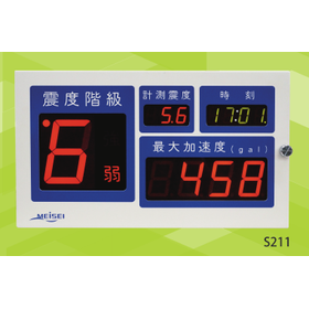
■ Can be directly received from reliable distribution operators such as the Meteorological Agency. ■ Displays estimated seismic intensity and countdown time with a grace period based on information for advanced users. ■ Allows for easy broadcast linkage without the worry of cutoff. ■ Provides industry-leading visibility with a large and easy-to-read display.
Added to bookmarks
Bookmarks listBookmark has been removed
Bookmarks listYou can't add any more bookmarks
By registering as a member, you can increase the number of bookmarks you can save and organize them with labels.
Free membership registration
■ Direct reception is possible from highly reliable distribution operators such as the Meteorological Agency. ■ The arrival of P-waves and S-waves calculated from the received data is displayed in animation. ■ The received data can be accumulated and used for analysis. ■ Since redistribution is possible, system expansion can be achieved at low cost. ■ It is possible to display registered locations in multiple points in order of estimated seismic intensity.
Added to bookmarks
Bookmarks listBookmark has been removed
Bookmarks listYou can't add any more bookmarks
By registering as a member, you can increase the number of bookmarks you can save and organize them with labels.
Free membership registration
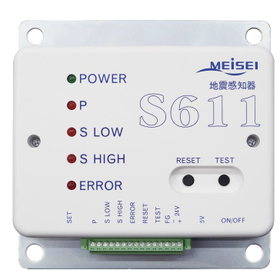
1. The adoption of the real-time seismic intensity calculation method by the Disaster Prevention Research Institute achieves an immediacy of 0.01 seconds. 2. It has been integrated to include sensors, processing, display, output, and maintenance functions. 3. It supports independent output with four contact points for real-time seismic intensity and acceleration. 4. It is network-compatible as standard, allowing for display, data acquisition, and setting changes via a general-purpose browser. 5. It supports a measurement range of up to ±6G.
Added to bookmarks
Bookmarks listBookmark has been removed
Bookmarks listYou can't add any more bookmarks
By registering as a member, you can increase the number of bookmarks you can save and organize them with labels.
Free membership registration
We capture the signs of weather changes through real-time observation and provide pinpoint weather information that you need. There are various functions available, from weather alert notification services to downloading weather data! Of course, we also provide real-time weather information. We have a proven track record of adoption for various applications, including disaster prevention and resident services in local governments and public agencies, environmental measurement in research institutions, and ensuring safety at construction sites. 【Features】 ■ Registered with the Ministry of Land, Infrastructure, Transport and Tourism's NETIS. (Registration number KT-160077-VE) ■ By simply purchasing an ID and password valid for one year, you can access real-time weather information from anywhere without the need for dedicated software. ■ There are no initial costs, and you can utilize actual measurements from weather meters with certification. ■ Alert notification services and weather forecast services are also available as standard.
Added to bookmarks
Bookmarks listBookmark has been removed
Bookmarks listYou can't add any more bookmarks
By registering as a member, you can increase the number of bookmarks you can save and organize them with labels.
Free membership registration