3D Laser Measurement Business 3D Laser Measurement
Can be read as 3D data! Dimension measurement and shape recognition are possible.
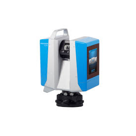
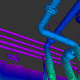
Our company conducts "3D laser measurement." 3D laser scanning involves using a 3D laser scanner to read the target object as point cloud data and obtain three-dimensional coordinates. Since it can read data in three dimensions, it allows for dimension measurement and shape recognition. 【How 3D Laser Scanners Work】 - The distance is calculated based on the waveform reflected from the target object when the laser is directed at it (the X, Y, and Z coordinates of the point are calculated from the angle of the scanner). - The measurement range is 150m, and the measurement accuracy is ±1.0mm at a distance of 10m. *The catalog can be downloaded from the related link.
- Company:東海テクノ
- Price:Other


![Leica RTC360 3D [Rental] [Sale]](https://image.www.ipros.com/public/product/image/109/2000586745/IPROS16356456011224363220.png?w=280&h=280)