
List of Surveys, Measurements, and Services products
- classification:Surveys, Measurements, and Services
2251~2295 item / All 29765 items


Natural wood endless tape with a thickness of 0.9 to 3 mm. It contributes to improved yield and productivity as a substitute for solid wood for the edges of furniture and fixtures.


- others


By simply increasing the formwork, we can achieve a variety of variations. Formwork costs are reduced, and productivity is improved! We respond to various site needs with multifunctionality.
- Gutters and U-shaped gutters
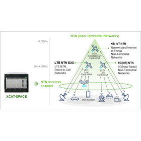

An emulator that can reproduce the wireless channel environment between the satellite and the UE in the lab!
- Analysis and prediction system

We have launched a special website!! New solutions are also featured.
Today, we have opened our special website. Until now, we have only featured measurement tools (XCAL) and analysis tools (XCAP), but starting today, we are showcasing products for the following five solutions: ◆ Local 5G Solution ◆ Network Optimization Solution ◆ NTN Measurement Solution ◆ Automotive Solution (V2X) ◆ Small Cell Solution In particular, the NTN Measurement Solution is related to the currently popular direct satellite communication solutions, and the Automotive Solution (V2X) pertains to solutions for autonomous driving, so please be sure to check it out!! If you have any questions, please feel free to contact us. Thank you very much for your continued support.
![[Plant and Equipment] Avoiding Inte...](https://image.www.ipros.com/public/product/image/2114348/IPROS896440735043422750.png?w=280&h=280)

Ensure accurate current conditions in design. Completely avoid interference on the PC, eliminating rework and re-measurement on site to zero!
- Drawing, tracing, CAD
- Surveying Consulting
- Architectural design office


This is a glass plate processed to increase strength (to make it less likely to break).
- Other analytical equipment


An autonomous mobile robot capable of measurement and imaging from any position.
- Other analytical equipment
- Automatic transport robot
![[Digital Jellyfish Case Study] Util...](https://image.www.ipros.com/public/product/image/867/2000779615/IPROS65152492172767399564.jpeg?w=280&h=280)

Submit evidence to the client for weather risk settlement type construction.
- Measurement and analysis equipment leasing and rental
- Harbor Construction
![[Digital Jellyfish Case Study] Tria...](https://image.www.ipros.com/public/product/image/6c4/2000958118/IPROS44170500257030087199.png?w=280&h=280)
Design change request to the client based on the data observed from the digital jellyfish.
- Harbor Construction
- Weather Survey

Easily obtain real-time wave heights on-site! [NETIS registration number QSK-170002-VE]
- Harbor Construction
- Coastal construction
- Weather Survey

What is the "utilization coefficient" used in port construction for those involved in marine construction?
Thank you for always watching. This time, I will talk about important indicators used in port operations. Depending on the site environment, offshore construction is easily affected by waves and wind, and it is particularly necessary to carefully consider weather conditions in cost management and labor management. For this reason, there is an important keyword in offshore construction known as "utilization coefficient." This time, we will take a rough look at this "utilization coefficient." 1. What does "utilization" mean? 2. Calculation of the utilization coefficient 3. Concept of the utilization coefficient 1. What does "utilization" mean? First, "utilization" refers to the state in which machinery and equipment have been delivered to the construction site. The number of days from when the equipment is delivered to when it is removed is called "utilization days." Additionally, the construction period (excluding preparation and cleanup) includes not only the days when work is performed (operating days) but also non-operating days (holidays, safety training days, days of inclement weather, etc.). The remaining days in a year (365 days) after excluding these non-operating days constitute the annual "operating days" for the machinery and equipment. *For more details, please visit our website or feel free to contact us.
![[Feature Introduction] Digital Jell...](https://image.www.ipros.com/public/product/image/c9a/2001488092/IPROS98225687944626931637.jpeg?w=280&h=280)
Utilize observation data as evidence for establishing unique construction standards and for work stoppages due to inclement weather!
- Weather Survey
- Coastal construction
- Harbor Construction


Strict confidentiality! Proposal for the planned management and reduction of suddenly occurring environmental costs!
- Geological Survey
- Environmental Survey


Considering spatial design based on graphics.
- Renovation Design
- Interior wall decoration


Understanding the sedimentation status of dam lakes and reservoirs in a spatial manner! Acquiring three-dimensional terrain data that can be used for maintenance management and capacity evaluation.
- Surveying
Responding to port, fishing port, and coastal area surveys in the Tohoku coastal area! High-precision multi-beam bathymetry for comprehensive understanding of seabed topography.
- Surveying
Using high-precision multi-beam sonar to comprehensively understand seabed topography for depth measurements and sediment accumulation checks in harbors and fishing ports.
- Surveying
Visualizing the seabed topography around port facilities in a planar manner! Usable for depth measurement, maintenance management, and dredging considerations.
- Surveying
Visualizing sediment accumulation and usable water depth in fishing ports in a planar manner! Three-dimensional terrain data that can be utilized for dredging studies and maintenance management.
- Surveying
Enhancing the maintenance and management of water infrastructure using three-dimensional terrain data! Supporting sediment accumulation monitoring and long-term change comparison.
- Surveying


[Free trial available] Affordable and high-functionality low-cost permanent license with high compatibility and expandability with AutoCAD. A must-see for those troubled by CAD costs!
- Drawing, tracing, CAD
[Case Study Presentation] Introduction of BricsCAD at Ebara Corporation! We will present a case study filled with key points on replacing a major general-purpose CAD.
■Do you have any of these concerns? - I want to switch to a DWG-compatible CAD, but I don't know where to start. - I want the new CAD to be accepted and used by the field after the switch. - I don't know what evaluation points to consider during the transition. Many companies are considering replacing their CAD with a DWG-compatible one to reduce costs and improve CAD operations. However, even though switching might seem straightforward, there are actually many factors to consider, such as how to manage the project and coordinate with the field. By looking at this case study, you can gain a clearer image of what the transition entails. Please feel free to download it.


Visualize indoor carbon dioxide levels at one-second intervals! A CO2 sensor that clearly indicates when to ventilate.
- Other measuring instruments
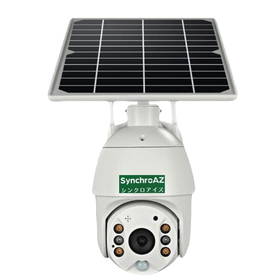

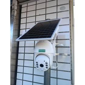
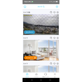
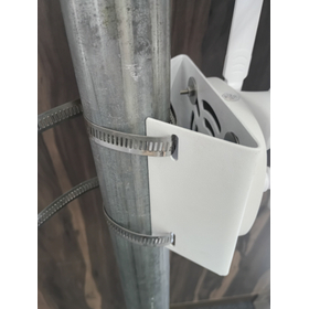
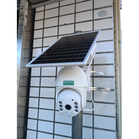
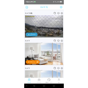
No power required! Remote monitoring camera to protect materials at construction sites.
- Security cameras and surveillance systems
- Construction company
- Solar power generation
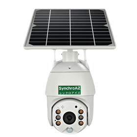
No power required! We will monitor the safety of the construction site.
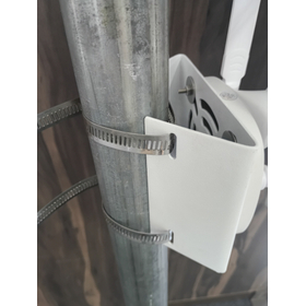
- Security cameras and surveillance systems
- Construction company
- Other civil engineering works
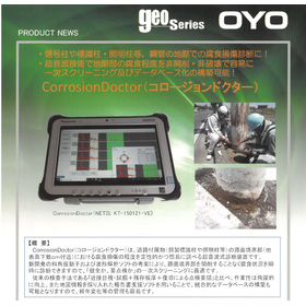

Screening investigation and corrosion site identification using non-destructive testing technology.
- Non-destructive testing
- maintenance
- Other civil engineering works

[New Feature Details Now Available] Supporting data utilization in the familiar .dwg format. Reducing "errors" and "losses" in electrical control design.
- Drawing, tracing, CAD
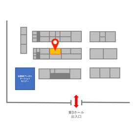
We will exhibit at the Electrical Construction Industry Exhibition (JECA FAIR) held from May 27 to 29, 2026!
Zuken Alphatech will be exhibiting at the Electrical Engineering Industry Exhibition (JECA FAIR) held at Tokyo Big Sight. 【Booth Number: 3-72 (East Hall 3)】 At our booth, we will introduce our new product "BAN DRAFTER," released last year, and our electrical design CAD software "ACAD-DENKI" and "WiringPLAN," focusing on solving challenges in electrical design and improving productivity. "BAN DRAFTER" is a tool that automatically creates reference drawings (single-line wiring diagrams and exterior views) to be attached to estimates for cubicles without requiring design labor. Additionally, the new grade of ACAD-DENKI, "EX Pack," addresses challenges such as: - High maintenance and registration efforts - Inability to align company practices with CAD - Lack of available human resources Through smart assist features like automatic accumulation of component libraries and automatic preliminary placement of equipment on panel drawings, it enables efficient operations. We have content that will provide useful tips for your daily work, so please feel free to stop by. *Pre-registration for visitors is available via the related link.
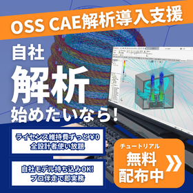
Break down the barriers of "high software costs" and "difficulty in environment setup and operation"! Our expert staff will provide support from software installation to analysis.
- Analysis and prediction system
- Architectural design office
- Specialized Construction
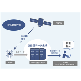

A service that provides generated correction data in file format for post-processing, based on data observed at SoftBank Corp.'s unique reference points.
- Surveying
Achieving high-precision positioning with an accuracy of a few centimeters using RTK technology.
- Surveying


The measurement accuracy is high, ranging from ±4mm to ±10mm! It is possible to measure a wide area in a short time.
- Surveying


Strong on-site performance, dustproof and waterproof capabilities, and robustness! Significantly reduces preparation, measurement, and cleanup tasks.
- Measurement and Inspection
- Other measuring instruments

With this one device, you can carry out network installation work! Simply connect the cables and press the TEST button for easy operation.
- Other measuring instruments

Correcting measurement errors of the torque meter! Safely evaluating power conditioners with high voltage.
- Other measuring instruments

Improve work efficiency with a lead that has a switch! An insulation resistance tester that allows for smooth start and stop operations.
- Measurement and Inspection
- Other measuring instruments

Specialized in 2D piping design! An extension software for AutoCAD/BricsCAD users.
- Facility Design
Support for the creation of a large number of components such as piping, fittings, and instruments necessary for plant design!
- Facility Design
Participant satisfaction rate of 98%! 400 companies and 2,500 people have attended over 10 years.
- Facility Design
Designing piping supports quickly and efficiently!
- Facility Design

A pressure-type seal strength testing machine widely used in the pharmaceutical, cosmetics, and food industries. It is a device for testing the seal strength of pouch and tube products.
- Other measuring instruments
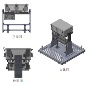
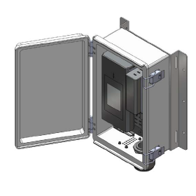
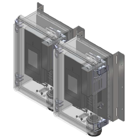
A fully automated testing and management solution for communication quality evaluation and monitoring in D2C satellite communication!
- Other measuring instruments

By subscribing to Archicad, you can use BIMcloud and BIMx Pro without limits! All-in-one BIM software.
- Drawing, tracing, CAD
Notice of the event "IGNITE Japan 2026" to be held on Thursday, October 15, 2026.
Graphisoft Japan Co., Ltd. will hold a free online event, 'IGNITE Japan 2026'. We will introduce new information about Archicad, the forefront of AI utilization that is significantly changing the industry, and the trends in drawing review and confirmation applications that are gaining attention. Through sessions by industry leaders, advanced case studies, and networking, discover hints to pave the way for the future of design and construction.


[New Release] Small, lightweight, and easy to measure! A magnetic field measuring device that responds to the voices from the field. Just press the hold button to save measurement data!
- Other measuring instruments
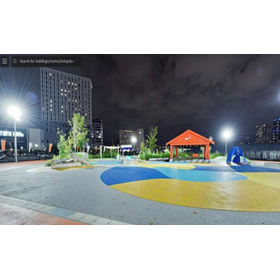
Faithfully reproducing real space with 16K panoramic photos. Smooth sharing with lightweight data. Supporting free secondary use and operation through the transfer of rights to the shooting data.
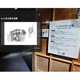
- Other measuring instruments
Announcement of the 4DKanKan Online Briefing on Starting Field DX with This Year's Budget
We would like to invite you to the online product presentation of "4DKanKan," a tool that promotes 3D digitalization and DX of sites and facilities. With a 3D digital twin camera that can simultaneously capture ultra-high-definition 16K panoramic photos and 1cm mesh point cloud data, you can advance the digitalization of your site without any specialized knowledge. 【Free】4DKanKan Online Product Presentation Presentation Content: 1. What is 4DKanKan? 2. Introduction of features using captured data 3. Introduction of optional services (hardware and software) 4. Use cases 5. Pricing and implementation methods 6. Q&A Do you have any of these concerns? - The burden of travel for site inspections is high - It is difficult to share the situation with just photos - You are interested in utilizing point clouds and 3D data but do not know how to implement them "4DKanKan" is here to solve these issues. It is being utilized to improve efficiency across a wide range of industries, including construction management, surveying, manufacturing, infrastructure, and events. Small starts are also possible through rentals, proof-of-concept experiments, and photography contracts. If you are considering DX initiatives for the next fiscal year, please join us.
![[Use Case] 2D Drawing and 3D Modeli...](https://image.www.ipros.com/public/product/image/2117853/IPROS6617157723042763101.png?w=280&h=280)
Efficient restoration and preservation of historical buildings without existing blueprints! Easy inter-departmental sharing with lightweight point cloud data.
- Other measuring instruments
Announcement of the 4DKanKan Online Briefing on Starting Field DX with This Year's Budget
We would like to invite you to the online product presentation of "4DKanKan," a tool that promotes 3D digitalization and DX of sites and facilities. With a 3D digital twin camera that can simultaneously capture ultra-high-definition 16K panoramic photos and 1cm mesh point cloud data, you can advance the digitalization of your site without any specialized knowledge. 【Free】4DKanKan Online Product Presentation Presentation Content: 1. What is 4DKanKan? 2. Introduction of features using captured data 3. Introduction of optional services (hardware and software) 4. Use cases 5. Pricing and implementation methods 6. Q&A Do you have any of these concerns? - The burden of travel for site inspections is high - It is difficult to share the situation with just photos - You are interested in utilizing point clouds and 3D data but do not know how to implement them "4DKanKan" is here to solve these issues. It is being utilized to improve efficiency across a wide range of industries, including construction management, surveying, manufacturing, infrastructure, and events. Small starts are also possible through rentals, proof-of-concept experiments, and photography contracts. If you are considering DX initiatives for the next fiscal year, please join us.
![[Use Case] Automation of Current Su...](https://image.www.ipros.com/public/product/image/2117853/IPROS17455615794412966743.png?w=280&h=280)
Achieving two-person system field measurements with just one person! Contributing to the reduction of manpower in surveying operations without the need for operational skills.
- Other measuring instruments
Announcement of the 4DKanKan Online Briefing on Starting Field DX with This Year's Budget
We would like to invite you to the online product presentation of "4DKanKan," a tool that promotes 3D digitalization and DX of sites and facilities. With a 3D digital twin camera that can simultaneously capture ultra-high-definition 16K panoramic photos and 1cm mesh point cloud data, you can advance the digitalization of your site without any specialized knowledge. 【Free】4DKanKan Online Product Presentation Presentation Content: 1. What is 4DKanKan? 2. Introduction of features using captured data 3. Introduction of optional services (hardware and software) 4. Use cases 5. Pricing and implementation methods 6. Q&A Do you have any of these concerns? - The burden of travel for site inspections is high - It is difficult to share the situation with just photos - You are interested in utilizing point clouds and 3D data but do not know how to implement them "4DKanKan" is here to solve these issues. It is being utilized to improve efficiency across a wide range of industries, including construction management, surveying, manufacturing, infrastructure, and events. Small starts are also possible through rentals, proof-of-concept experiments, and photography contracts. If you are considering DX initiatives for the next fiscal year, please join us.
![[Use Case] Advancement of Repair Co...](https://image.www.ipros.com/public/product/image/2117853/IPROS2994227258621096594.png?w=280&h=280)
Records clearly even in dark places with 16K high resolution! Reduces re-investigation and rework, and streamlines repair considerations.
- Other measuring instruments
Announcement of the 4DKanKan Online Briefing on Starting Field DX with This Year's Budget
We would like to invite you to the online product presentation of "4DKanKan," a tool that promotes 3D digitalization and DX of sites and facilities. With a 3D digital twin camera that can simultaneously capture ultra-high-definition 16K panoramic photos and 1cm mesh point cloud data, you can advance the digitalization of your site without any specialized knowledge. 【Free】4DKanKan Online Product Presentation Presentation Content: 1. What is 4DKanKan? 2. Introduction of features using captured data 3. Introduction of optional services (hardware and software) 4. Use cases 5. Pricing and implementation methods 6. Q&A Do you have any of these concerns? - The burden of travel for site inspections is high - It is difficult to share the situation with just photos - You are interested in utilizing point clouds and 3D data but do not know how to implement them "4DKanKan" is here to solve these issues. It is being utilized to improve efficiency across a wide range of industries, including construction management, surveying, manufacturing, infrastructure, and events. Small starts are also possible through rentals, proof-of-concept experiments, and photography contracts. If you are considering DX initiatives for the next fiscal year, please join us.
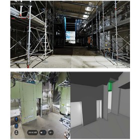
Record the completed state in 16K×3D! Enable remote consideration for future renovations.
- Other measuring instruments
Announcement of the 4DKanKan Online Briefing on Starting Field DX with This Year's Budget
We would like to invite you to the online product presentation of "4DKanKan," a tool that promotes 3D digitalization and DX of sites and facilities. With a 3D digital twin camera that can simultaneously capture ultra-high-definition 16K panoramic photos and 1cm mesh point cloud data, you can advance the digitalization of your site without any specialized knowledge. 【Free】4DKanKan Online Product Presentation Presentation Content: 1. What is 4DKanKan? 2. Introduction of features using captured data 3. Introduction of optional services (hardware and software) 4. Use cases 5. Pricing and implementation methods 6. Q&A Do you have any of these concerns? - The burden of travel for site inspections is high - It is difficult to share the situation with just photos - You are interested in utilizing point clouds and 3D data but do not know how to implement them "4DKanKan" is here to solve these issues. It is being utilized to improve efficiency across a wide range of industries, including construction management, surveying, manufacturing, infrastructure, and events. Small starts are also possible through rentals, proof-of-concept experiments, and photography contracts. If you are considering DX initiatives for the next fiscal year, please join us.
![[Use Case] Creation of Simulation F...](https://image.www.ipros.com/public/product/image/2117853/IPROS14244326159460833710.png?w=280&h=280)
Build a 3D point cloud field that faithfully reproduces the real world! Improve the accuracy of robot route verification.
- Other measuring instruments
Announcement of the 4DKanKan Online Briefing on Starting Field DX with This Year's Budget
We would like to invite you to the online product presentation of "4DKanKan," a tool that promotes 3D digitalization and DX of sites and facilities. With a 3D digital twin camera that can simultaneously capture ultra-high-definition 16K panoramic photos and 1cm mesh point cloud data, you can advance the digitalization of your site without any specialized knowledge. 【Free】4DKanKan Online Product Presentation Presentation Content: 1. What is 4DKanKan? 2. Introduction of features using captured data 3. Introduction of optional services (hardware and software) 4. Use cases 5. Pricing and implementation methods 6. Q&A Do you have any of these concerns? - The burden of travel for site inspections is high - It is difficult to share the situation with just photos - You are interested in utilizing point clouds and 3D data but do not know how to implement them "4DKanKan" is here to solve these issues. It is being utilized to improve efficiency across a wide range of industries, including construction management, surveying, manufacturing, infrastructure, and events. Small starts are also possible through rentals, proof-of-concept experiments, and photography contracts. If you are considering DX initiatives for the next fiscal year, please join us.
![[Use Case] Simple Earth Volume Calc...](https://image.www.ipros.com/public/product/image/2117853/IPROS16936213434408863165.png?w=280&h=280)
Suppressing soil volume discrepancies with point cloud data! Reducing shooting time to half compared to total station.
- Other measuring instruments
Announcement of the 4DKanKan Online Briefing on Starting Field DX with This Year's Budget
We would like to invite you to the online product presentation of "4DKanKan," a tool that promotes 3D digitalization and DX of sites and facilities. With a 3D digital twin camera that can simultaneously capture ultra-high-definition 16K panoramic photos and 1cm mesh point cloud data, you can advance the digitalization of your site without any specialized knowledge. 【Free】4DKanKan Online Product Presentation Presentation Content: 1. What is 4DKanKan? 2. Introduction of features using captured data 3. Introduction of optional services (hardware and software) 4. Use cases 5. Pricing and implementation methods 6. Q&A Do you have any of these concerns? - The burden of travel for site inspections is high - It is difficult to share the situation with just photos - You are interested in utilizing point clouds and 3D data but do not know how to implement them "4DKanKan" is here to solve these issues. It is being utilized to improve efficiency across a wide range of industries, including construction management, surveying, manufacturing, infrastructure, and events. Small starts are also possible through rentals, proof-of-concept experiments, and photography contracts. If you are considering DX initiatives for the next fiscal year, please join us.