Drone photogrammetry using surveying techniques and 3D measurement technology developed over many years.

Acquire extensive 3D data in a short time while walking! For data creation related to plant and factory maintenance, renovation design, urban planning, and infrastructure maintenance!

Using "collision-resistant drones" that leverage autonomous flying technology! Suitable for under-bridge operations.

It is a technology that is active in various fields of imaging, such as still photography, video recording, and 3D surveying!

Capture and edit the construction process of commercial facilities, welfare facilities, universities, hotels, etc., in videos to promote construction methods and techniques!

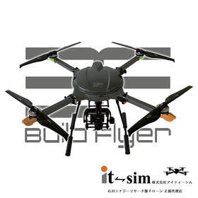
A high-quality drone that has passed rigorous testing. It excels in strength and weather resistance, achieving stable measurements and imaging. It is also equipped with a large-capacity battery.


