Underwater drone
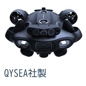
We are introducing a multifunctional underwater drone (FIFISH E-MASTER NAVI).

It is possible to capture images with an underwater drone camera, perform laser measurements, and acquire terrain data (point clouds) using a downward sonar beam.
The images are clarified by the onboard AI, which removes impurities and noise. Dimension measurements, such as cracks, can be made to the millimeter. There are achievements in scouring investigations of bridge piers and damage assessments of port structures.
Inquire About This Product
basic information
Dimensions: L430 x W345 x H185mm Weight: 6.7kg Maximum Depth: 200m Speed: Up to 3 knots
Price range
Delivery Time
Applications/Examples of results
Investigation of scour around bridge piers, investigation of damage to port structures, etc.
Detailed information
-
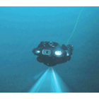
High-resolution camera with headlights equipped.
-
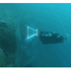
Laser measurement obstacle sensor
-
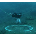
Terrain Acquisition Narrow Beam
Company information

Focusing on the investigation and design of roads and bridges, we also provide engineer support and personnel dispatch. A group of engineers that meets the diverse needs of infrastructure development.