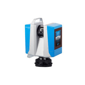
Quickly create a 3D model of the site! Achieve surface management using high-density 3D point cloud data.
The "GLS-2000" is a 3D Laser Scanner suitable for point cloud measurement in i-Construction. It employs a pulse method known for its low noise and long-range capabilities, combined with ultra-high-speed sampling technology to achieve high-speed performance. Additionally, you can choose from three types based on your needs, ranging from short distances for equipment and interiors to current work at civil engineering sites and large structures. 【Features】 ■ Three lineups to choose from based on measurement range ■ Pulse (TOF) method scanner focused on speed ■ Easy-to-use onboard controller ■ Equipped with Direct Height Measurement (automatic instrument height measurement) function ■ Wide-angle and narrow-angle dual cameras *For more details, please download the PDF or feel free to contact us.
Inquire About This Product
basic information
【Other Features】 ■ Equipped with 8 types of measurement scan modes ■ Road surface mode included ■ Target scan 360° prism compatible ■ Achieves high-quality data acquisition with Precise Scan Technology II engine *For more details, please download the PDF or feel free to contact us.
Price range
Delivery Time
Applications/Examples of results
【Usage Examples】 ■i-Construction ■BIM ■Infrastructure Surveys ■Facility Condition Surveys ■Tunnel Interior Cross-Section Measurement ■Historical Buildings and Cultural Heritage ■Road Surface Measurement and Slope Measurement *For more details, please download the PDF or feel free to contact us.
catalog(1)
Download All CatalogsCompany information
Our company is a certified office of JSIMA (Japan Surveying Instrument Manufacturers Association). We are equipped with dedicated facilities and can provide services such as inspections and adjustments in-house, as well as repairs for various manufacturers. We offer reliable support through services provided by certified personnel. Please feel free to contact us if you have any requests.


![[Reference Case] 3D Measurement Work for New Piping Design](https://image.www.ipros.com/public/product/image/56b/2001181647/IPROS64160757444625566968.jpeg?w=280&h=280)


