Directly digitize images and register them in a database! A practical application with extensive experience overseas.
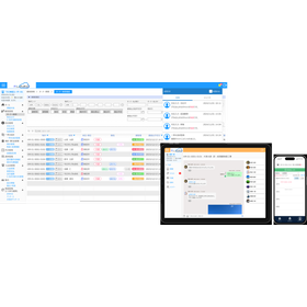
"ALVforArcGIS" is an application that allows for the construction of a full-fledged facility database by integrating with existing GIS through an SDK. In addition to being able to view CV footage, 2D maps, and Geo databases in an integrated manner, it can digitize current footage and update the existing database. We also provide tools such as "Ortho Creator," which can automatically convert 3D footage into 2D maps, and "CVCG Modeler," which can extract 3D information from digitized footage. [Features] ■ A practical application with a wealth of experience overseas ■ Compatible with new versions of ArcGIS through continuous upgrades ■ Directly digitizes footage and registers it in the database ■ Visualizes GIS by linking with databases like ArcGIS ■ Integrates and allows viewing of CV footage, 2D maps, and Geo databases *For more details, please refer to the PDF materials or feel free to contact us.

Inquire About This Product
basic information
【Other Features】 ■ Digitizes current status images and updates the existing database ■ Shares field information through integration with ArcGIS Server ■ Tsunami water level display ・ Represents changes in water levels due to tsunamis using computer graphics ・ Ensures high realism by using real images for the background scenery ・ Can be used as a hazard video to supplement hazard maps * For more details, please refer to the PDF document or feel free to contact us.
Price range
Delivery Time
Applications/Examples of results
For more details, please refer to the PDF document or feel free to contact us.
catalog(1)
Download All Catalogs
Company information

Since the establishment of the Iwane Research Institute in 1979, our company has upheld the philosophy of being "a company that is one with the Earth, kind to the Earth, and contributes to the Earth," and we have acted accordingly to this day. From now on, we aim to create a virtual Earth and transform into an evolved version of ourselves as a "company that contributes to the Earth." The "Creation of Another Earth Project" begins with establishing a new platform for economic and cultural activities on this other Earth. For this purpose, we have developed a universal worldview, principles that arise from it, detailed policies, and the technologies necessary for realization (CV technology and PRM technology), and we have decided to create "Another Earth" using our unique technology that turns images directly into 3D maps. In this new Earth, a wide variety of economic and cultural activities will take place, and even nations can be constructed here. This is made possible by the widespread communication environment of modern times, and in the future, our company will open the API of the system, aiming to create a new Earth together with people around the world who seek peace.