iPROS Urban Planning
  • Search for products by classification category

    • Building Materials
      Building Materials
      36492items
    • Facilities
      Facilities
      58408items
    • Lighting and Interior
      Lighting and Interior
      17615items
    • Common materials
      Common materials
      37190items
    • Civil Engineering Materials
      Civil Engineering Materials
      10252items
    • Construction, work and methods
      Construction, work and methods
      29171items
    • Surveys, Measurements, and Services
      Surveys, Measurements, and Services
      29619items
    • IT/Software
      IT/Software
      33728items
    • others
      others
      92099items
    • Store and facility supplies
      Store and facility supplies
      4632items
    • Office and commercial supplies
      Office and commercial supplies
      11759items
    • Hospital and welfare facility supplies
      Hospital and welfare facility supplies
      1059items
    • Logistics Equipment
      Logistics Equipment
      7382items
    • Energy and Resources
      Energy and Resources
      11963items
  • Search for companies by industry

    • Information and Communications
      7299
    • others
      7221
    • Building materials, supplies and fixtures manufacturers
      6661
    • Service Industry
      4787
    • Trading company/Wholesale
      3096
    • Other construction industries
      2456
    • Electrical equipment construction business
      748
    • Construction Consultant
      635
    • General contractors and subcontractors
      564
    • Interior Design
      520
    • Facility Design Office
      487
    • Housing manufacturers and construction companies
      414
    • Architectural design office
      364
    • retail
      363
    • Warehousing and transport related industries
      331
    • Building Management
      298
    • Electricity, Gas and Water Industry
      286
    • Interior construction business
      281
    • Medical and Welfare
      278
    • Educational and Research Institutions
      255
    • Renovation and home construction industry
      225
    • Water supply and drainage construction business
      202
    • Transportation
      178
    • Real Estate Developers
      168
    • Fisheries, Agriculture and Forestry
      136
    • Structural Design Office
      65
    • Finance, securities and insurance
      41
    • Restaurants and accommodations
      33
    • self-employed
      31
    • Mining
      26
    • Public interest/special/independent administrative agency
      20
    • Police, Fire Department, Self-Defense Forces
      17
    • Property Owner
      9
    • Store and building owners
      9
    • Government
      9
    • Individual
      9
  • Special Features
  • Ranking

    • Overall Products Ranking
    • Overall Company Ranking
Search for Products
  • Search for products by classification category

  • Building Materials
  • Facilities
  • Lighting and Interior
  • Common materials
  • Civil Engineering Materials
  • Construction, work and methods
  • Surveys, Measurements, and Services
  • IT/Software
  • others
  • Store and facility supplies
  • Office and commercial supplies
  • Hospital and welfare facility supplies
  • Logistics Equipment
  • Energy and Resources
Search for Companies
  • Search for companies by industry

  • Information and Communications
  • others
  • Building materials, supplies and fixtures manufacturers
  • Service Industry
  • Trading company/Wholesale
  • Other construction industries
  • Electrical equipment construction business
  • Construction Consultant
  • General contractors and subcontractors
  • Interior Design
  • Facility Design Office
  • Housing manufacturers and construction companies
  • Architectural design office
  • retail
  • Warehousing and transport related industries
  • Building Management
  • Electricity, Gas and Water Industry
  • Interior construction business
  • Medical and Welfare
  • Educational and Research Institutions
  • Renovation and home construction industry
  • Water supply and drainage construction business
  • Transportation
  • Real Estate Developers
  • Fisheries, Agriculture and Forestry
  • Structural Design Office
  • Finance, securities and insurance
  • Restaurants and accommodations
  • self-employed
  • Mining
  • Public interest/special/independent administrative agency
  • Police, Fire Department, Self-Defense Forces
  • Property Owner
  • Store and building owners
  • Government
  • Individual
Special Features
Ranking
  • Overall Products Ranking
  • Overall Company Ranking
  • privacy policy
  • terms of service
  • About Us
  • Careers
  • Advertising
  1. Home
  2. Trading company/Wholesale
  3. 横浜測器 本社
  4. [New Service] '3D Measurement Service' utilizing ground-based laser scanners.
COMPANY
  • Aug 19, 2024
  • Added to bookmarks

    Bookmarks list

    Bookmark has been removed

    Bookmarks list

    You can't add any more bookmarks

    By registering as a member, you can increase the number of bookmarks you can save and organize them with labels.

    Free membership registration
Aug 19, 2024

[New Service] '3D Measurement Service' utilizing ground-based laser scanners.

横浜測器 横浜測器 本社
We can acquire 3D point cloud data using our terrestrial and handheld laser scanners. Additionally, we offer GNSS surveying services and can accommodate requests for RTK surveying and static surveying as needed! 【Features of 3D Measurement Services】 - Smooth support from meetings to the field - Delivery of 3D point cloud data in the requested data format - Data delivery within as little as 2 business days* (Delivery time may vary depending on the size of the site.) 【Main Equipment Used】 - Leica RTC360 - Leica BLK G2 - Leica BLK 2GO - Leica GS18 I - Leica GS18 T - Leica GS07 We have a proven track record in various scenes such as roads and fields. Please feel free to consult with us!
  • Inquiry about this news

    Contact Us Online

Related Documents

AP20.pdf[760351]

Related product

イプロス用補助金表紙?-min (1) (2).png

3D Measurement Service Utilizing Ground-Based Laser Scanners

We provide 3D measurement services using ground-based laser scanners! We can accommodate various sites such as factories, plants, and fields.

We can acquire 3D point cloud data using our terrestrial and handheld laser scanners. Additionally, we offer GNSS surveying services and can accommodate requests for RTK surveying and static surveying as needed! 【Features of 3D Measurement Services】 - Smooth support from initial meetings to the field - Delivery of 3D point cloud data in the requested data format - Data delivery within as little as 2 business days (delivery time may vary depending on the scale of the site). We have a proven track record in various scenes such as roads and fields. Please feel free to consult with us!

  • Other measuring instruments

Added to bookmarks

Bookmarks list

Bookmark has been removed

Bookmarks list

You can't add any more bookmarks

By registering as a member, you can increase the number of bookmarks you can save and organize them with labels.

Free membership registration
image_4044.png

[Subsidy-eligible product] Laser scanner Leica RTC360

Speedy, portable, and high precision! Equipped with seamless automatic data transfer functionality from the field to the office.

The "Leica RTC360 Laser Scanner" features a measurement speed of up to 2 million points per second and an advanced HDR imaging system, allowing for the acquisition of color 3D point cloud data in just 2 minutes. With its target-free automatic registration function powered by VIS technology and seamless automatic data transfer from the field to the office, it significantly reduces field measurement time and greatly enhances productivity. 【Features】 ■ Achieves 3D reality capture in a short time ■ Portable design and foldable dedicated tripod can be stored in a backpack ■ Can be carried anywhere ■ Simply go to the site and perform a quick and easy scan with a single button operation ★ This product qualifies as surveying equipment eligible for "subsidy utilization" upon purchase. It may be available for purchase at 1/2 to 1/3 of the regular price! If you are interested, please feel free to contact us. * For more details, please refer to the PDF materials or feel free to reach out to us.

  • Other measuring instruments

Added to bookmarks

Bookmarks list

Bookmark has been removed

Bookmarks list

You can't add any more bookmarks

By registering as a member, you can increase the number of bookmarks you can save and organize them with labels.

Free membership registration
イプロス用補助金表紙.jpg

Compact ground-based laser scanner 'Leica BLK360 G2'

Lightweight and compact for easy portability! High-speed scanning of up to 680,000 points per second with simple operation.

The "BLK360 G2" can perform a full scan, including spherical images, in just 20 seconds, which is more than five times faster than the conventional BLK360, with just the push of a button. The data from the BLK360 G2 is useful for a wide range of applications, from traditional architecture and construction to innovative VFX (visual effects) and VR (virtual reality). With a scanning speed of up to 680,000 points per second, it can measure up to 45 meters away. Additionally, the data from the BLK360 G2 is beneficial for many applications, from traditional architecture and construction to innovative VFX (visual effects) and VR (virtual reality). For more details, please refer to the product catalog. 【Features】 ■ Lightweight, compact, and affordable 3D laser scanner ■ Easy operation with just the push of a button ★ We provide comprehensive support for the application process for manufacturing subsidies in collaboration with specialized consultants. Please feel free to contact us for more details. ★ Our company offers a variety of surveying equipment and systems, and we can provide proposals tailored to your needs. Please refer to the basic information section for examples of our products.

  • Surveying
  • Other measuring instruments

Added to bookmarks

Bookmarks list

Bookmark has been removed

Bookmarks list

You can't add any more bookmarks

By registering as a member, you can increase the number of bookmarks you can save and organize them with labels.

Free membership registration
イプロス用補助金表紙.jpg

SLAM technology Mobile handheld laser scanner BLK2GO

While walking through the space, you can scan large buildings, structures, and environments at an unprecedented speed and with ease.

The BLK2GO performs millions of high-precision measurements simply by pressing a button to power it on and walking around, recreating the surrounding space in 3D. The data from the BLK2GO serves as the foundational data for accurate floor plans, BIM models, and 3D visualizations. With a scanning speed of up to 420,000 points per second, it can measure up to 25 meters away. 【Features】 ■ Lightweight, compact, and affordable 3D laser scanner ■ Easy operation with just a button press ■ Rechargeable battery allows for continuous scanning for 45 minutes ★ We provide comprehensive support for the application process for manufacturing subsidies in collaboration with specialized consultants. Please feel free to contact us for more details. ★ Our company offers a variety of surveying equipment and systems, allowing us to make proposals tailored to your needs. Please refer to the basic information section for examples of our products.

  • Surveying
  • Other measuring instruments

Added to bookmarks

Bookmarks list

Bookmark has been removed

Bookmarks list

You can't add any more bookmarks

By registering as a member, you can increase the number of bookmarks you can save and organize them with labels.

Free membership registration
ダウンロード.jpg

Fully autonomous flying laser scanner "Leica BLK2FLY"

Orders will start in Japan from March 1, 2024! Fully autonomous flying laser scanner Leica BLK2FLY.

The "Leica BLK2FLY" can perform 3D scanning in hard-to-reach places such as ceilings and roofs, both indoors and outdoors. It captures the exterior of buildings, structures, and environments, creating 3D point clouds while in flight. It can be activated with just a few taps on a tablet, allowing for aerial scanning of structures and environments. Aerial scanning is beneficial for accurately capturing the features and dimensions of a structure's exterior, especially in cases where access is difficult or where it is hard to reach. 【Features】 ■ One-button operation ■ No calibration required for flight ■ Safe and stress-free flight enabled by obstacle detection features ■ Easy creation of automated flight plans from the operating application

  • Other civil engineering services
  • Surveying

Added to bookmarks

Bookmarks list

Bookmark has been removed

Bookmarks list

You can't add any more bookmarks

By registering as a member, you can increase the number of bookmarks you can save and organize them with labels.

Free membership registration
gnss.PNG

【Subsidy-Eligible Product】GNSS Surveying Instrument 'Leica GS18I'

Innovative and speedy! It is possible to locate points from images both on-site and in the office.

The "Leica GS18I" is a high-precision GNSS surveying instrument with excellent operability. Designed to efficiently position a large number of points, this product allows you to measure hundreds of points within minutes after capturing images. Since there is no need to physically move to the points being measured, it reduces the time spent on-site and the time required for redoing measurement tasks. Additionally, by creating point cloud data from the data acquired on Infinity, new proposals become possible. 【Features】 ■ Adopts innovative visual positioning technology developed by seamlessly integrating GNSS, IMU, and cameras ■ Capable of positioning points from images both in the field and in the office ■ Designed to efficiently position a large number of points ■ Able to measure hundreds of points within minutes after capturing *For more details, please refer to the catalog or PDF materials, or feel free to contact us. ★ This product is a surveying instrument eligible for "subsidy utilization" upon purchase. It may be available for purchase at 1/2 to 1/3 of the regular price! If you are interested, please do not hesitate to contact us.

  • Other measuring instruments

Added to bookmarks

Bookmarks list

Bookmark has been removed

Bookmarks list

You can't add any more bookmarks

By registering as a member, you can increase the number of bookmarks you can save and organize them with labels.

Free membership registration
images.jpg

『Leica AP20 AutoPole』

[Special Campaign Now!] Breaking Common Sense! The World's First Prism Ball That Can Be Measured by Tilting!

【Features】 Point 1: Measurement possible at wall edges! Point 2: Reduced number of instrument setups! Point 3: No need to input pole height! Significantly increases current surveying speed without the need for two legs! *For more details, please refer to the catalog or PDF materials, or feel free to contact us.

  • Other measuring instruments

Added to bookmarks

Bookmarks list

Bookmark has been removed

Bookmarks list

You can't add any more bookmarks

By registering as a member, you can increase the number of bookmarks you can save and organize them with labels.

Free membership registration
image_05.jpg

Laser scanner "Leica ScanStation P50"

[Subsidy-eligible products] Accurately measure details! Generate high-quality and realistic 3D color point cloud data.

The "Leica ScanStation P50" is a laser scanner equipped with long-range scanning capabilities that reliably captures details. It can measure up to 1 million points per second and quickly measure distances exceeding 1 km, generating the highest quality 3D data and HDR images. Additionally, it complies with the IP54 standard for waterproof and dustproof performance. 【Features】 ■ High performance even in harsh environments ■ Excellent measurement range and angular accuracy ■ Operates in extreme temperature conditions from -20°C to +50°C ■ Comprehensive solutions including software, services, training, and support *For more details, please refer to the PDF document or feel free to contact us. ★ This product is a surveying instrument eligible for "subsidy utilization" upon purchase. It may be available for purchase at a price of 1/2 to 1/3 of the regular price! If you are interested, please do not hesitate to contact us.

  • Other civil engineering services
  • Other measuring instruments
  • Measurement and analysis equipment leasing and rental

Added to bookmarks

Bookmarks list

Bookmark has been removed

Bookmarks list

You can't add any more bookmarks

By registering as a member, you can increase the number of bookmarks you can save and organize them with labels.

Free membership registration
3d_laser_scanner_02_822d8f8fca-300x362.jpg

Acquisition of realistic point cloud data is possible with Z+F IMAGER 5016.

[Subsidy-eligible products] Achieve 3D modeling at low cost with ultra-fast and ultra-high precision scanning! Providing new solutions that were previously difficult to realize!

The "PENTAX Z+F IMAGER 5016 Laser Scanner" achieves a compact and lightweight design while incorporating advanced HDR camera capabilities, built-in navigation system, and high-speed Wi-Fi functionality without compromising on the advantages of high precision, high scan rate, and low range noise provided by the phase difference method! It comes standard with an LED light for color photography in dark environments (capable of illuminating up to 10m). Equipped with high-speed Wi-Fi, it enables real-time high-speed data transfer of measurement data to a Tablet PC using the included IMAGER5016 dedicated software "LC SCOUT"! It allows for simultaneous verification of 3D point cloud data during measurement, significantly improving productivity. 【Features】 ■ Achieves 3D reality capture in a short time ■ Portable design that can be stored in a backpack *For more details, please refer to the PDF document or feel free to contact us. ★ This product is a surveying instrument eligible for "subsidy utilization" upon purchase. It may be available for purchase at 1/2 to 1/3 of the regular price! If you are interested, please do not hesitate to contact us.

  • Other measuring instruments

Added to bookmarks

Bookmarks list

Bookmark has been removed

Bookmarks list

You can't add any more bookmarks

By registering as a member, you can increase the number of bookmarks you can save and organize them with labels.

Free membership registration
スクリーンショット 2021-05-27 104639.png

Latest Case Studies of Point Clouds

Introducing point cloud data obtained from a laser scanner that measures various objects with excellent productivity, versatility, and operability!

Introducing point cloud data obtained from the latest laser scanner product lineup provided by Yokohama Measuring Instruments Co., Ltd.! The selection of the appropriate model is crucial depending on the intended use of the laser scanner. We offer the most suitable laser scanner for our customers from a wide range of models. The point cloud data acquired by leveraging the characteristics and features of each model has the potential to significantly impact our customers' future business development. 【Point Cloud Data by Characteristics】 ■ UAV Laser Scanner Point Cloud Data ■ Long-range Ground Laser Scanner Point Cloud Data ■ Mid-range Ground Laser Scanner Point Cloud Data ■ Compact and Lightweight Ground Laser Scanner Point Cloud Data *For more details, please refer to the catalog or PDF materials, or feel free to contact us.

  • Surveying
  • Other measuring instruments

Added to bookmarks

Bookmarks list

Bookmark has been removed

Bookmarks list

You can't add any more bookmarks

By registering as a member, you can increase the number of bookmarks you can save and organize them with labels.

Free membership registration

Related catalog(9)

3D Measurement Service Utilizing Ground-Based Laser Scanners

3D Measurement Service Utilizing Ground-Based Laser Scanners

OTHER
  • E-book viewing
  • Catalog download

Contact this catalog

[Subsidy-eligible product] 'Leica RTC360' 3D reality capture solution

[Subsidy-eligible product] 'Leica RTC360' 3D reality capture solution

OTHER
  • E-book viewing
  • Catalog download

Contact this catalog

Leica Geosystems 3D Laser Scanner 'BLK360 G2' Product Documentation

Leica Geosystems 3D Laser Scanner 'BLK360 G2' Product Documentation

PRODUCT
  • E-book viewing
  • Catalog download

Contact this catalog

Leica Geosystems 3D Laser Scanner 'BLK2GO' Product Documentation

Leica Geosystems 3D Laser Scanner 'BLK2GO' Product Documentation

PRODUCT
  • E-book viewing
  • Catalog download

Contact this catalog

[Latest Equipment] Fully Autonomous Flight Laser Scanner "Leica BLK2FLY"

[Latest Equipment] Fully Autonomous Flight Laser Scanner "Leica BLK2FLY"

PRODUCT
  • E-book viewing
  • Catalog download

Contact this catalog

[Subsidy-eligible product] PENTAX Z+F IMAGER5016 Laser Scanner

[Subsidy-eligible product] PENTAX Z+F IMAGER5016 Laser Scanner

PRODUCT
  • E-book viewing
  • Catalog download

Contact this catalog

[Subsidy-eligible product] 'Leica AP20 AutoPole'

[Subsidy-eligible product] 'Leica AP20 AutoPole'

PRODUCT
  • E-book viewing
  • Catalog download

Contact this catalog

Leica Geosystems 3D Laser Scanner 'BLK360' Product Documentation

Leica Geosystems 3D Laser Scanner 'BLK360' Product Documentation

PRODUCT
  • E-book viewing
  • Catalog download

Contact this catalog

Point Cloud Data Case Studies

Point Cloud Data Case Studies

OTHER
  • E-book viewing
  • Catalog download

Contact this catalog

Distributors

横浜測器
Trading company/Wholesale
  • Added to bookmarks

    Bookmarks list

    Bookmark has been removed

    Bookmarks list

    You can't add any more bookmarks

    By registering as a member, you can increase the number of bookmarks you can save and organize them with labels.

    Free membership registration
横浜測器 本社
  • Special site
  • Official site
Phone number/address

news

PERI products are used at construction sites around the world. (Poland: Construction work on the Dunajec Road Bridge)

  • NEW
  • COMPANY

PERI products are used at construction sites around the world. This time, we would like to introduce the construction work of the "Dunajec Road Bridge" spanning the Dunajec River in the town of Nowy Targ in southern Poland. The road bridge was planned to be constructed using a balanced cantilever method, dividing the cantilever beams starting from each pier into 10 segments. A particular concern was to strictly adhere to the concrete pouring cycle for each segment. To achieve this, a balanced cantilever carriage (VBC) equipped with a hydraulic advance system and an automatic formwork stripping function was adopted. By utilizing the VBC, it became possible to pour concrete for segments up to a maximum length of 5 meters in a single cycle, allowing for efficient and timely construction. PERI products: 1. TRIO Panel Formwork 2. VARIO GT24 Wall Formwork 3. PERI UP Flex Modular Scaffold 4. VST Heavy-Duty Shoring Tower PERI Japan Co., Ltd.

Oct 12, 2026

Added to bookmarks

Bookmarks list

Bookmark has been removed

Bookmarks list

You can't add any more bookmarks

By registering as a member, you can increase the number of bookmarks you can save and organize them with labels.

Free membership registration

Aroma presentation of major purchasing specialty stores.

  • NEW
  • PRODUCT

At a major purchasing specialty store located in Kanagawa Prefecture, we have introduced our commercial aroma diffuser rental service "MajestaFragrance," enhancing the store's atmosphere with fragrance. Installed models: MFmini (4,400 yen per month) × 2 units Adopted fragrance: Freesia Pear To ensure that customers visiting the store can relax during their appraisal and consultation time, we have implemented space branding with a "refined and approachable scent." The fragrance used is "Freesia Pear," which pleasantly spreads the freshness of fruity pear and the vibrant aroma of freesia. It warmly welcomes customers with a clean and high-quality scent. The "MFmini" introduced this time is a compact yet powerful diffuser known for its strong diffusion capabilities. It blends smartly into limited installation spaces such as reception counters and customer service areas, efficiently delivering fragrance. At Majesta Fragrance, we offer optimal diffuser models and fragrance suggestions tailored to the size of the store, type of business, and interior atmosphere. A "free trial installation" is also available before signing a contract.

Oct 10, 2026

Added to bookmarks

Bookmarks list

Bookmark has been removed

Bookmarks list

You can't add any more bookmarks

By registering as a member, you can increase the number of bookmarks you can save and organize them with labels.

Free membership registration
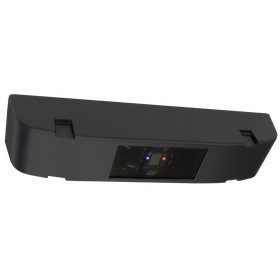
CCS3 product photo

The new product "Vehicle Count Sensor CCS3" enables efficient occupancy management of large parking lots.

  • NEW
  • PRODUCT

Hotron Inc. has launched its new product, the "Vehicle Count Sensor CCS3"! This product is a ceiling-mounted sensor that combines infrared and radar technology. It reliably detects vehicles in both directions with a single unit, accommodating traffic during congestion and vehicle passing, thus achieving efficient occupancy management in large parking lots. Additionally, it can be utilized for exit warning purposes in addition to vehicle counting, contributing to the safe and smooth operation of parking facilities. 'Features' - Improved detection performance against changes in road surface during rainy weather by using both infrared and radar. - Equipped with IP67 waterproof and dustproof performance, making it effective even in salt damage areas. - Various settings can be configured from a dedicated app (for Android devices), with current settings easily visible at a glance. - The base dimensions are the same as the previous model "CCS2," allowing for smooth replacement of existing equipment. *For more details, please refer to the product information, catalog download, or contact us.*

Oct 09, 2026

Added to bookmarks

Bookmarks list

Bookmark has been removed

Bookmarks list

You can't add any more bookmarks

By registering as a member, you can increase the number of bookmarks you can save and organize them with labels.

Free membership registration

We will exhibit at the Osaka Industrial Exhibition 2026.

  • NEW
  • COMPANY

We will be exhibiting at the "Osaka Industry Exhibition 2026" held at MyDome Osaka from October 14 (Wednesday) to 15 (Thursday), 2026. We will introduce our stress check, health management system, reservation and reception system, and interview system.

Oct 09, 2026

Added to bookmarks

Bookmarks list

Bookmark has been removed

Bookmarks list

You can't add any more bookmarks

By registering as a member, you can increase the number of bookmarks you can save and organize them with labels.

Free membership registration

Announcement of the publication of ISO-related information magazine "Intertek News" Issue 94.

  • NEW
  • OTHER

We have published the latest issue (Issue 94) of the ISO-related information magazine "Intertek News." Intertek News delivers information and various topics related to ISO audits, certifications, and verifications. The feature of this issue is titled "Understanding Standard Revisions," where we introduce key points of management system standard requirements that new personnel should first understand in preparation for standard revisions. Additionally, we have included customer case studies, contributions from auditors, and information on certifications and standards, as well as the latest topics, so please take a look.

Oct 09, 2026

Added to bookmarks

Bookmarks list

Bookmark has been removed

Bookmarks list

You can't add any more bookmarks

By registering as a member, you can increase the number of bookmarks you can save and organize them with labels.

Free membership registration
Return to news list
  • Inquiry about this news

    Contact Us Online

Products

  • Search for Products

Company

  • Search for Companies

Special Features

  • Special Features

Ranking

  • Overall Products Ranking
  • Overall Company Ranking

support

  • site map
IPROS
  • privacy policy Regarding external transmission of information
  • terms of service
  • About Us
  • Careers
  • Advertising
IPROS Services
  • >IPROS GMS | Search site for the manufacturing industry
  • >IPROS | Search site for the B2B industry
COPYRIGHT © 2001-2026 IPROS CORPORATION ALL RIGHTS RESERVED.
Please note that the English text on this page is automatically translated and may contain inaccuracies.